A shadow moves beneath the surface.
At first, it is only a darker shape inside darker water. Then the shape shifts, and the human mind does what it always does. It tries to make sense of what the eyes are seeing.
Fish? Ray? Shark? Something else?
We look harder. We search for a fin, a tail, a clear outline, some familiar clue that lets us name the animal before it disappears again. That is how we enter the ocean. We enter it as visual animals.
We rely on sight first.
On land, that makes sense. We look both ways before crossing a street. We recognize faces. We read signs. We notice color, distance, motion, and shape. Even when our other senses help us understand the world, sight usually leads the way.
But the ocean is not built for human sight.
Light bends and scatters. Sand clouds the water. Storms stir sediment. Tannins darken creeks and estuaries. Waves break the surface into fragments. A fish can vanish into shadow. A ray can disappear beneath one thin layer of sand. A shark can move through water we are staring directly into and still be almost impossible to see.
To us, the ocean often becomes less clear the moment we step into it.
To sharks, rays, skates, sawfish, and chimaeras, that same water is not empty. It is not silent. It is not blank.
It is filled with signals.
These animals belong to a group called chondrichthyans, fishes with skeletons made of cartilage instead of bone. Sharks, rays, skates, sawfish, and chimaeras all belong here. We often separate them by the way they look: sharks with their familiar fins and teeth, rays flattened against the bottom, skates moving quietly over sand, sawfish carrying a toothed rostrum, and chimaeras drifting through deeper water like something half-remembered from another age.
But they are connected by more than cartilage.
They share sensory worlds that are difficult for us to imagine because they include abilities we do not have in the same way. They use sight, smell, hearing, touch, and temperature, but they also read movement through the water with the lateral line. They detect weak electrical fields with ampullae of Lorenzini. They interpret the ocean through pressure, vibration, chemistry, contrast, motion, and life itself (Collin, 2012; Hart & Collin, 2015).
We may look into murky water and see almost nothing.
They may be reading an entire landscape.
The Ocean as a Different Kind of World
Sometimes, we do sense the world in ways that remind us we are not only visual.
A storm approaches, and some people feel pressure before the first drop of rain falls. Sinuses tighten. Migraines build. The air feels different. We walk into a dark room and suddenly sound becomes more important. A creak in the corner, a moving shadow, or a change in the air near our skin, these matter.
We still try to confirm everything with sight, but when sight weakens, the rest of the body steps forward.
Now imagine living in a world where sight is helpful, but never enough.
Water carries information differently than air. A fish swimming does not simply move from one place to another. It pushes water aside. A tailbeat sends movement outward. A struggling animal leaves a different pattern than a calm one. A crab moving under sand may be hidden from view, but its body is still alive. Muscles contract. A heart beats. Nerves fire. Gills pump. Chemicals dissolve and drift.
Every animal changes the water around it.
For chondrichthyans, that matters.
A shark does not have to wait until prey forms a perfect picture in front of its eyes. A ray does not need the seafloor to look busy in order for it to be busy. A skate does not need color to know the bottom is alive. A sawfish does not carry its rostrum only as a weapon. A chimaera in deep water does not move through darkness without information.
Their sensory systems allow them to gather information across different distances and conditions. Smell, hearing, vision, lateral line detection, and electroreception do not work as separate switches. They overlap, reinforce, and sometimes compensate for one another depending on habitat, prey, visibility, and behavior (Gardiner et al., 2014; Hart & Collin, 2015).
Their world is not less detailed than ours.
It is detailed differently.
Their world is not less detailed than ours.
It is detailed differently.
A Shark’s World
A shark moving through shallow water can be almost impossible to see until it is already there.
Its body color may match the shifting bottom. Sunlight breaks over its back. Ripples blur the outline. The water may be green, gray, brown, or blue depending on the tide, weather, and sediment. Even in clear water, the shark can appear as a shadow before it appears as an animal.

But the shark’s awareness does not begin when our eyes finally notice its shape.
Long before sight confirms what is nearby, other senses may already be gathering information. A fish moving ahead sends pressure changes through the water. A school changing direction creates a pattern of motion. A wounded or stressed animal moves differently than a calm animal. Muscle contractions and heartbeats create weak electrical fields. Odors move through the water as chemical trails.
To us, the ocean may look open.
To a shark, it is full of clues.
The lateral line runs along the body and head and helps detect movement, vibration, and changes in water flow. It is not vision, but it can reveal that something nearby is moving. It can help an animal sense direction, intensity, and disturbance (Webb, 2023).
The ampullae of Lorenzini add another layer. These small, jelly-filled pores are concentrated around the head and snout. They detect weak electrical fields produced by living animals. This is especially useful at close range, when prey is hidden, when light is low, or when the final decision about an object must be made (Bellono et al., 2017; Hart & Collin, 2015).
A hammerhead makes this easier to picture.
Its wide head may look strange to us, but that shape spreads sensory structures across a broader surface. Moving over the bottom, a hammerhead can sweep its head across the sand. A buried ray may be invisible to human eyes. To the shark, the sand may not be silent at all.
This is where our imagination reaches its limit.
We can compare electroreception to the feeling of standing near an electrical charge or sensing the strange energy in the air during an intense lightning storm. But even that comparison is weak. We do not move through the world constantly reading tiny electrical fields from other living bodies.
Sharks do.
Their world is not a human picture with extra details added. It is a different kind of picture altogether.
Sight Still Matters
Sharks have eyes, and those eyes matter.
They detect contrast, motion, light, shadow, and shape. Many sharks are well suited for low-light conditions. Some have reflective structures behind the retina that help make better use of dim light. This is part of why shark eyes may appear to glow when light catches them underwater. Vision is one piece of a broader sensory strategy that changes by species, habitat, and ecological role (Collin, 2012; Hart & Collin, 2015).
But shark vision is not human vision.
Humans rely heavily on color. We use it to separate objects, judge ripeness, read warning signs, choose clothing, and notice differences in our surroundings. Sharks appear to rely less on color and more on contrast, brightness, movement, and shape. They only have one type of cone photoreceptor with many rods. This makes them more likely to be color blind or have very limited color discrimination (Hart et al., 2019).
That does not mean sharks see poorly.
It means color may not be the priority in their world.
In water, color disappears with depth and distance. Red fades quickly. Light changes constantly. Suspended particles blur edges. A fish flashing silver, a silhouette against the surface, or a sudden burst of movement may matter more than whether something is red, green, or blue.
A shark’s visual world may be built more from shadow, contrast, motion, and form than from color.
This is important when we talk about shark-human encounters. A swimmer, surfer, or splashing person at the surface is not being interpreted through human categories. The shark is not thinking “person.” It is receiving a mixture of signals: movement, vibration, silhouette, chemical traces, electrical fields, contrast, and the surrounding activity of fish or bait.
Sometimes, those signals may be confusing.
The phrase “mistaken identity” is often used to explain shark bites, but it should be used carefully. It does not explain every bite. It does not mean sharks are foolish. It does not mean they are unable to tell anything apart. It means that, in some situations, the clues available to the shark may overlap with the clues produced by prey. This is why some human silhouettes at the surface can resemble seal and sea lion prey to a shark, especially when viewed from below and under certain movement conditions (Ryan et al., 2021).
We know a version of this ourselves.
Walk through a dark house at night and hear something move in the corner. Your eyes search for shape. Your ears sharpen. Your body tenses before your mind has enough information. You move closer. Maybe you speak into the darkness. Maybe you reach out with your hand or nudge with your foot.
Then the light turns on, and the intruder becomes a chair with a jacket over it.
You were not hunting the chair.
You were investigating a signal you did not fully understand.
A shark does not have hands. Its fins move it through the water, but they do not investigate the way our fingers do. Its mouth becomes one of the ways it tests the world. That does not make the animal cruel or mindless. It means its body solves a sensory problem differently than ours does.
For people, that difference can be dangerous. An investigative bite can still cause serious injury. But it is not the same thing as a shark deciding humans belong on the menu.
Most of the time, we do not match the full pattern of shark prey.
We smell different. We move differently. We do not behave like fish, rays, turtles, seals, or other natural prey. But in the wrong place, at the wrong time, with the wrong signals around us, we can become part of a confusing sensory scene.
This is why swimming near active fishing, bait, chum, or dense schools of baitfish matters. The shark is not being summoned by evil intent. It is following information.
The ocean is speaking in the language it knows.
The Ocean as Touch and Sound
A school of fish turns all at once.
There is no visible leader. No signal we can see. One moment the school moves in one direction, and the next it shifts like one silver body. Each fish keeps its place without crashing into the others. The turn happens faster than sight alone seems able to explain.
This is one of the easiest ways to understand the lateral line.
Fish do not only see their neighbors. They feel the water their neighbors move. Each tailbeat, each change in direction, each surge away from danger creates tiny changes in water motion. Those changes travel across the bodies of nearby fish.
The lateral line detects those movements.
This sensory system is found in many fishes, not only sharks and rays. It helps animals orient in currents, avoid obstacles, respond to predators, follow prey, and move together in groups. It turns water into a kind of touch-field. The structure and function of the lateral line vary across fishes, but its role in detecting water motion is central to how aquatic animals interpret movement around them (Webb et al., 2023).
In sharks, this sense is closely tied to the way sound and vibration move through water. We often think of hearing as something that happens only through ears, but underwater, the whole body can become part of how an animal detects vibration. The lateral line helps a shark feel nearby water movement across its body, while the inner ear detects sound and orientation. Together, these systems make the shark’s body seem less like a body moving through water and more like an instrument tuned to it (Collin, 2012; Hart & Collin, 2015; Webb, 2023).
For a shark, this means the ocean is never simply open space.
It has texture.
A mullet swimming calmly leaves one kind of disturbance. A frightened fish leaves another. A crab moving across the bottom creates a different pattern than a shrimp flicking backward. Waves break. Boat motors pulse. Rain hits the surface. Feet shuffle through sand. A fish struggles on a line. A school turns.
Each movement changes the water.
We might stand at the edge of an inlet and see only ripples. A shark, ray, or skate moving through that same water may sense layers of motion overlapping one another. Some signals fade into background noise. Others stand out.
A calm fish and a frantic fish do not write the same message.
Along the Onslow County coast, this matters. Our nearshore waters are not always clear. Wind, tide, storms, suspended sand, tannins from creeks, plankton blooms, and wave energy all change visibility. Animals living here cannot depend on sight alone in a world where the water can cloud overnight.
A shark does not need a perfect view to know something is moving.
A ray does not need to see every small animal beneath it to know the bottom is alive.
A fish in a school does not need to wait for its neighbor to bump into it before turning.
Water carries the conversation.
The Hidden Electricity of Living Things
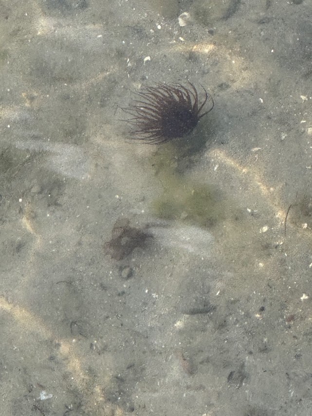
The sandy bottom can look blank.
A flat stretch of seafloor may seem empty to us, especially when nothing obvious moves. But beneath that surface may be worms, clams, crabs, shrimp, small fish, or rays. Some are hiding. Some are resting. Some are feeding. Some are waiting for the tide to shift.
To our eyes, they disappear.
To an animal with electroreception, hidden does not always mean gone.
Ampullae of Lorenzini allow sharks, rays, skates, sawfish, and chimaeras to detect weak electrical fields. These fields are extremely small, but they are part of what living bodies produce. Muscles contract. Hearts beat. Nerves fire. In saltwater, and especially at close range, those signals can become useful information (Bellono et al., 2017; Collin, 2012).
The sand may cover the animal.
It does not erase it.
This is especially important for animals that feed along the bottom. A shark searching a flat may combine smell, movement, vision, and electroreception. A ray may use similar signals to locate prey in sediment. A sawfish carries this ability into one of the strangest-looking structures in the sea.
Electroreception also reminds us that the ocean is not only a visual habitat.
It is a habitat of fields and traces.
We are used to thinking an animal is hidden when we cannot see it. But concealment depends on who is looking, and how.
A crab hidden from a bird may not be hidden from a ray.
A ray hidden from us may not be hidden from a hammerhead.
A fish buried beneath sand may still be detectable to a predator passing overhead.
This does not make the ocean more frightening.
It makes it more alive.
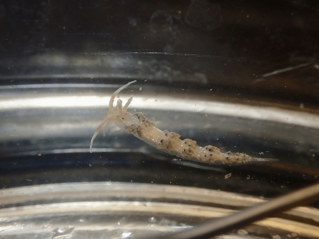
A Ray’s World
A stingray resting in shallow water can vanish beneath a thin covering of sand.
Only the eyes may remain visible. Sometimes even those are difficult to see. The body becomes part of the bottom: a soft outline, a slight rise, a place where the sand seems smoother than the sand around it.
To us, a buried ray may feel like a surprise.
To the ray, the world is still open.
Its eyes sit high on the body, watching the water above. Its mouth is underneath, positioned for feeding along the bottom. Its spiracles allow water to move across the gills while the animal rests or feeds close to the seafloor. Its lateral line and electrosensory system help detect movement and electrical signals nearby (Bedore et al., 2014; Collin, 2012).
The ray does not need to see the world exactly as we do.
It lives in layers.
Above, there may be predators, shadows, swimmers, boats, birds, and changing light. Below and around it, there may be worms, shrimp, crabs, clams, and small fish hidden in or on the sediment. A ray’s flattened body makes sense in this in-between place. It is shaped for bottom life, but it is not cut off from the water column above it.
Its eyes are important, but they are not everything.
Rays can detect contrast, shape, motion, and orientation. Some rays may have stronger color discrimination than sharks. Some also have a reflective layer in the eye, the tapetum lucidum, that helps make better use of dim light (Hart et al., 2019). We often compare this to the eye shine seen in cats and other animals at night.
But a ray buried in sand is not simply waiting with its eyes.
It is reading pressure. It is reading smell. It is reading electrical traces from animals moving nearby. It is receiving information through more than one doorway.
This is why the stingray shuffle matters.
A stingray spine is not used to chase people. It is a defense. When a ray is stepped on or startled from above, the spine can rise quickly. The injury is real, but the behavior is not personal. The ray is responding to pressure and threat in the only way its body allows.
A shuffled foot gives warning.
It tells the hidden animal that something large is moving through the sand and gives it a chance to leave before contact happens.
That small human behavior recognizes something important: the shallow edge is shared space.
We may be wading through it.
The ray may be living in it.
A Skate’s World
Skates are often confused with rays.
From above, the difference may not seem important to a casual observer. Both are flattened. Both move close to the bottom. Both can disappear into the shape and color of the seafloor.
But skates are not simply stingrays without drama.
They are their own kind of bottom reader.
Like rays, skates use sensory systems that help them understand the seafloor without relying only on sight. Their eyes are positioned on top of the body, while the mouth is underneath. Their flattened form allows them to move close to the bottom, where many small animals hide in sand, shell hash, mud, and seagrass.
A skate moving over the bottom is not only looking.
It is sampling the landscape through touch, smell, pressure, and electricity.
This makes the bottom less like a floor and more like a page. Each small animal leaves some sign: a movement, a chemical trace, a disturbance, a weak electrical field, a change in sediment (Bedore et al., 2014).
Skates remind us that not every chondrichthian is built around speed, teeth, and open-water pursuit. Some are built for patience. Some are built for closeness. Some read the world by staying near the place where water meets sediment.
Along our coast, that meeting place matters.
Sand flats, tidal creeks, inlets, oyster edges, and shallow nearshore bottoms are not empty spaces between “real” habitats. They are habitats. They hold the smaller lives that larger animals follow.
To understand the skate or ray, we have to stop seeing the bottom as blank.
A Sawfish’s World
A sawfish looks almost impossible the first time you really consider it.
It has the flattened body of a ray, but extending from the head is a long, tooth-edged rostrum — the “saw” that gives the animal its name. It looks like a weapon, and it can be used that way. Sawfish can swing the rostrum through schools of fish, stunning or injuring prey. It can also help defend the animal.
But the saw is not only a blade.
It is also a sensory surface.
The rostrum contains electroreceptive organs, ampullae of Lorenzini, that help detect weak electrical signals from nearby animals. In other words, the part of the animal that looks most like a weapon is also part of how it reads the world.
That changes the way we see it.
A sawfish is not blindly sweeping through water with a strange tool attached to its face. It is carrying a detector through the habitat ahead of its body. The saw helps locate prey. It helps interpret the space in front of the animal. It turns the water ahead into information (Wueringer et al., 2011; Wueringer, 2012).
This is different from the way we usually imagine rays and skates sensing the bottom.
A ray or skate often reads the world close to and beneath its flattened body. Its mouth is underneath. Its eyes look upward. Its sensory systems help it interpret the bottom as it rests, glides, or feeds along the sediment. A sawfish, however, extends part of that sensory world forward. The rostrum projects into the water ahead of the body, giving the animal information about prey before the prey reaches the mouth or passes beneath the disc.
That changes the animal’s sensory shape.
A sawfish does not only sense what is under it.
It can sense what is ahead of it.
The saw becomes a leading edge of perception. As the animal moves, the rostrum samples the space in front of the body. A fish hidden in murky water, a prey item moving near the bottom, or a school passing just ahead may be detected through electrical signals before the sawfish strikes. The same structure that can stun prey can also help find it (Wueringer et al., 2011; Wueringer, 2012).
That is what makes the sawfish so fascinating.
The feature that looks most dramatic to us is not simply for attack or defense. It is part of the animal’s sensory map. It stretches the invisible world forward.
Smalltooth sawfish were historically found as far north as North Carolina, but today they are generally associated with Florida waters in the United States (NOAA Fisheries, 2025). Seeing one along the Onslow County coast would be unusual. Still, they belong in this story because they show how far the chondrichthian sensory world can go.
A body part we notice for its shape may be important because of what it senses.
The ocean often works that way.
The feature that looks strange to us may be perfectly sensible in the world where the animal lives.
A Chimaera’s World
Far from the beach, beyond the bright shallows and beyond the places most of us will ever swim, chimaeras move through deeper water.
They are sometimes called ghost sharks, though they are not true sharks. They are relatives within the larger chondrichthian group, with cartilage skeletons and a long evolutionary history. Their bodies seem stitched together from familiar parts in unfamiliar ways: large eyes, winglike fins, smooth skin, and tooth plates instead of the replaceable teeth we associate with many sharks.
They look like animals from the edge of imagination.
But their strangeness is not random.
Many chimaeras live in deep, dim environments where sight has limits. In that world, an animal cannot depend on color and daylight the way we do at the surface. Light fades. Pressure increases the deeper you go. The landscape becomes colder, darker, and harder for human senses to understand.
A chimaera still has eyes, and those eyes can be large. But like other chondrichthyans, chimaeras also use sensory structures that detect electrical fields. In deep water, where prey may be sparse and visibility limited, the ability to detect life without needing a clear visual image becomes essential (Bottaro et al., 2022).
A chimaera reminds us that “seeing” does not always mean forming a bright picture.
Sometimes it means detecting what is alive in darkness.
That may be the hardest part for us to imagine. We tend to picture the deep sea as emptiness because our senses fail there. But the animals that live there are not moving through emptiness. They are moving through a world shaped by pressure, chemistry, temperature, vibration, faint light, and electrical traces.
The deep sea is not empty.
It is written in a language we barely read.
Reading the Ocean Instead of Fearing the Shadow
It is easy to turn sharks into symbols.
Fear does that. So do movies, headlines, and stories told from the shoreline after something frightening happens. A fin becomes a threat. A bite becomes proof of intent. A shadow becomes a monster.
But the real animal is more interesting than the symbol.
A shark is not moving through the water thinking like a person. A ray is not buried beneath the sand waiting for a human foot. A skate is not a flat shadow without a story. A sawfish is not only a saw. A chimaera is not only a ghost.
Each animal is built for a sensory world we do not naturally share.
That does not mean we ignore risk. Quite the opposite. Understanding these senses helps us behave with more respect in the water. We can avoid swimming near fishing activity, bait, or chum. We can pay attention when baitfish are schooling near shore. We can shuffle our feet in ray habitat. We can remember that murky water changes the way animals rely on different senses. We can stop assuming that clear human intent matters in an animal’s sensory landscape.
The ocean does not interpret us the way we interpret ourselves.
We may enter the water as swimmers, surfers, paddlers, anglers, or beachgoers. But to the animals already living there, we are also movement, pressure, chemistry, vibration, shadow, sound, and electricity.
We are part of the signal.
That is humbling, and it should be.
Our world is three-dimensional, but it is still mostly built around what we can see. Their world is three-dimensional too, but it includes layers we barely notice.
They are not seeing less of the ocean than we are. They are reading more of it differently. And maybe that is the point.
Standing at the edge of the ocean, we see waves, color, and surface. Beneath that surface, other animals are reading movement, pressure, chemistry, and electrical traces in ways we cannot naturally feel.
The shark may not be looking for us.
The ray may not be hiding from us.
The fish may not be moving randomly.
They are reading the ocean.
We are only beginning to learn the alphabet.

References
Bangley, C. (2026, January 26). Sharks of NC. Coastwatch. https://ncseagrant.ncsu.edu/coastwatch/the-sharks-of-north-carolina/
Bedore, C. N., Harris, L. L., & Kajiura, S. M. (2014). Behavioral responses of batoid elasmobranchs to prey-simulating electric fields are correlated to peripheral sensory morphology and ecology. Zoology, 117(2), 95-103. https://doi.org/10.1016/j.zool.2013.09.002
Bellono, N. W., Leitch, D. B., & Julius, D. (2017). Molecular basis of ancestral vertebrate electroreception. Nature, 543(7645), 391-396. https://doi.org/10.1038/nature21401
Bottaro, M. (2022). Sixth sense in the deep-sea: The electrosensory system in ghost shark Chimaera monstrosa. Scientific Reports, 12(1). https://doi.org/10.1038/s41598-022-14076-2
Collin, S. P. (2012). The Neuroecology of cartilaginous fishes: Sensory strategies for survival. Brain, Behavior and Evolution, 80(2), 80-96. https://doi.org/10.1159/000339870
Gardiner, J. M., Atema, J., Hueter, R. E., & Motta, P. J. (2014). Multisensory integration and behavioral plasticity in sharks from different ecological niches. PLoS ONE, 9(4), e93036. https://doi.org/10.1371/journal.pone.0093036
Hart, N. S., & Collin, S. P. (2015). Sharks senses and shark repellents. Integrative Zoology, 10(1), 38-64. https://doi.org/10.1111/1749-4877.12095
Hart, N. S., Lamb, T. D., Patel, H. R., Chuah, A., Natoli, R. C., Hudson, N. J., Cutmore, S. C., Davies, W. I., Collin, S. P., & Hunt, D. M. (2019). Visual Opsin diversity in sharks and rays. Molecular Biology and Evolution, 37(3), 811-827. https://doi.org/10.1093/molbev/msz269
NOAA Fisheries. (2025). Smalltooth sawfish. NOAA. https://www.fisheries.noaa.gov/species/smalltooth-sawfish
Ryan, L. A., Slip, D. J., Chapuis, L., Collin, S. P., Gennari, E., Hemmi, J. M., How, M. J., Huveneers, C., Peddemors, V. M., Tosetto, L., & Hart, N. S. (2021). A shark’s eye view: Testing the ‘mistaken identity theory’ behind shark bites on humans. Journal of The Royal Society Interface, 18(183). https://doi.org/10.1098/rsif.2021.0533
Webb, J. F. (2023). Structural and functional evolution of the mechanosensory lateral line system of fishes. The Journal of the Acoustical Society of America, 154(6), 3526-3542. https://doi.org/10.1121/10.0022565
Wueringer, B. E. (2012). Electroreception in elasmobranchs: Sawfish as a case study. Brain, Behavior and Evolution, 80(2), 97-107. https://doi.org/10.1159/000339873
Wueringer, B., Peverell, S., Seymour, J., Squire, Jr., L., Kajiura, S., & Collin, S. (2011). Sensory systems in Sawfishes. 1. The ampullae of Lorenzini. Brain, Behavior and Evolution, 78(2), 139-149. https://doi.org/10.1159/000329515