
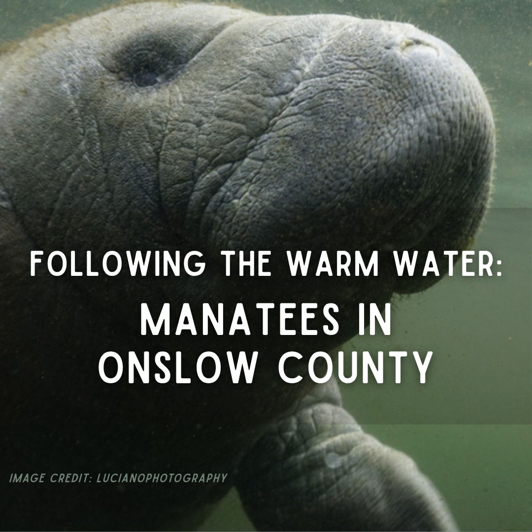
At first, it may look like a series of smooth rings spreading across the water.
Then bubbles rise. A dark shape moves beneath them. A broad back reaches the surface, followed by a rounded nose taking a quick breath before disappearing again.
Along the docks, channels, and marsh-lined sounds of Onslow County, we are used to watching for dolphins, sea turtles, rays, and the passing shadows of large fish. A manatee belongs to a different picture—one usually associated with Florida’s clear springs, mangrove rivers, and groups gathered in the warm water near power plants during winter.
Yet manatees have been appearing around Topsail Island, Surf City, and other parts of the North Carolina coast during the warmer months. In July 2024, drone footage captured several together in Topsail Beach Sound. By the following summer, the University of North Carolina Wilmington’s Marine Mammal Stranding Program reported receiving more than 100 manatee sightings from across North Carolina since 2024 (Bergin, 2024; UNCW, 2026; WECT/6, 2025).
That does not necessarily mean more than 100 different manatees visited our coast. The same animal may be seen several times as it moves from one sound or waterway to another. More people also have phones ready to photograph an animal that might once have surfaced briefly and disappeared without ever being reported.
Even so, the growing number of sightings gives us reason to look more closely.
A manatee in Onslow County may still be unexpected. It is not necessarily lost.
Farther North, but Not Entirely Out of Place
The manatees seen here are Florida manatees (Trichechus manatus latirostris), a subspecies of the West Indian manatee (Trichechus manatus) (Reep & Bonde, 2021).
Florida remains the center of their range in the United States, particularly during winter. Once the water warms in spring, however, some begin traveling.
They move into rivers, bays, estuaries, and coastal waters along the southeastern United States. Some remain within Florida. Others follow the Atlantic coast through Georgia and the Carolinas. A few have traveled as far north as Chesapeake Bay, New England, and beyond (Cummings, 2014; Deutsch et al., 2003; Rathbun et al., 1981).

North Carolina manatee sightings are therefore not new. Records of animals north of Florida go back for generations (Cummings, 2014; Gunter, 1941; Irvine & Campbell, 1978; Rathbun et al., 1981). What may be changing is how frequently they are being seen and how much of their movement we are now able to record.
A growing Florida population may mean more animals are reaching the outer edges of their range. Warmer coastal water may allow them to travel farther north or remain here longer. Better reporting may also be filling gaps in a migration that was already happening but was easier to miss (Cloyed et al., 2025; Laist, 2019).
One sighting cannot tell us which explanation is responsible. A collection of sightings can begin to show a pattern.
Each report adds a location and a date. Over time, those points may reveal when manatees reach North Carolina, whether they return to the same places, how long they remain, and whether mothers eventually bring calves along routes they have traveled before.
A Coast Reached by Memory
Manatees do not look like long-distance travelers.
They usually move with slow strokes of a broad, paddle-shaped tail. They may appear to drift through a canal or graze without any particular destination. Their normal swimming pace is only a few miles per hour, although they can move much faster in a short burst when startled.
A slow pace does not prevent a long journey.
A manatee traveling north does not need to swim hundreds of miles without stopping. It can move for part of the day, rest, feed, explore a side creek, and then continue. Some migrations are fairly direct. Others stretch over weeks or months as the animal pauses along the route.
The path is not as simple as keeping the beach on one side and open water on the other.
A manatee traveling along the Atlantic coast must pass through inlets, move around shoals, cross open stretches of water, and enter branching networks of rivers, sounds, and tidal creeks. Along the way, it must find water deep enough to travel, warm enough to enter, and productive enough to make stopping worthwhile.
Many manatees return to familiar summer and winter habitats year after year. They can remember travel corridors, feeding areas, freshwater sources, and the warm-water refuges that become essential once winter arrives (Deutsch et al., 2003; Reep & Bonde, 2021).
That ability was once easy to underestimate because a manatee’s brain looks different from the deeply folded brains of dolphins, primates, and elephants. Behavioral research has since shown that manatees can learn visual and sound-based tasks, remember what they have learned, and solve some discrimination problems at levels comparable with animals better known for their intelligence, including dolphins and elephants. Their intelligence is not simply a slower version of a dolphin’s. It is shaped around the problems a manatee must solve: locating food, reading water movement, recognizing useful habitat, and finding its way through a large and changing network of waterways (Cook et al., 2025; Reep & Bonde, 2021).
They also experience that watery landscape through more than sight.
The coarse hairs around a manatee’s face are called vibrissae—the same word used for a cat’s whiskers. Manatees also have smaller sensory hairs spread across the rest of their bodies. Each hair can respond to touch and movement in the surrounding water (Reep et al., 2001, 2002).
Around the mouth, the stiffest hairs help examine, grasp, and pull vegetation. Across the body, the finer hairs may help the animal detect water currents and nearby movement, giving it information about surroundings that may be difficult to see in cloudy water. It is less like having fur and more like being covered in a field of small underwater sensors (Reep et al., 2001, 2002).
The vibrissae do not hold a map of the coast. They help supply some of the information from which that map can be learned.
A familiar current, bottom texture, channel, or opening between shorelines may become one part of the larger set of clues a manatee uses as it moves. Sight, sound, touch, water temperature, and memory work together rather than as separate navigation systems.
Some of that map is learned early.
A calf remains beside its mother through its first year and sometimes longer. During that time, it follows her between feeding grounds, resting places, travel corridors, and winter refuges. The calf is not only being led from one place to another. It is learning where those places are (Deutsch et al., 2003; Reep & Bonde, 2021).
If a female repeatedly travels north and later brings a calf with her, a North Carolina sound could become part of another manatee’s remembered landscape.
That does not mean every animal seen here learned the route from its mother. Manatees also explore, and individuals do not all follow the same migration. But the animal rising beside a local dock may not have arrived here by accident.
It may be returning to a place where it previously found the right combination of water, food, and shelter.
An Animal Guided by Temperature
A manatee may weigh more than half a ton, but its large body does not protect it from cold water as well as we might expect.
Unlike whales and seals, manatees do not carry a thick layer of insulating blubber. Much of their rounded shape comes from an enormous digestive system needed to break down the plants they eat (Reep & Bonde, 2021).
When water remains below about 68°F, or 20°C, they begin losing body heat faster than they can replace it. Prolonged exposure can cause cold stress, damage internal organs, weaken the immune system, and eventually kill the animal (Bossart et al., 2003; Laist & Reynolds, 2005; Reep & Bonde, 2021).
That lower temperature limit shapes their annual movement.
During winter, Florida manatees gather around places where the water remains reliably warm. Some use natural springs that stay near the same temperature throughout the year. Others depend on warm water released near power plants. These refuges allow them to survive cold periods, but they do not always provide enough vegetation for the animals to remain there throughout the year (Flamm et al., 2012; Laist & Reynolds, 2005).
When spring warms the rivers and coast, the manatees spread out again.
They are generally comfortable in water from about 70°F to 86℉, or roughly 21–30°C. During summer, some shallow Florida bays and lagoons may reach the upper 80s or low 90s—approximately 28–33°C—while coastal waters farther north finally rise above the lower limit manatees need (Cloyed et al., 2025; Reep & Bonde, 2021).

That helps explain the seasonal movement, although it does not prove that animals are leaving Florida simply because it has become too hot. Manatees already live in warm tropical and subtropical environments, and individual animals respond to more than temperature alone.
But temperature does open and close the route.
As the Atlantic coast warms through spring, areas that were dangerous in February become usable by May or June. A manatee can move north through a widening corridor of suitable water, stopping where it finds food, freshwater, quiet resting places, and channels it can safely navigate.
Warmer conditions may also keep that corridor open longer than it once did. Recent models suggest that future changes in temperature and habitat could alter where manatees occur within the continental United States. For now, however, sightings alone cannot tell us how much of the increase comes from changing water temperatures, population recovery, improved reporting, or individual animals exploring beyond familiar areas (Cloyed et al., 2025; Laist, 2019).
They tell us the animals are here.
Understanding why takes a much longer record.
What They Find in Onslow County
Warm water makes the journey possible.
Food gives a manatee a reason to remain.
Manatees are plant eaters. In coastal and estuarine water, they graze on seagrasses, algae, and other aquatic vegetation. Their divided upper lip works almost like two short fingers, grasping and pulling plants into the mouth. Their front flippers can help guide the vegetation as they feed (Reep & Bonde, 2021).
An adult manatee may spend several hours grazing each day. Finding a calm creek is therefore not enough if the bottom offers little to eat. So, manatees explore to find the best combination of resources.
Onslow County’s sounds, tidal creeks, river mouths, and sheltered shorelines can provide many of the pieces a visiting manatee needs. Shallow water allows underwater grasses and algae to grow. Marsh edges offer some protection from larger waves. Inlets and deeper channels connect one feeding area to another.
Much of this habitat is easy to overlook because its most important part lies below the surface.
Submerged aquatic vegetation—or SAV—is the underwater grass growing across parts of our sounds and estuaries. These grass beds are already important to the animals that live here.
Juvenile fish hide among the blades (Orth et al., 2006). Blue crabs, shrimp, snails, and other small animals feed and shelter there. The plants slow the water enough for suspended sediment to settle, hold parts of the bottom in place, release oxygen, and absorb nutrients that might otherwise feed large algae blooms (Heck et al., 2003; Orth et al., 2006).
Clearer water then allows more sunlight to reach the bottom, which helps more grass grow.
It is a habitat that helps maintain the conditions it needs.
To a visiting manatee, the same grass may also be food.
A few summer visitors are unlikely to graze enough to remake Onslow County’s grass beds. In Florida, however, large groups of manatees can remove substantial amounts of vegetation from places they use heavily. If North Carolina becomes a regular summer destination for more animals, researchers will eventually need to understand both sides of that relationship: whether our grass beds can support repeated grazing and whether the grazing changes the beds themselves.
What Changes What They Find Here
For now, the larger concern may be whether those feeding grounds remain available at all.
Underwater grass needs light. When runoff, algae, boat wakes, or disturbed sediment make the water cloudy, less sunlight reaches the bottom. The plants may thin even though the surface of the sound looks much as it did before (Burkholder et al., 2007; Sagerman et al., 2019).
Some changes happen directly within the grass beds. Boat propellers can cut trenches through shallow vegetation. Docks shade the bottom. Development adds more hard surfaces that send runoff toward the water instead of allowing it to soak into the ground. Each change may seem small when viewed from a single property, dock, or channel. Across an estuary, those changes begin to alter how much clear, shallow habitat remains (Burdick & Short, 1999; Sagerman et al., 2019).
Other changes begin farther away but still reach the same habitat.
Beach nourishment can affect this connected system, but the effects depend greatly on where sand is removed, where it is placed, and how the project is carried out. Sand borrowed from the nearshore bottom removes or alters habitat at the borrow site. Sediment escaping into nearby water may temporarily increase cloudiness, and misplaced sand can bury submerged plants or other bottom communities (Peterson & Bishop, 2005).
That does not make every nourishment project equally harmful. Beach nourishment can protect oceanfront infrastructure and restore parts of a storm-damaged beach. The ecological question is not simply whether sand is moved. It is what habitat occupies the borrow and placement areas, how closely the new sediment matches the original sand, how much enters surrounding water, and whether sensitive areas can be avoided (Peterson & Bishop, 2005).

The ocean side of a barrier island and the sound behind it may look like separate shorelines, but they belong to the same moving island.
Barrier islands naturally respond to waves, storms, rising water, and shifting inlets by changing shape and gradually moving. Sand is carried along the beach, pushed over the island during storms, and moved through inlets into the sounds behind it. Those movements help rebuild beaches, create shoals, and allow marshes and shallow-water habitats to form in new places as older ones erode (FitzGerald et al., 2008; Nienhuis & Lorenzo-Trueba, 2019).
Those shallow sound-side habitats are part of what a traveling manatee encounters. The grass beds, marsh edges, shoals, and deeper channels behind the island are shaped partly by sand moving across and around the barrier island itself.
Hard structures are designed to stop part of that movement.
A seawall, revetment, terminal groin, or other hardened structure may protect a building, road, or inlet beside it. But the barrier island does not stop moving simply because one section has been fixed in place. Waves continue carrying sand. Storm water still crosses the island. Inlets and neighboring shorelines continue adjusting around the structure (Dugan et al., 2017; FitzGerald et al., 2008).
When sand can no longer move naturally through one part of the system, erosion may increase nearby or the beach in front of the structure may narrow (Dugan et al., 2017; Kraus & McDougal, 1996). Changes on the ocean side can also affect the amount and path of sediment reaching the inlet, shoals, marsh edges, and shallow sound-side habitat behind the island (FitzGerald et al., 2008; Hein et al., 2019).
That is why the current North Carolina debate over hard structures is larger than whether one structure protects one stretch of property. The question is also what happens to the connected habitats behind the barrier island when a moving shoreline is held in one place.
The same principle applies along the sounds.
A bulkhead may protect a particular property line, but it replaces the gradual meeting of land and water with a wall. Waves strike that wall and may scour sediment from its base or neighboring shoreline. Marsh plants lose the gently sloping ground they need, and as water levels rise, the marsh cannot move inland through a structure.
Living shorelines take a different approach. Marsh plants, oyster shell, low sills, and other natural materials soften waves while keeping more of the gradual connection between land and water. They do not fit every location, but where conditions allow them, they can protect a shoreline without removing all of the habitat at its edge (Gittman et al., 2015, 2016).
Marsh edges, shallow bottoms, shell beds, and underwater grasses do not function as separate pieces. They are part of the bigger ecosystem.
Young shrimp and fish shelter in the grass. Larger fish feed on them. Birds, dolphins, sharks, and people then depend on animals produced within those nursery areas. Remove enough bottom vegetation and the effect does not stop with the grass (Heck et al., 2003; Seitz et al., 2013).
It moves through the food web.
The manatee is not part of that food chain in quite the same way because it eats the plants directly. But its dependence on those grasses places it within the same connected system. Habitat that feeds a manatee also shelters prey for red drum, flounder, speckled trout, blue crabs, and many of the animals people come here hoping to catch or see (Heck et al., 2003; Orth et al., 2006).
A manatee allows us to view that familiar landscape from another direction.
The animal may be large enough to notice from a pier, but it depends on plants that can vanish from the bottom without most people realizing anything has changed. A sound may still look open and inviting from the surface while offering less food and shelter beneath it.
Dredging More Than a Channel
Dredging is part of living along a coast built from moving sand.
Inlets shoal. Channels fill. Boats need safe routes between docks, sounds, and the ocean. Removing sediment can reopen water that has become too shallow to navigate, and a maintained channel may also provide a deeper travel route for a manatee.
But dredging does more than deepen a line across a map.
Where dredging passes through shallow habitat, it may remove submerged grass, soft-bottom communities, shell material, worms, clams, and the small animals living within the sediment. Deepening shallow water may also change how light reaches the bottom and how water moves through the surrounding area (Erftemeijer & Lewis, 2006; Newell et al., 1998).
A patch of grass is not simply removed from the manatee’s menu.
The plants, shell material, and soft sediment form habitat for organisms living both on and beneath the bottom. When that bottom is removed, the community living within it is removed as well. How quickly it returns depends on the type of sediment, the organisms that lived there, surrounding currents, and whether the area is disturbed again before it can recover (Newell et al., 1998).
Sediment suspended during the work may spread beyond the channel itself. As it settles, it can cover nearby plants or shell bottom. While it remains in the water, it blocks light and makes it harder for underwater vegetation to grow. Suspended sediment can also affect fish and shellfish, although the severity depends on how much sediment is present and how long the organisms are exposed to it (Erftemeijer & Lewis, 2006; Wilber & Clarke, 2001).
The answer is not that dredging should never occur. Boats, commercial fisheries, emergency access, and coastal communities all depend on navigable waterways.
The important part is recognizing what lies beneath the proposed route before the bottom is removed—and understanding that a channel cannot be considered separately from the grass beds, marshes, shellfish areas, and shallow nurseries around it.
The same is true when we look at the coast as a whole.
Dredging, bottom trawling, beach nourishment, hardened shorelines, docks, and development are often considered one project or one management decision at a time. The habitat experiences all of them together.
A grass bed already weakened by cloudy water may then be crossed by propellers. A bottom community disturbed by dredging may have less time to recover if the same area is repeatedly trawled or altered by another project. A nursery area may also receive less sediment because of a structure farther along the barrier island.
One action may cause a temporary or limited change. Several disturbances layered across the same connected system can create a larger or longer-lasting effect than any one of them would create alone (Korpinen & Andersen, 2016; Stockbridge et al., 2020).
Protecting the coast therefore requires more than reducing the effects of each individual project. It requires looking at where those projects overlap, what has already changed, and how much working habitat remains before the next solution is added.
The habitat that draws a manatee here is not simply warm water or one patch of grass.
It is the connection among those places: enough food to feed, deeper water to travel, quieter areas to rest, and a route that remains open when it is time to move south.
When Summer Habitat Becomes a Winter Trap
The same waterway that supports a manatee in August may become dangerous by late fall.
Manatees can detect small differences in water temperature and use those differences to locate warmer areas. That sensitivity helps them follow changing conditions, but it cannot create a warm refuge where none exists.
Florida contains springs and heated outfalls that remain warm during winter. Onslow County does not offer the same dependable network.
A deep canal may appear sheltered from wind and waves. Its depth alone cannot keep the water above the temperature a manatee needs.
Because manatees have a relatively slow metabolism and little insulating fat, prolonged cold affects more than their comfort. Digestion begins to slow, appetite falls, and the animal may rapidly lose weight even though its body still needs energy to stay warm. Pale or white areas and open sores may develop across the skin, particularly around the face, flippers, and tail (Bossart et al., 2003).
Cold stress also weakens the immune system. A manatee that survives the first loss of body heat may then become vulnerable to pneumonia, bacterial infections, and a wider breakdown of normal body functions. What begins as exposure to water only a few degrees too cold can become a chain of problems the animal can no longer reverse on its own (Bossart et al., 2003).
The first documented live rescue of a manatee in North Carolina showed how quickly seasonal habitat can become a trap. In November 2024, responders removed a cold-stressed manatee from a canal connected to the Tar River in Greenville. The animal had remained in North Carolina after the surrounding water cooled and could no longer survive there safely. It was transported to Florida, rehabilitated, and later returned to the wild (Gurney, 2024).
The rescue succeeded because someone recognized that the animal was in trouble and reported it.
It also showed the narrow line between opportunity and danger at the northern edge of a species’ range. A longer warm season may allow manatees to travel farther north, but an abrupt autumn cold spell can close that seasonal window very quickly.
Reaching North Carolina is only half the migration.
The animal must also leave in time.
Sea Cows Before Manatees
A living manatee in Onslow County may seem like a new arrival, but it belongs to a much older coastal story.
Manatees are sirenians, members of the group that also includes dugongs and their extinct relatives. The name “sea cow” comes from the way they graze, but the comparison ends there. Their closest living land relatives include elephants, not cattle (Reep & Bonde, 2021).
The first known sirenians appeared about 50 million years ago, during the Eocene (Domning, 2001; Reep & Bonde, 2021).
The world they entered was warmer than ours. Sea levels were high, and broad areas along the edges of the continents were covered by shallow seas.
The earliest known members of the group did not yet look like modern manatees. Animals such as Prorastomus sirenoides still had four usable limbs and probably divided their time between shallow water and land. A later early sirenian called Pezosiren portelli had the heavy ribs and plant-eating teeth associated with sea cows, but it also had four well-developed legs capable of supporting its body on land (Domning, 2001; Reep & Bonde, 2021).


They were the beginning of the transition, not its finished form.
As later sirenians spent more of their lives in water, their bodies changed around that way of life. The front limbs became flippers used for steering, handling vegetation, and moving along the bottom. The hind limbs became smaller until they were no longer visible outside the body. Their ribs and other bones became unusually thick and dense, adding weight that helped keep them submerged while they grazed (Domning, 2001; Reep & Bonde, 2021).
By the end of the Eocene, some branches had become fully aquatic and carried the basic sea-cow shape we would recognize today (Uhen, 2007).
But the place beneath those animals would not have looked like the Onslow County coastline we know.
The Atlantic had not yet arranged our barrier islands, sounds, inlets, and tidal creeks into their modern positions. Shorelines lay elsewhere as sea level rose and fell. Rivers carried different loads of sediment across a coastal plain that repeatedly shifted between dry land, estuary, and shallow sea (Harris & Laws, 1997)
There was no Surf City Pier. There was no fixed line where today’s sound ended and ocean began.

Warm, shallow water stretched across parts of the region. Ancient sea cows moved through those waters, grazing over sediments that would later be buried, compacted, lifted, exposed, and cut through again by waves and rivers (Harris & Laws, 1997; Vélez-Juarbe et al., 2012).
Different branches took different forms.
Both branches inherited a horizontal tail used for propulsion. Modern manatees have a broad, rounded paddle, while dugongs have a divided fluke shaped more like that of a whale (Buchholtz et al., 2007; Reidenberg, 2007).
By the late Oligocene, roughly 23 to 28 million years ago, dugong relatives lived along the coast that would eventually become North Carolina. Fossils of the extinct sirenian, Crenatosiren olseni, have been reported from deposits associated with Onslow Beach (Reep & Bonde, 2021).
A fossil found today is therefore not simply the remains of an animal that once lived near our modern beach.

It is a piece of an older coastline carried into the present.
Those ancient animals were not Florida manatees, and a manatee visiting today is not the return of the same local species. It is a distant relative entering a kind of warm, shallow habitat that sirenians used here millions of years before the first recognizable version of our coastline existed.
That makes the animal both new and familiar.
The back rising beside a dock belongs to a visitor from Florida.
The larger story of sea cows along this coast is written much deeper beneath us.
The Shadow Beside the Boat
The most dangerous part of a manatee’s journey may be the water it shares with us.
Manatees often feed, rest, and travel close to the surface. They do not have a dorsal fin cutting above the water like a dolphin or shark. Their gray backs can disappear beneath glare, cloudy estuarine water, or the reflection of the sky.
Sometimes the animal itself is not the first thing we see.
As a manatee swims beneath the surface, each stroke of its tail may leave a smooth circular swirl behind it. These rings are called their “footprint”. One appears and begins to fade. Another forms several feet away. Together, they trace the path of an animal that may remain almost completely hidden (Factheu et al., 2023).
To a boater, those circles should mean slow down and look more carefully.
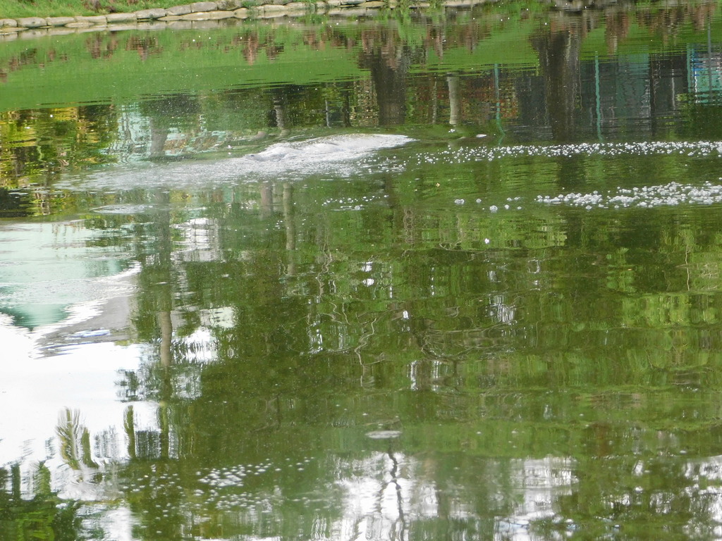

A manatee can make a brief burst of speed to escape danger, but that does not mean it can always avoid a boat. In shallow water, there may be nowhere for it to dive. Even when the animal hears or feels a vessel approaching, it still needs enough time and space to move out of the path.
A propeller can cut deeply into the back or tail. The force of a hull or lower-unit strike can break ribs and cause internal injuries even when the outside of the animal shows little damage (Ackerman et al., 1995; Reep & Bonde, 2021).
Some manatees survive repeated strikes. The pale lines and deep cuts across their backs become permanent scars. Researchers can sometimes use those patterns to recognize the same animal when it is photographed somewhere else (Ackerman et al., 1995; Reep & Bonde, 2021).
A scar can help us follow a migration.
It is still a wound the animal should never have received.

When Kindness Creates Danger
A manatee approaching a dock can be hard to resist.
It may raise its face near a running hose or move toward water draining while someone flushes a boat engine. Offering a drink may feel like helping an animal that has traveled hundreds of miles.
The problem is not only the water it receives. It is what the manatee learns from the encounter.
Manatees remember useful places. If a dock provides freshwater or food, the animal may return. It may begin approaching other docks and boats expecting the same reward. Instead of avoiding propellers, fishing lines, and crowded marinas, it learns to remain close to them.
The behavior that looks friendly may therefore place the animal in greater danger during its next encounter (SC DNR, 2014).
Never feed a manatee or offer it water. Turn off dock hoses when they are not being used. Do not touch, pursue, surround, or enter the water to approach one (SC DNR, 2014).
Manatees are protected under the Marine Mammal Protection Act and the Endangered Species Act, but the more immediate reason is simpler: an animal traveling this far needs to remain able to find what it needs without depending on people (Baier, 2023; Marine mammal protection act of 1972; Perry Roberts & Wieting, 2001).
The safest manatee is not the one that trusts every boat.
It is the one that continues to give boats room.
Sharing the Water
Because manatees are still unusual here, North Carolina boaters may not think to look for them.
Summer also brings more boats into our inlets, sounds, and narrow channels. Many are operated by visitors who may be unfamiliar with the waterway, the shifting shoals, or the wildlife moving beneath them.
Navigation rules are not separate from wildlife protection.

No-wake zones, speed restrictions, channel markers, right-of-way rules, and safe-distance requirements serve much the same purpose as traffic rules on land. They give everyone using a shared space enough time to see a hazard, understand what is happening, and respond.
That includes swimmers, paddlers, anglers, other boaters, and animals resting or traveling near the surface.
A person driving too quickly through a narrow waterway is not simply breaking a rule marked on a sign. Speed reduces the time available to notice a kayak, a child in the water, a shallow bar, a floating log, a sea turtle—or the faint circles left by a manatee just below the surface.
Watching the water means looking beyond the next marker (Calleson & Kipp Frohlich, 2007; Laist & Shaw, 2006).
Before starting an engine, check around the hull, stern, and dock. A manatee may be resting nearby without making a sound. When underway, polarized sunglasses can reduce glare and make dark shapes easier to see.
Watch for a rounded nose, part of a broad back, a patch of bubbles, or a trail of circular footprints. If a manatee is present, slow to idle, steer away from its path, and allow it to leave on its own.
Do not follow it for a photograph or block it against a dock, seawall, or shoreline. If you are in a boat, keep the vessel at least 50 feet away when possible and allow the manatee to choose its own path (Langtimm et al., 2004; USFWS, 2023)..
A photograph taken from a safe distance can still be useful, particularly if it shows scars on the back or tail (Langtimm et al., 2004) .
Every North Carolina sighting should be reported to UNCW’s Marine Mammal Stranding Program. Reports help researchers determine whether several observations involve the same animal, identify locations manatees use repeatedly, and record how early they arrive or how late they remain (UNCW, 2026).
Manatee sightings can be reported to UNCW at 910-515-7354.
An injured, entangled, distressed, stranded, or dead manatee should be reported immediately to the North Carolina Marine Mammal Stranding Network at 252-241-5119 (UNCW, 2026).
Do not try to free, move, feed, or treat the animal yourself.
A sighting report may feel like a small thing after the animal disappears.
Placed beside reports from other docks, piers, and waterways, it becomes part of the record researchers need to understand what is changing.
A New Summer Neighbor
For now, Onslow County is summer habitat at the northern edge of a Florida manatee’s range.
It cannot provide the dependable winter warmth of Florida’s springs and heated refuges. Autumn still places a limit on how long an animal can safely remain.
Summer may be becoming a different story.
Our sounds offer protected water, underwater vegetation, tidal creeks, and connected travel routes. If manatees continue finding those resources here, some may return. A female may eventually travel the route with a calf beside her. A place first reached through exploration may become part of a migration remembered from one year to the next.
That does not mean Onslow County is suddenly becoming another Florida.
It means the familiar landscape may be serving an animal many of us never expected to find within it.
The first sign may be no more than a circle opening across the water. Then another. A dark body rises where we expected a dolphin, takes one breath, and disappears beneath the surface.
What happens next depends partly on the animal—where it travels, what it finds, and whether it returns.
It also depends on what it finds from us.

References
Ackerman, B. B., Wright, S. D., Bonde, R. K., Odell, D. K., & Banowetz, D. J. (1995). Trends and Patterns in Mortality of Manatees in Florida, 1974-1995. National Biological Society, 223-258. https://www.researchgate.net/profile/Robert-Bonde/publication/276987612_Trends_and_patterns_in_mortality_of_manatees_in_Florida_1974-1992_Pages_223-258_in_TJ_O’Shea_BB_Ackerman_and_HF_Percival_editors_1995_Population_Biology_of_the_Florida_Manatee_National_Biological_Serv/links/556db62108aefcb861d9f936/Trends-and-patterns-in-mortality-of-manatees-in-Florida-1974-1992-Pages-223-258-in-TJ-OShea-BB-Ackerman-and-HF-Percival-editors-1995-Population-Biology-of-the-Florida-Manatee-National-Biological-S.pdf
Baier, L. E. (2023). Appendix C. The Endangered Species Act of 1973, as amended today. The Codex of the Endangered Species Act, 671-718. https://doi.org/10.5771/9781538112083-671
Bergin, M. (2024, July 12). Drone video shows manatees at Topsail Beach sound. WRAL.com. https://www.wral.com/archive/21522123/
Bossart, G. D., Meisner, R. A., Rommel, S. A., Ghim, S., & Jenson, A. B. (2003). Pathological features of the Florida manatee cold stress syndrome. Aquatic Mammals, 29(1), 9-17. https://doi.org/10.1578/016754203101024031
Buchholtz, E. A., Booth, A. C., & Webbink, K. E. (2007). Vertebral anatomy in the Florida manatee, Trichechus manatus latirostris: A developmental and evolutionary analysis. The Anatomical Record, 290(6), 624-637. https://doi.org/10.1002/ar.20534
Burdick, D. M., & Short, F. T. (1999). The effects of boat docks on eelgrass beds in coastal waters of Massachusetts. Environmental Management, 23(2), 231-240. https://doi.org/10.1007/s002679900182
Burkholder, J. M., Tomasko, D. A., & Touchette, B. W. (2007). Seagrasses and eutrophication. Journal of Experimental Marine Biology and Ecology, 350(1-2), 46-72. https://doi.org/10.1016/j.jembe.2007.06.024
Calleson, C., & Kipp Frohlich, R. (2007). REVIEW: Slower boat speeds reduce risks to manatees. Endangered Species Research, 3, 295-304. https://doi.org/10.3354/esr00056
Cloyed, C., Hieb, E., Whitehead, H., & Carmichael, R. (2025). Distributional analyses of American manatees in the continental United States under current and future conditions using multiple modeling approaches. Marine Ecology Progress Series, 759, 107-122. https://doi.org/10.3354/meps14836
Cook, P. F., Bauer, G. B., & Reep, R. L. (2025). Manatee cognition and behavior: A neurobiological perspective on an unusual constellation of senses and a unique brain. Frontiers in Behavioral Neuroscience, 19. https://doi.org/10.3389/fnbeh.2025.1576378
Cummings, E. (2014). Spatial and temporal patterns of habitat use and mortality of the Florida manatee (Trichechus manatus latirostris) in the Mid-Atlantic states of North Carolina and Virginia from 1991 to 2012. Aquatic Mammals, 40(2), 126-138. https://doi.org/10.1578/am.40.2.2014.126
Deutsch, C. J., Reid, J. P., Bonde, R. K., Easton, D. E., Kochman, H. I., & O’Shea, T. J. (2003). Seasonal Movements, Migratory Behavior, and Site Fidelity of West Indian Manatees along the Atlantic Coast of the United States. Journal of Wildlife Management, 67(1), 1-77. https://www.jstor.org/stable/3830830
Domning, D. P. (2001). The earliest known fully quadrupedal sirenian. Nature, 413(6856), 625-627. https://doi.org/10.1038/35098072
Dugan, J. E., Emery, K. A., Alber, M., Alexander, C. R., Byers, J. E., Gehman, A. M., McLenaghan, N., & Sojka, S. E. (2017). Generalizing ecological effects of shoreline armoring across soft sediment environments. Estuaries and Coasts, 41(S1), 180-196. https://doi.org/10.1007/s12237-017-0254-x
Erftemeijer, P. L., & Robin Lewis III, R. R. (2006). Environmental impacts of dredging on seagrasses: A review. Marine Pollution Bulletin, 52(12), 1553-1572. https://doi.org/10.1016/j.marpolbul.2006.09.006
Factheu, C., Rycyk, A. M., Kekeunou, S., Keith-Diagne, L. W., Ramos, E. A., Kikuchi, M., & Takoukam Kamla, A. (2023). Acoustic methods improve the detection of the endangered African manatee. Frontiers in Marine Science, 9. https://doi.org/10.3389/fmars.2022.1032464
FitzGerald, D. M., Fenster, M. S., Argow, B. A., & Buynevich, I. V. (2008). Coastal Impacts Due to Sea-Level Rise. Annual Review of Earth and Planetary Sciences, 36(2008), 601-647. https://www.annualreviews.org/content/journals/10.1146/annurev.earth.35.031306.140139
Flamm, R. O., Reynolds, J. E., & Harmak, C. (2012). Improving conservation of Florida manatees (Trichechus manatus latirostris): Conceptualization and contributions toward a regional warm-water network management strategy for sustainable winter habitat. Environmental Management, 51(1), 154-166. https://doi.org/10.1007/s00267-012-9985-4
Gittman, R. K., Peterson, C. H., Currin, C. A., Fodrie, F. J., Piehler, M. F., & Bruno, J. F. (2015). Living shorelines can enhance the nursery role of threatened estuarine habitats. Ecological Applications, 150511113453001. https://doi.org/10.1890/14-0716.1
Gittman, R. K., Scyphers, S. B., Smith, C. S., Neylan, I. P., & Grabowski, J. H. (2016). Ecological consequences of shoreline hardening: A meta-analysis. BioScience, 66(9), 763-773. https://doi.org/10.1093/biosci/biw091
Gunter, G. (1941). Occurrence of the manatee in the United States, with records from Texas. Journal of Mammalogy, 22(1), 60. https://doi.org/10.2307/1374684
Gurney, A. (2024, November 27). First North Carolina live rescue of a manatee. NC Wildlife. https://www.ncwildlife.gov/news/press-releases/2024/11/27/first-north-carolina-live-rescue-manatee
Harris, W., & Laws, R. A. (1997). Paleogene stratigraphy and sea-level history of the North Carolina coastal plain: Global coastal onlap and tectonics. Sedimentary Geology, 108(1-4), 91-120. https://doi.org/10.1016/s0037-0738(96)00049-8
Heck, K., Hays, G., & Orth, R. (2003). Critical evaluation of the nursery role hypothesis for seagrass meadows. Marine Ecology Progress Series, 253, 123-136. https://doi.org/10.3354/meps253123
Hein, C. J., Fallon, A. R., Rosen, P., Hoagland, P., Georgiou, I. Y., FitzGerald, D. M., Morris, M., Baker, S., Marino, G. B., & Fitzsimons, G. (2019). Shoreline dynamics along a developed river mouth barrier island: Multi-decadal cycles of erosion and event-driven mitigation. Frontiers in Earth Science, 7. https://doi.org/10.3389/feart.2019.00103
Irvine, A. B., & Campbell, H. W. (1978). Aerial census of the west Indian manatee, Trichechus manatus, in the southeastern United States. Journal of Mammalogy, 59(3), 613-617. https://doi.org/10.2307/1380237
Korpinen, S., & Andersen, J. H. (2016). A global review of cumulative pressure and impact assessments in marine environments. Frontiers in Marine Science, 3. https://doi.org/10.3389/fmars.2016.00153
Kraus, N. C., & McDougal, W. G. (1996). The Effects of Seawalls on the Beach: Part I, An Updated Literature Review. Journal of Coastal Research, 12(3), 691-701. https://www.academia.edu/31099155/The_Effects_of_Seawalls_on_the_Beach_Part_I_An_Updated_Literature_Review
Laist, D. W. (2019, April 29). More manatees in NC waters signal recovery. Coastal Review. https://coastalreview.org/2019/04/more-manatees-in-nc-waters-signal-recovery/
Laist, D. W., & Reynolds, J. E. (2005). Influence of power plants and other warm-water refuges on Florida manatees. Marine Mammal Science, 21(4), 739-764. https://doi.org/10.1111/j.1748-7692.2005.tb01263.x
Laist, D. W., & Shaw, C. (2006). Preliminary evidence that boat speed restrictions reduce deaths of Florida manatees. Marine Mammal Science, 22(2), 472-479. https://doi.org/10.1111/j.1748-7692.2006.00027.x
Langtimm, C. A., Beck, C. A., Edwards, H. H., Fick‐Child, K. J., Ackerman, B. B., Barton, S. L., & Hartley, W. C. (2004). Survival estimates for Florida manatees from the photo‐identification of individuals. Marine Mammal Science, 20(3), 438-463. https://doi.org/10.1111/j.1748-7692.2004.tb01171.x
Marine mammal protection act (1972). (1987). Federal Statutes on Environmental Protection, 66-67. https://doi.org/10.5040/9798216968115.ch-040
Newell, R. C., Seiderer, L. J., & Hitchcock, D. (1998). The impact of dredging works in coastal waters: a review of the sensitivity to disturbance and subsequent recovery of biological resources on the sea bed. Oceanography and Marine Biology, 36, 127-178. https://www.researchgate.net/publication/298415859_The_impact_of_dredging_works_in_coastal_waters_a_review_of_the_sensitivity_to_disturbance_and_subsequent_recovery_of_biological_resources_on_the_sea_bed
Nienhuis, J. H., & Lorenzo-Trueba, J. (2019). Simulating barrier island response to sea level rise with the barrier island and inlet environment (BRIE) model v1.0. Geoscientific Model Development, 12(9), 4013-4030. https://doi.org/10.5194/gmd-12-4013-2019
Orth, R. J., Carruthers, T. J., Dennison, W. C., Duarte, C. M., Fourqurean, J. W., Heck, K. L., Hughes, A. R., Kendrick, G. A., Kenworthy, W. J., Olyarnik, S., Short, F. T., Waycott, M., & Williams, S. L. (2006). A global crisis for seagrass ecosystems. BioScience, 56(12), 987. https://doi.org/10.1641/0006-3568(2006)56[987:agcfse]2.0.co;2
Perry Roberts, S., & Wieting, D. S. (2001). Marine mammal protection act (MMPA) and Endangered Species Act (ESA) regulations for marine mammal nonfishery interactions. The Journal of the Acoustical Society of America, 110(5_Supplement), 2710-2710. https://doi.org/10.1121/1.4777360
Peterson, C. H., & Bishop, M. J. (2005). Assessing the environmental impacts of beach nourishment. BioScience, 55(10), 887. https://doi.org/10.1641/0006-3568(2005)055[0887:ateiob]2.0.co;2
Rathbun, G. B., Bonde, R. K., & Clay, D. (1981). The Status of the West Indian Manatee on the Atlantic Coast North of Florida (Technical Bulletin WL 5). Georgia Department of Natural Resources. https://www.researchgate.net/profile/Robert-Bonde/publication/299397456_The_status_of_the_West_Indian_manatee_on_the_Atlantic_Coast_north_of_Florida/links/56f3f24308ae95e8b6d05e32/The-status-of-the-West-Indian-manatee-on-the-Atlantic-Coast-north-of-Florida.pdf
Reep, R. L., & Bonde, R. K. (2021). The Florida Manatee: Biology and Conservation (2nd ed.). University Press of Florida. https://books.google.com/books?hl=en&lr=&id=wYLSEAAAQBAJ&oi=fnd&pg=PT11&dq=manatees+north+carolina&ots=5TwY4_i8ry&sig=aIRCpfy2Nf6YHspnimQd1pgUnSg#v=onepage&q&f=false
Reep, R., Marshall, C., & Stoll, M. (2002). Tactile hairs on the Postcranial body in Florida manatees: A mammalian lateral line? Brain, Behavior and Evolution, 59(3), 141-154. https://doi.org/10.1159/000064161
Reep, R., Stoll, M., Marshall, C., Homer, B., & Samuelson, D. (2001). Microanatomy of facial vibrissae in the Florida manatee: The basis for specialized sensory function and Oripulation. Brain, Behavior and Evolution, 58(1), 1-14. https://doi.org/10.1159/000047257
Reidenberg, J. S. (2007). Anatomical adaptations of aquatic mammals. The Anatomical Record, 290(6), 507-513. https://doi.org/10.1002/ar.20541
Sagerman, J., Hansen, J. P., & Wikström, S. A. (2019). Effects of boat traffic and mooring infrastructure on aquatic vegetation: A systematic review and meta-analysis. Ambio, 49(2), 517-530. https://doi.org/10.1007/s13280-019-01215-9
SC DNR. (2014, April 24). Feeding, watering manatees is illegal. South Carolina Department of Natural Resources. https://www.dnr.sc.gov/news/yr2014/april24/april24_manatee.html
Seitz, R. D., Wennhage, H., Bergström, U., Lipcius, R. N., & Ysebaert, T. (2013). Ecological value of coastal habitats for commercially and ecologically important species. ICES Journal of Marine Science, 71(3), 648-665. https://doi.org/10.1093/icesjms/fst152
Short, F. T., & Burdick, D. M. (1996). Quantifying eelgrass habitat loss in relation to housing development and nitrogen loading in Waquoit Bay, Massachusetts. Estuaries, 19(3), 730. https://doi.org/10.2307/1352532
Stockbridge, J., Jones, A. R., & Gillanders, B. M. (2020). A meta-analysis of multiple stressors on seagrasses in the context of marine spatial cumulative impacts assessment. Scientific Reports, 10(1). https://doi.org/10.1038/s41598-020-68801-w
Todd, V. L., Todd, I. B., Gardiner, J. C., Morrin, E. C., MacPherson, N. A., DiMarzio, N. A., &
Thomsen, F. (2014). A review of impacts of marine dredging activities on marine mammals. ICES Journal of Marine Science, 72(2), 328-340. https://doi.org/10.1093/icesjms/fsu187
Uhen, M. D. (2007). Evolution of marine mammals: Back to the sea after 300 million years. The Anatomical Record, 290(6), 514-522. https://doi.org/10.1002/ar.20545
UNCW. (2026). Marine mammal stranding program. University of North Carolina Wilmington | UNCW. https://www.uncw.edu/research/major-programs/marine-mammal-stranding/
USFWS. (2023). Technical Assistance to Evaluate Effects on Antillean Manatees. U. S. Fish and Wildlife Service – Caribbean Ecological Services Field Office. https://www.fws.gov/sites/default/files/documents/Technical%20Assistance%20to%20Evaluate%20Effects%20on%20Antillean%20manatees_0.pdf
Velez-Juarbe, J., Domning, D. P., & Pyenson, N. D. (2012). Iterative evolution of sympatric Seacow (Dugongidae, sirenia) assemblages during the past ∼26 million years. PLoS ONE, 7(2), e31294. https://doi.org/10.1371/journal.pone.0031294
WECT/6. (2025, August 5). Marine mammal expert pushes boating safety after reported increase of more manatees in NC. https://www.wect.com. https://www.wect.com/video/2025/08/05/marine-mammal-expert-pushes-boating-safety-after-reported-increase-more-manatees-nc/
Wilber, D. H., & Clarke, D. G. (2001). Biological effects of suspended sediments: A review of suspended sediment impacts on fish and shellfish with relation to dredging activities in estuaries. North American Journal of Fisheries Management, 21(4), 855-875. https://doi.org/10.1577/1548-8675(2001)021<0855:beossa>2.0.co;2