Tag: Topsail Island sharks

  • Reader Request: The Horizon Line: Where Great White Sharks Live off Onslow County

    Reader Request: The Horizon Line: Where Great White Sharks Live off Onslow County

    At low tide in winter, the creeks around Topsail Island narrow into quiet channels. Spartina stems lean toward one another across dark water. Oyster reefs stand exposed, their edges iced with salt. What remains moves slowly—ribbed mussels closing, mullet idling in the deeper bends, a heron pacing the shallows with stiff patience. The marsh looks reduced, as though winter has thinned it to structure and shadow.

    Out beyond the last line of cordgrass, the sound changes. Surf carries a different cadence in January—longer intervals, heavier breaks. The nearshore bar holds a pale line of foam that drifts south with the longshore current. Between creek mouth and open ocean, water mixes: tannin-dark runoff meeting green Atlantic, cold layers sliding beneath one another, density sorting itself by temperature and salinity. This seam—where the estuary exhales into the sea—remains active even when everything else seems paused.

    Stand at the mouth of a Topsail inlet in winter. Behind you, the marsh exhales through narrow creeks, dark water slipping between oyster and spartina. In front of you, the ocean opens in bands—foam, green, deeper blue.

    Now lift your eyes. Let them pass the breakers, the outer bar, the long surface of moving water. Where sky finally meets ocean—two to four miles offshore—the shelf settles into depths of roughly 10–40 m (30–130 ft), and winter temperatures stabilize between about 12–18 °C (54–64 °F) (Thorrold et al., 2014; Jorgensen et al., 2012; Weng et al., 2007). That is the band these sharks inhabit. Not the inlet. Not the surf. The horizon itself.

    It is along that distant seam, where depth, temperature, and prey structure become coherent across miles of water, that great white sharks pass.

    They do not announce themselves. Their movement is inferred through instruments, through acoustic detections and satellite tracks that appear weeks later as lines on maps. Winter on this coast is a season of quiet transfers—energy shifting offshore, biomass redistributing, heat draining southward along the shelf—and the sharks move within that transfer rather than against it.

    A Corridor Without a Shoreline

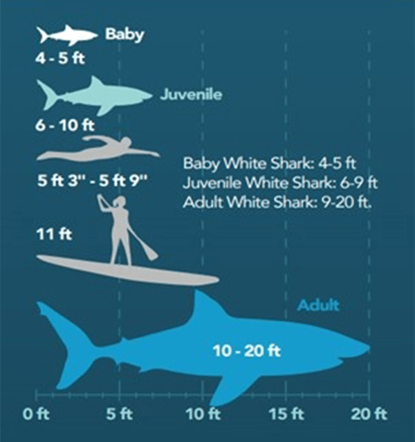
    Juvenile and subadult great white sharks (Carcharodon carcharias) follow these gradients. Individuals tagged in the western North Atlantic move south in autumn, traveling along the inner continental shelf in response to cooling surface temperatures and changing prey fields (Thorrold et al., 2014; Weng et al., 2007). Their paths run parallel to beaches that appear empty, unfolding not at wading depth but across the first miles of open water beyond land.

    What scientists call nearshore along this coast is not the water at your feet, but the inner shelf itself—the first one to five miles of ocean beyond the dunes. From Topsail, that span begins well past the surf zone and extends to the horizon. It is within this band, most often two to four miles offshore, that great white sharks are detected, tracking thermal structure and prey fields rather than the visible edge of land (Jorgensen et al., 2012; Thorrold et al., 2014).

    Satellite track of the white shark Lydia across the western North Atlantic. Each point marks a location in time. The Carolina coast appears here not as an edge, but as a corridor—one segment in a much larger pattern of movement measured in hundreds of miles, not yards. | Photo credit: OCEARCH
    Satellite track of the white shark Lydia across the western North Atlantic. Each point marks a location in time. The Carolina coast appears here not as an edge, but as a corridor—one segment in a much larger pattern of movement measured in hundreds of miles, not yards. | Photo credit: OCEARCH

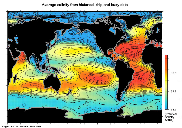
    Near Topsail, winter surface temperatures drop into the low teens Celsius. Estuarine outflow forms narrow plumes that extend beyond the bars on ebb tides, carrying silts, copepods, and the chemical signature of the marsh outward. These plumes flatten and stretch across miles of shelf water, generating faint fronts—microboundaries in temperature and turbidity that organize small fishes and forage species into coherent fields (Govoni & Grimes, 1992). Where prey becomes legible at that scale, predators follow.

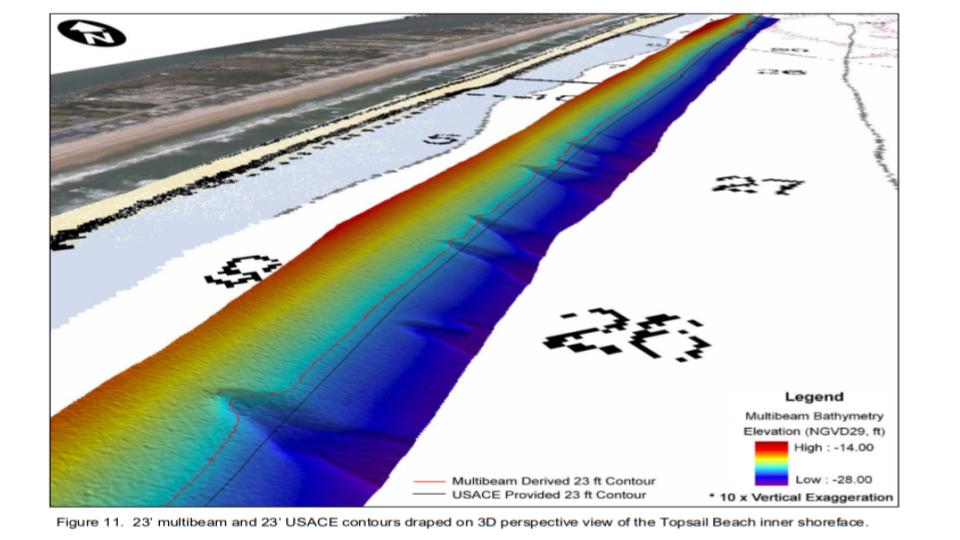
    The sharks do not enter the creeks. Their bodies are built for open water: rigid caudal keels, high-aspect fins, a metabolism tuned for sustained movement. Estuaries in this region are shallow, variable, and often less saline than oceanic preference. Studies of juvenile white shark habitat use show strong association with nearshore coastal zones but little penetration into true estuarine environments (Curtis et al., 2015; Weng et al., 2007). They patrol the edge instead, working along bars and troughs that persist far offshore as submerged ridges, where mullet, menhaden, and small elasmobranchs concentrate.

    This boundary behavior is not avoidance. It is partitioning.

    The marsh produces, the ocean receives, and predators remain where exchange becomes structured.

    Winter as Reconfiguration

    In winter, this exchange intensifies. Cold fronts arrive from the northwest, pushing surface water offshore and steepening nearshore wave energy. Bottom stress increases. Sand and shells are mobilized along the bars. Each storm reshapes the nearshore topography, altering trough depth and current velocity across miles of shelf in ways that reorganize prey habitat in real time (Riggs et al., 1995). Fish shift position, rays redistribute, and the water column reorders itself around new gradients.

    White sharks read these changes through sensory fields invisible to surface observers. Their lateral lines register turbulence. Electroreception resolves the faint impulses of buried prey. Olfaction extends across kilometers. Movement becomes a continuous dialogue between physiology and physics (Kajiura & Holland, 2002; Klimley, 1994).

    The sensory landscape of a shark is measured in gradients, not edges. Vision resolves only tens of meters. Pressure and electrical cues register within arm’s length. Scent and sound, however, extend across hundreds to thousands of meters, allowing sharks to navigate and track structure far beyond what any shoreline observer can perceive. | Photo credit: Ocean Noise
    The sensory landscape of a shark is measured in gradients, not edges. Vision resolves only tens of meters. Pressure and electrical cues register within arm’s length. Scent and sound, however, extend across hundreds to thousands of meters, allowing sharks to navigate and track structure far beyond what any shoreline observer can perceive. | Photo credit: Ocean Noise

    Winter is not a pause in this system. It is a reconfiguration.

    Acoustic detections along the Carolina coast show juvenile white sharks present through late autumn and early winter, with some individuals remaining offshore well into colder months (Thorrold et al., 2014). Their movements correlate more strongly with temperature fronts than with latitude alone (Jorgensen et al., 2012). They do not migrate in straight lines. Instead, they spiral along shelf edges, revisit productive zones, and pause in thermal refugia that may lie several miles from the beach.

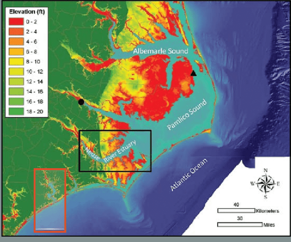
    These behaviors mirror the structure of the coast itself. Topsail Island is not a fixed boundary but a shifting interface shaped by inlet migration, storm overwash, and sediment exchange, where creek mouths relocate over decades and bars emerge and vanish under successive storms, leaving the spatial memory of the landscape provisional—held only as long as sediment and flow allow.

    So too is the habitat of a shark.

    Why There Are Nurseries Elsewhere—and Not Here

    Nursery grounds for great white sharks are well documented along parts of the U.S. Atlantic coast and in southern California, where juveniles aggregate in shallow nearshore zones that maintain moderate depths, stable thermal structure, and consistent prey availability (Curtis et al., 2015; Weng et al., 2007). These systems tend to hold water within the same 12–20 °C (54–68 °F) envelope for extended periods and provide refuge from larger predators while supporting rapid growth.

    Relative size of baby, juvenile, and adult white sharks. True nurseries support animals in the 4–6 ft range—small, energetically constrained, and vulnerable. These habitats are shallow, protected, and bounded. The open, wave-driven shelf off Onslow County is built for movement, not residence. | California State University of Long Beach
    Relative size of baby, juvenile, and adult white sharks. True nurseries support animals in the 4–6 ft range—small, energetically constrained, and vulnerable. These habitats are shallow, protected, and bounded. The open, wave-driven shelf off Onslow County is built for movement, not residence. | California State University of Long Beach

    What distinguishes these regions is not simply abundance, but predictability.

    Along the Pacific coast and in parts of the Northeast, pinniped rookeries concentrate thousands of seals and sea lions into narrow coastal bands. Each breeding season injects dense, spatially fixed pulses of biomass into shallow water. Energy arrives at the same place, at the same time, year after year. Juvenile white sharks in these systems do not patrol corridors; they occupy fields. Foraging becomes localized rather than distributed (Curtis et al., 2015; Weng et al., 2007; Heithaus et al., 2008).

    The waters off Topsail differ.

    There are no pinniped rookeries anchoring prey to shore. Winter temperatures fall rapidly below nursery thresholds. Nearshore depths drop into energetic surf zones. Storm frequency reshapes the seafloor weekly. Forage fishes are abundant, but diffuse—organized by fronts and bars that shift across miles of shelf rather than accumulating at fixed nodes. Energy here is mobile.

    This does not exclude juvenile white sharks. It alters how they use the coast.

    Rather than residency, this region becomes a corridor.

    A short field documentary traces this same corridor northward, showing how white sharks follow seals and thermal structure along the Atlantic shelf. The movement is quiet, methodical, and seasonal—more migration than pursuit.

    The Horizon Line

    Great white sharks moving along the Carolina coast occupy a band of water that feels farther away than it is. Telemetry detections cluster not in the surf, not in the creeks, but along the inner continental shelf—most often between one and five miles offshore, with a strong concentration in the two–to–four mile range (Thorrold et al., 2014; Jorgensen et al., 2012).

    From the beach at Topsail, that distance aligns almost exactly with the horizon line. At eye level, the curve of the Earth hides the ocean surface at roughly two to three miles. The place where water meets sky is not poetic. It is geometric. It is where the sharks most often pass.

    Stand at an inlet and let your eyes move outward. Past the spartina. Past the oyster. Past the breakers. Past the outer bar. Across the long surface of moving water.

    The marsh is feet.
    The surf is tens of yards.
    The sharks are miles.

    Satellite-tracked movements of two white sharks, Lydia and Mary Lee, overlaid on sea surface height anomalies. Pink and green points show locations within ocean eddies and Gulf Stream meanders—features invisible from shore but persistent in the water column. These are not random paths. They trace structure. | Photo credit: Peter Gaube/University of Washington
    Satellite-tracked movements of two white sharks, Lydia and Mary Lee, overlaid on sea surface height anomalies. Pink and green points show locations within ocean eddies and Gulf Stream meanders—features invisible from shore but persistent in the water column. These are not random paths. They trace structure. | Photo credit: Peter Gaube/University of Washington

    They move along a band of sea that is still shaped by the coast—where sandbars continue offshore as submerged ridges, where storm energy reorganizes the bottom across long reaches of shelf, where creek plumes stretch into faint fronts that may never be visible from land. It is nearshore in every ecological sense, but far beyond the scale of swimmers and anglers.

    This is why their presence feels paradoxical. They are coastal sharks, yet almost never beach sharks.

    The surf zone is turbulent, shallow, and repeatedly reworked. For a large-bodied predator built for glide efficiency and sustained cruising, it is energetically expensive and ecologically thin. The outer bars and troughs beyond it, however, form stable corridors where prey aligns with bathymetry and current seams persist long enough to be read across miles of water (Riggs et al., 1995; Govoni & Grimes, 1992).

    White sharks patrol the architecture of the coast rather than its edge.

    Reading the Geometry of Water

    Along this coast, the critical structure is not reef or rock but relief within sand. Outer bars, troughs, and subtle shelf undulations shape current velocity and wave energy so that where flow accelerates over a bar and relaxes into a trough, particles accumulate, plankton concentrates, and baitfish align across long seams of water. These features are transient, redrawn by storms, but the process persists, and sharks move with that process rather than with any single landmark.

    Temperature acts as the first gate.

    Juvenile and subadult white sharks in the western North Atlantic consistently occupy water between roughly 12–20 °C, shifting position to remain within that band as seasons change (Thorrold et al., 2014; Jorgensen et al., 2012). In winter, this envelope compresses toward the shelf and organizes into narrow ribbons—fronts formed where cold coastal water meets slightly warmer offshore layers.

    These fronts emerge precisely where nearshore bathymetry and estuarine outflow intersect.

    They are not visible in calm seas. They are persistent enough to organize prey.

    Schooling fishes—menhaden, mullet, anchovies, juvenile drum—respond to temperature microgradients, oxygen regimes shaped by mixing, turbidity edges created by creek plumes, and current seams formed by bar–trough relief (Able & Fahay, 2010; Whitfield et al., 2012). Their schools elongate along these boundaries and compress where water masses converge.

    White sharks are not oriented to the bottom in the way flounder, rays, or crabs are. They move through fields of temperature, density, and motion, following the places where gradients hold their shape long enough to be read. Far offshore, those gradients diffuse into broad, indistinct layers. In the surf, they fracture under turbulence. Between them lies a narrow, shifting band where structure persists—where fronts stretch, prey aligns, and information remains coherent across distance.

    As the tide turns, creek water pauses and then begins to drain. Foam lines detach from oyster edges and slide seaward. The surface darkens as tannins mix with green. That exported water does not vanish at the bar; it stretches outward across miles of shelf, flattening into a plume that reorganizes temperature and turbidity along its path. Miles offshore, a shark adjusts depth, not in response to the marsh itself, but to the geometry that marsh has become within the sea.

    Elevation and coastal structure along the North Carolina shore. What appears from the beach as a single edge is, in fact, a layered interface—river basins, marsh plains, barrier islands, and shelf waters braided together. The geometry of this coast is written in gradients, not lines. | Image credit: J. P. Walsh
    Elevation and coastal structure along the North Carolina shore. What appears from the beach as a single edge is, in fact, a layered interface—river basins, marsh plains, barrier islands, and shelf waters braided together. The geometry of this coast is written in gradients, not lines. Orange rectangle shows Onslow county area. | Image credit: J. P. Walsh

    Closing

    The tide does not complete this exchange. It only begins it. Each ebb redraws the shelf in faint ways—altering where heat settles, where turbidity thins, where prey holds for a moment before dispersing. The coast does not end at the dunes. It continues offshore as structure, as gradient, as corridor. Somewhere within that extension, a shark moves, not toward land and not away from it, but along the shifting shape of the boundary itself.

    References

    Able, K. W., & Fahay, M. P. (2010). Ecology of estuarine fishes: Temperate waters of the western North Atlantic. Johns Hopkins University Press.

    Curtis, T. H., Metzger, G., Fischer, C., McBride, B., McCallister, M., Winn, L. J., Quinlan, J., & Ajemian, M. J. (2018). First insights into the movements of young-of-the-year white sharks (Carcharodon carcharias) in the western North Atlantic Ocean. Scientific Reports, 8(1). https://doi.org/10.1038/s41598-018-29180-5

    Govoni, J. J., & Grimes, C. B. (1992). The surface accumulation of larval fishes by hydrodynamic convergence within the Mississippi River plume front. Continental Shelf Research, 12(11), 1265-1276. https://doi.org/10.1016/0278-4343(92)90063-p

    Heithaus, M. R., Frid, A., Wirsing, A. J., & Worm, B. (2008). Predicting ecological consequences of marine top predator declines. Trends in Ecology & Evolution, 23(4), 202-210. https://doi.org/10.1016/j.tree.2008.01.003

    Jorgensen, S. J., Reeb, C. A., Chapple, T. K., Anderson, S., Perle, C., Van Sommeran, S. R., Fritz-Cope, C., Brown, A. C., Klimley, A. P., & Block, B. A. (2009). Philopatry and migration of Pacific white sharks. Proceedings of the Royal Society B: Biological Sciences, 277(1682), 679-688. https://doi.org/10.1098/rspb.2009.1155

    Kajiura, S. M., & Holland, K. N. (2002). Electroreception in juvenile scalloped hammerhead and sandbar sharks. Journal of Experimental Biology, 205(23), 3609-3621. https://doi.org/10.1242/jeb.205.23.3609

    Klimley, A. P. (1994). The predatory behavior of the white shark. American Scientist, 82(2), 122-133. https://www.jstor.org/stable/29775147

    Riggs, S. R., Cleary, W. J., & Snyder, S. W. (1995). Influence of inherited geologic framework on barrier shoreface morphology and dynamics. Marine Geology, 126(1-4), 213-234. https://doi.org/10.1016/0025-3227(95)00079-e

    Thorrold, S., Houghton, L., & Skomal, G. (2014). Temperature-depth profiles from archival tags deployed on basking sharks tagged from F/V Ezyduzit in the Northwest Atlantic ocean from 2004-2011 (Basking shark Geochem tracers project). Biological and Chemical Oceanography Data Management Office. https://doi.org/10.1575/1912/bco-dmo.476294.1

    Weng, K. C., Boustany, A. M., Pyle, P., Anderson, S. D., Brown, A., & Block, B. A. (2007). Migration and habitat of white sharks (Carcharodon carcharias) in the eastern Pacific Ocean. Marine Biology, 152(4), 877-894. https://doi.org/10.1007/s00227-007-0739-4

    Whitfield, A., Elliott, M., Basset, A., Blaber, S., & West, R. (2012). Paradigms in estuarine ecology – A review of the Remane diagram with a suggested revised model for estuaries. Estuarine, Coastal and Shelf Science, 97, 78-90. https://doi.org/10.1016/j.ecss.2011.11.026

  • The Winter Guild: Nearshore Sharks and the Ecology of Cold Water

    The Winter Guild: Nearshore Sharks and the Ecology of Cold Water

    On a winter morning in Surf City, the beach feels emptied of its usual cast. Pelicans still cruise the shoreline in loose, patient lines, rising and settling with the wind. Gulls hover over seams in the water where green folds into brown. The tide sounds heavier now, denser, carrying cold through the shallows.

    Along Topsail Island, the nearshore zone becomes a narrow corridor of motion and restraint. Waves collapse without urgency. The water clears between fronts. What summer spreads wide, winter compresses.

    To most people, this looks like absence. The season reads as retreat.

    But the coastal system has not gone dormant. It has been edited.

    Cold water does not simply slow life along the coast; it reorganizes it. As the air cools, shallow waters lose heat first. Deeper layers follow. The sharp thermal steps of summer—warm surface, cool bottom—soften into sameness. What had been stacked becomes blended. Oceanographers describe this seasonal collapse as thermal and density homogenization (Cai et al., 2021), but on the shore it feels like weight: the water darker, heavier, less willing to give anything up.

    This change reshapes everything that lives within it. Temperature governs metabolism. Light governs production. Density governs movement. Winter redraws those rules.

    Predation does not vanish. It narrows.

    Reading the Cold and Salt

    Winter along the Carolina coast is defined less by dates than by gradients. Surface waters along the inner shelf commonly cool into the range of about 8–12 °C (46–54 °F), while deeper waters offshore remain slightly warmer under the influence of slope waters and the Gulf Stream (Atkinson et al., 1983; Cai et al., 2021; Rasmussen et al., 2005). The warm-bottom refuges of summer collapse. The mixed layer deepens. A single, colder column replaces the layered world of warm months.

    Sea surface temperature (SST) range for Topsail Island, NC from 1981-2005. The thick yellow line shows average SST compared to 1984, while thin, black lines show extreme temperatures. | Photo credit: Surf-forecast.com, 2005
    Sea surface temperature (SST) range for Topsail Island, NC from 1981-2005. The thick yellow line shows average SST compared to 1984, while thin, black lines show extreme temperatures. | Photo credit: Surf-forecast.com, 2005

    Salinity follows a similar simplification. In winter, open shelf waters settle into a narrow band—typically around 32–35 parts per thousand (ppt), the same saltiness as the open Atlantic. Freshwater input diminishes, and stronger winds and tides smooth what summer once layered.

    Average salinity utilizing historical ship and buoy data. Notice practical salinity is higher (red) along the North Carolina coastline. | Photo credit: World Ocean Atlas, 2009
    Average salinity utilizing historical ship and buoy data. Notice practical salinity is higher (red) along the North Carolina coastline. | Photo credit: World Ocean Atlas, 2009

    In summer, that chemistry fractures. Heavy rains, river discharge, and weak vertical mixing dilute nearshore and estuarine waters into the low 20s ppt or even the teens, sending plumes of brackish water outward from creek mouths and sounds (Singer et al., 1980). Onslow Bay becomes chemically patchworked: stratified sounds, plume-fed inlets, and salinity fronts that drift and reform with each tide.

    Winter erases that mosaic. Only near inlets and estuary mouths do sharp gradients persist, briefly stacking fresher creek water over denser seawater before winds and tides flatten them again. Where summer offered a quilt of chemical habitats, winter replaces it with continuity.

    Light changes too. Shorter days and deeper mixing reduce phytoplankton growth, pushing the productive layer below the surface and dimming the water’s green cast. Satellite and in situ records from the Mid-Atlantic shelf show winter as the seasonal low point for surface chlorophyll and primary productivity (Xu et al., 2011). The surface darkens. The food web thins from its base upward.

    Winter does not remove life. It rearranges it.

    Benthic invertebrates burrow or slow. Many fishes retreat or become lethargic. Bait compresses into fewer corridors—thermal seams, nearshore troughs, inlet mouths, shelf breaks—where temperature and oxygen remain tolerable. What summer scattered across marsh, creek, sound, and surf now funnels into lines.

    This is what the filter does. It sheds surplus. It strips away species that require warmth, shallow stability, or dense prey. What remains are animals built to endure cold, exploit structure, or move precisely between systems.

    Winter does not simplify the coast. It sharpens it.

    3D perspective of coastline of Topsail Beach inner shoreface visualizes depth. | Photo credit: Greenhorn & O'Mara Consulting Engineers & Geodynamics, 2007, p. 221
    3D perspective of coastline of Topsail Beach inner shoreface visualizes depth. | Photo credit: Greenhorn & O’Mara Consulting Engineers & Geodynamics, 2007, p. 221

    The Inshore Winterer: Atlantic Spiny Dogfish

    By midwinter, nearshore waters along this coast settle into a narrow thermal band—often between about 8 and 12 °C (46–54 °F) from surface to bottom (Atkinson et al., 1983; Cai et al., 2021). For many coastal fishes, that range marks the edge of activity. For Atlantic spiny dogfish (Squalus acanthias), it is home.

    Across the North Atlantic, dogfish remain active in waters as cold as 4–6 °C (39–43 °F), with their highest densities often occurring well below the temperatures that drive other sharks away (Bangley & Rulifson, 2014; Sulikowski et al., 2010). Their physiology, growth patterns, and life history are tuned to persistence rather than speed, favoring endurance in lean systems over burst performance in rich ones (Tribuzio et al., 2010).

    When winter flattens the water column into uniform cold, dogfish are not pushed to the margins of survival. They are moving within their preferred envelope.

    Their bodies are built for this season. Unlike sharks bound to a narrow depth band, dogfish move freely through the water column—from the surface to depths approaching 200 meters—tracking temperature and prey through vertical space (Campana et al., 2009; Carlson et al., 2014; Sulikowski et al., 2010). In winter, when baitfish and invertebrates compress into fewer layers, that vertical freedom becomes a hunting advantage. A predator locked to one plane must wait. Dogfish can follow.

    Nearshore waters and inlets become conveyor belts in winter. Tides concentrate prey flushed from estuaries. Cold fronts reorganize the column. What looks empty from the beach is often a thin band of movement just beyond the breakers. Dogfish occupy that band—persistent, economical, often in loose groups—feeding on schooling fishes and benthic prey even as energy margins tighten (Bangley & Rulifson, 2014).

    Winter does not exclude them. It clears room for them.

    The Atlantic spiny dogfish moves freely through the water column from the surface up to 200 meters. | Photo credit: ©Malcolm Francis
    The Atlantic spiny dogfish moves freely through the water column from the surface up to 200 meters. | Photo credit: ©Malcolm Francis

    The Threshold Species: Sandbar Sharks

    Sandbar sharks (Carcharhinus plumbeus) read that same winter map very differently. In warm months, juveniles rely on shallow estuaries where bottom temperatures routinely exceed 15–18 °C (59–64 °F), conditions that accelerate growth, digestion, and survival (Bangley et al., 2018; Collatos, Abel & Martin, 2020). These flats become engines of development—wide, shallow spaces where warmth turns food into body.

    By winter, those same bottoms cool into the low teens Celsius—often around 10–13 °C (50–55 °F) and sometimes lower. The estuary does not become lethal. It becomes unprofitable. Feeding no longer offsets the energetic cost of movement and digestion in cold water, particularly for juveniles still building mass.

    Unlike dogfish, sandbar sharks cannot remain inside a cold system and adapt to its structure. Their bodies and life histories are tuned to warm, shallow stability. Their performance drops rapidly as temperature declines; muscle efficiency, digestion, and growth all slow (Crear et al., 2019). When that stability collapses, they respond laterally rather than vertically—sliding down the coast or into slightly deeper nearshore waters where bottom temperatures remain marginally warmer (Bangley et al., 2018).

    Where dogfish remain and work winter’s compression, sandbars leave it.

    They are still part of the region, but they are absent from the nearshore corridor. They become threshold species—present in the seasonal arc, absent from the winter system itself. The estuary no longer belongs to them.

    Sandbar sharks will move to warmer water in winter and will move to deeper offshore waters or move southward down the coast. | Photo credit: (c) The Wet Lens, 2023
    Sandbar sharks will move to warmer water in winter and will move to deeper offshore waters or move southward down the coast. | Photo credit: (c) The Wet Lens, 2023

    The Offshore Presence: Dusky Sharks

    Dusky sharks (Carcharhinus obscurus) follow a third geometry. They tolerate cool water, but within a narrower band than many coastal sharks—most often occupying waters between roughly 10 and 20 °C (50–68 °F) (Bangley et al., 2020; Manz et al., 2025). When nearshore temperatures along this coast fall into that range, duskies can be present. When they rise beyond it in spring and summer, they are gone.

    Their winter preference therefore lies not in the compressed nearshore column, but along offshore corridors where temperature is steadier and remains within that narrow envelope. Shelf and slope waters influenced by the Gulf Stream often stay buffered within those bounds even as inshore waters swing widely (Atkinson et al., 1983; Rasmussen et al., 2005).

    Dusky sharks do not attempt to work winter’s compression. They choose stability instead. Rather than hunting within a narrowed corridor, they reposition along thermally buffered routes where cold arrives slowly and predictably.

    From land, this reads as vacancy. The surf appears emptied. Yet beyond the bar, duskies remain active in a parallel winter economy—tracking prey along shelf edges and slope corridors invisible from shore.

    They have not disappeared. They have changed address.

    Dusky sharks prefer cooler temperature waters and may be present in our nearshore waters. However, when waters warm beyond 20 °C (68 °F), they will move to cooler waters. | Photo credit: jmartincrossley, iNaturalist, 2026
    Dusky sharks prefer cooler temperature waters and may be present in our nearshore waters. However, when waters warm beyond 20 °C (68 °F), they will move to cooler waters. | Photo credit: jmartincrossley, iNaturalist, 2026

    Winter as an Ecological Filter

    By February, the coast has shed its surplus.

    The fish that needed warmth are gone. The invertebrates that depended on light have slowed or buried. What remains are species built to move through cold, to wait, or to follow structure instead of abundance.

    Winter filters by physics first.

    A deep mixed layer removes warm-bottom refuges (Cai et al., 2021). Bottom-water intrusions in Onslow Bay and adjacent shelf waters restructure the vertical habitat, replacing summer’s layered gradients with cold continuity (Hofmann et al., 1981). Uniform salinity simplifies the chemical landscape. Reduced light and productivity shrink the food web’s base (Xu et al., 2011). Currents sharpen boundaries between inshore and offshore waters, and periodic Gulf Stream intrusions create moving seams of heat and prey (Atkinson et al., 1983; Rasmussen et al., 2005).

    These constraints become biological.

    Prey compress. Movement costs rise. Energy budgets tighten. Species that require constant warmth, shallow stability, or dense forage are excluded. Those that remain are specialists: animals that tolerate cold, exploit vertical structure, or reposition with precision.

    Dogfish persist because they can work the layered winter column, remaining inside nearshore waters and inlets even as surface and bottom temperatures converge. Sandbar sharks withdraw from estuaries and shallow flats, shifting down the coast or into slightly deeper nearshore habitats where bottom temperatures remain metabolically tolerable. Dusky sharks relocate more completely, leaving the coastal corridor for offshore shelf and slope waters where Gulf Stream influence preserves thermal stability and prey remains distributed.

    Each species reads the same season and answers it differently—not by disappearance, but by repositioning within a changing map.

    Winter does not erase complexity. It concentrates it.

    Meteorological seasons are based upon the annual temperature cycle and differ from the astronomical seasons based upon the position of the sun relative to the Earth. The meteorological seasons help scientists track climate and weather changes. | Photo credit: NOAA, 2024
    Meteorological seasons are based upon the annual temperature cycle and differ from the astronomical seasons based upon the position of the sun relative to the Earth. The meteorological seasons help scientists track climate and weather changes. | Photo credit: NOAA, 2024

    A Season That Is Beginning to Shift

    The cues that drive migration—photoperiod, temperature thresholds, energetic margins—are no longer fixed. Recent models suggest that warming oceans are already altering how and when coastal sharks move, stretching winter windows and delaying departures (Manz et al., 2025).

    This does not announce collapse. It signals reorganization.

    From the beach, the change may remain imperceptible. The surf will still look calm. Pelicans will still cruise. The marsh will still pale. But beneath that surface, the system will continue to read its invisible clocks.

    Winter along Surf City and Topsail Island is not an end. It is a narrowing—a season where cold, salt, light, and current decide who remains.

    They are still here. They have simply become harder to see.

    References

    Atkinson, L. P., Lee, T. N., Blanton, J. O., & Chandler, W. S. (1983). Climatology of the southeastern United States continental shelf waters. Journal of Geophysical Research: Oceans, 88(C8), 4705-4718. https://doi.org/10.1029/jc088ic08p04705

    Bangley, C. W., Curtis, T. H., Secor, D. H., Latour, R. J., & Ogburn, M. B. (2020). Identifying important juvenile dusky shark habitat in the Northwest Atlantic ocean using acoustic telemetry and spatial modeling. Marine and Coastal Fisheries, 12(5), 348-363. https://doi.org/10.1002/mcf2.10120

    Bangley, C. W., Paramore, L., Dedman, S., & Rulifson, R. A. (2018). Delineation and mapping of coastal shark habitat within a shallow lagoonal Estuary. PLOS ONE, 13(4), e0195221. https://doi.org/10.1371/journal.pone.0195221

    Bangley, C. W., & Rulifson, R. A. (2014). Feeding habits, daily ration, and potential predatory impact of mature female spiny dogfish in North Carolina coastal waters. North American Journal of Fisheries Management, 34(3), 668-677. https://doi.org/10.1080/02755947.2014.902410

    Cai, C., Kwon, Y., Chen, Z., & Fratantoni, P. (2021). Mixed layer depth climatology over the Northeast U.S. continental shelf (1993–2018). Continental Shelf Research, 231, 104611. https://doi.org/10.1016/j.csr.2021.104611

    Campana, S. E., Jamie, A., & Gibson, F. (2008). Stock structure, life history, fishery and abundance indices for spiny dogfish (Squalus Acanthias) in Atlantic Canada (2007/089). Canadian Science Advisory Secretariat. https://www.researchgate.net/publication/268389393_Stock_Structure_Life_History_Fishery_and_Abundance_Indices_for_Spiny_Dogfish_Squalus_acanthias_in_Atlantic_Canada

    Carlson, A. E., Hoffmayer, E. R., Tribuzio, C. A., & Sulikowski, J. A. (2014). The use of satellite tags to redefine movement patterns of spiny dogfish (Squalus acanthias) along the U.S. East Coast: Implications for fisheries management. PLoS ONE, 9(7), e103384. https://doi.org/10.1371/journal.pone.0103384

    Collatos, C., Abel, D. C., & Martin, K. L. (2020). Seasonal occurrence, relative abundance, and migratory movements of juvenile sandbar sharks, Carcharhinus plumbeus, in Winyah Bay, South Carolina. Environmental Biology of Fishes, 103(7), 859-873. https://doi.org/10.1007/s10641-020-00989-2

    Crear, D. P., Brill, R. W., Bushnell, P. G., Latour, R. J., Schweiterman, G. D., Steffen, R. M., & Weng, K. C. (2019). The impacts of warming and hypoxia on the performance of an obligate ram ventilator. Conservation Physiology, 7(1). https://doi.org/10.1093/conphys/coz026

    Greenhorn & O’Mara Consulting Engineers, & Geodynamics. (2007). High-Resolution 3D Bathymetric Assessment of Potential Hard Bottom Habitats: Topsail Island, Surf City and North Topsail Island, NC (Project No. DACW54-02-D-0006, Delivery Order 0035 Modification 01 Nearshore Hardbottom Sidescan Survey for Multibeam Data Collections Topsail Island, NC G&O Project Number 146046.T35.6481.GEO). https://www.saw.usace.army.mil/Portals/59/docs/coastal_storm_damage_reduction/SCNTB/R%20-%20Hard%20Bottom%20Survey%20Reports.pdf

    Hofmann, E. E., Pietrafesa, L. J., & Atkinson, L. P. (1981). A bottom water intrusion in Onslow Bay, North Carolina. Deep Sea Research Part A. Oceanographic Research Papers, 28(4), 329-345. https://doi.org/10.1016/0198-0149(81)90003-0

    Manz, M. H., Shipley, O. N., Cerrato, R. M., Hueter, R. E., Newton, A. L., Tyminski, J. P., Franks, B. R., Curtis, T. H., Fischer, C., Zacharias, J. P., Scott, C., Dunton, K. J., Kneebone, J., Peterson, B. J., Scannell, B. J., Dodd, J. F., & Frisk, M. G. (2025). Predictions of southern migration timing in coastal sharks under future ocean warming. Conservation Biology, 39(6). https://doi.org/10.1111/cobi.70080

    NASA Salinity. (2011, October 20). Average Salinity From Historical Ship and Buoy Data. https://salinity.oceansciences.org/gallery-images-more.htm?id=10

    Rasmussen, L. L., Gawarkiewicz, G., Owens, W. B., & Lozier, M. S. (2005). Slope water, Gulf Stream, and seasonal influences on southern Mid‐Atlantic bight circulation during the fall‐winter transition. Journal of Geophysical Research: Oceans, 110(C2). https://doi.org/10.1029/2004jc002311

    Singer, J. J., Atkinson, L. P., & Pietrafesa, L. J. (1980). Summertime advection of low salinity surface waters into Onslow Bay. Estuarine and Coastal Marine Science, 11(1), 73-82. https://doi.org/10.1016/s0302-3524(80)80030-2

    Sulikowski, J., Galuardi, B., Bubley, W., Furey, N., Driggers, W., Ingram, G., & Tsang, P. (2010). Use of satellite tags to reveal the movements of spiny dogfish Squalus acanthias in the western North Atlantic Ocean. Marine Ecology Progress Series, 418, 249-254. https://doi.org/10.3354/meps08821

    Surf-forecast.com. (2005). Topsail island water temperature (Sea) and wetsuit guide (Carolina north, USA). https://www.surf-forecast.com/breaks/Topsail-Island/seatemp

    Tribuzio, C. A., Kruse, G. H., & Fujioka, J. T. (2010). Age and growth of spiny dogfish (Squalus acanthias) in the Gulf of Alaska: analysis of alternative growth models ( Fishery Bulletin(Vol. 108, Issue 2)). National Marine Fisheries Service. https://go.gale.com/ps/i.do?id=GALE%7CA227944663&sid=googleScholar&v=2.1&it=r&linkaccess=abs&issn=00900656&p=AONE&sw=w&userGroupName=anon%7E4fe11d55&aty=open-web-entry

    Xiu, Y., Chant, R., Gong, D., Castelao, R., Glenn, S., & Schofield, O. (2011). Seasonal variability of chlorophyll a in the Mid-Atlantic Bight. Continental Shelf Research, 31(16), 1640-1650. https://doi.org/10.1016/j.csr.2011.05.019