Tag: Topsail Island

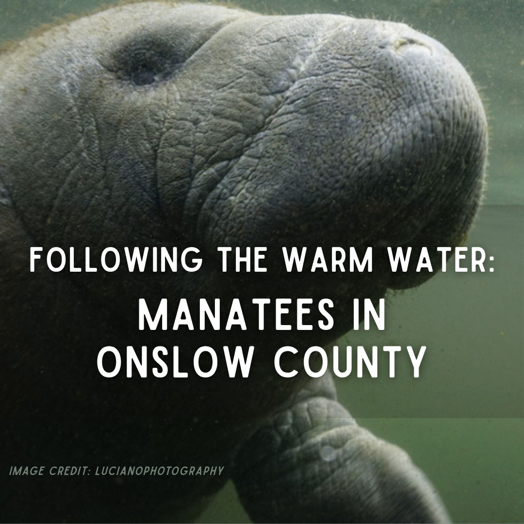
  • Following the Warm Water: Manatees in Onslow County

    Following the Warm Water: Manatees in Onslow County

    At first, it may look like a series of smooth rings spreading across the water.

    Then bubbles rise. A dark shape moves beneath them. A broad back reaches the surface, followed by a rounded nose taking a quick breath before disappearing again.

    Along the docks, channels, and marsh-lined sounds of Onslow County, we are used to watching for dolphins, sea turtles, rays, and the passing shadows of large fish. A manatee belongs to a different picture—one usually associated with Florida’s clear springs, mangrove rivers, and groups gathered in the warm water near power plants during winter.

    Yet manatees have been appearing around Topsail Island, Surf City, and other parts of the North Carolina coast during the warmer months. In July 2024, drone footage captured several together in Topsail Beach Sound. By the following summer, the University of North Carolina Wilmington’s Marine Mammal Stranding Program reported receiving more than 100 manatee sightings from across North Carolina since 2024 (Bergin, 2024; UNCW, 2026; WECT/6, 2025).

    That does not necessarily mean more than 100 different manatees visited our coast. The same animal may be seen several times as it moves from one sound or waterway to another. More people also have phones ready to photograph an animal that might once have surfaced briefly and disappeared without ever being reported.

    Even so, the growing number of sightings gives us reason to look more closely.

    A manatee in Onslow County may still be unexpected. It is not necessarily lost.

    Farther North, but Not Entirely Out of Place

    The manatees seen here are Florida manatees (Trichechus manatus latirostris), a subspecies of the West Indian manatee (Trichechus manatus) (Reep & Bonde, 2021).

    Florida remains the center of their range in the United States, particularly during winter. Once the water warms in spring, however, some begin traveling.

    They move into rivers, bays, estuaries, and coastal waters along the southeastern United States. Some remain within Florida. Others follow the Atlantic coast through Georgia and the Carolinas. A few have traveled as far north as Chesapeake Bay, New England, and beyond (Cummings, 2014; Deutsch et al., 2003; Rathbun et al., 1981).

    Florida remains the center of the manatee’s U.S. range, but during warmer months some individuals travel north along the Atlantic coast into Georgia, the Carolinas, Virginia, and beyond. | Image credit: Manatee Migration and Facts
    Florida remains the center of the manatee’s U.S. range, but during warmer months some individuals travel north along the Atlantic coast into Georgia, the Carolinas, Virginia, and beyond. | Image credit: Manatee Migration and Facts

    North Carolina manatee sightings are therefore not new. Records of animals north of Florida go back for generations (Cummings, 2014; Gunter, 1941; Irvine & Campbell, 1978; Rathbun et al., 1981). What may be changing is how frequently they are being seen and how much of their movement we are now able to record.

    A growing Florida population may mean more animals are reaching the outer edges of their range. Warmer coastal water may allow them to travel farther north or remain here longer. Better reporting may also be filling gaps in a migration that was already happening but was easier to miss (Cloyed et al., 2025; Laist, 2019).

    One sighting cannot tell us which explanation is responsible. A collection of sightings can begin to show a pattern.

    Each report adds a location and a date. Over time, those points may reveal when manatees reach North Carolina, whether they return to the same places, how long they remain, and whether mothers eventually bring calves along routes they have traveled before.

    A Coast Reached by Memory

    Manatees do not look like long-distance travelers.

    They usually move with slow strokes of a broad, paddle-shaped tail. They may appear to drift through a canal or graze without any particular destination. Their normal swimming pace is only a few miles per hour, although they can move much faster in a short burst when startled.

    A slow pace does not prevent a long journey.

    A manatee traveling north does not need to swim hundreds of miles without stopping. It can move for part of the day, rest, feed, explore a side creek, and then continue. Some migrations are fairly direct. Others stretch over weeks or months as the animal pauses along the route.

    The path is not as simple as keeping the beach on one side and open water on the other.

    A manatee traveling along the Atlantic coast must pass through inlets, move around shoals, cross open stretches of water, and enter branching networks of rivers, sounds, and tidal creeks. Along the way, it must find water deep enough to travel, warm enough to enter, and productive enough to make stopping worthwhile.

    Many manatees return to familiar summer and winter habitats year after year. They can remember travel corridors, feeding areas, freshwater sources, and the warm-water refuges that become essential once winter arrives (Deutsch et al., 2003; Reep & Bonde, 2021).

    That ability was once easy to underestimate because a manatee’s brain looks different from the deeply folded brains of dolphins, primates, and elephants. Behavioral research has since shown that manatees can learn visual and sound-based tasks, remember what they have learned, and solve some discrimination problems at levels comparable with animals better known for their intelligence, including dolphins and elephants. Their intelligence is not simply a slower version of a dolphin’s. It is shaped around the problems a manatee must solve: locating food, reading water movement, recognizing useful habitat, and finding its way through a large and changing network of waterways (Cook et al., 2025; Reep & Bonde, 2021).

    They also experience that watery landscape through more than sight.

    The coarse hairs around a manatee’s face are called vibrissae—the same word used for a cat’s whiskers. Manatees also have smaller sensory hairs spread across the rest of their bodies. Each hair can respond to touch and movement in the surrounding water (Reep et al., 2001, 2002).

    Around the mouth, the stiffest hairs help examine, grasp, and pull vegetation. Across the body, the finer hairs may help the animal detect water currents and nearby movement, giving it information about surroundings that may be difficult to see in cloudy water. It is less like having fur and more like being covered in a field of small underwater sensors (Reep et al., 2001, 2002).

    The vibrissae do not hold a map of the coast. They help supply some of the information from which that map can be learned.

    A familiar current, bottom texture, channel, or opening between shorelines may become one part of the larger set of clues a manatee uses as it moves. Sight, sound, touch, water temperature, and memory work together rather than as separate navigation systems.

    Some of that map is learned early.

    A calf remains beside its mother through its first year and sometimes longer. During that time, it follows her between feeding grounds, resting places, travel corridors, and winter refuges. The calf is not only being led from one place to another. It is learning where those places are (Deutsch et al., 2003; Reep & Bonde, 2021).

    If a female repeatedly travels north and later brings a calf with her, a North Carolina sound could become part of another manatee’s remembered landscape.

    That does not mean every animal seen here learned the route from its mother. Manatees also explore, and individuals do not all follow the same migration. But the animal rising beside a local dock may not have arrived here by accident.

    It may be returning to a place where it previously found the right combination of water, food, and shelter.

    An Animal Guided by Temperature

    A manatee may weigh more than half a ton, but its large body does not protect it from cold water as well as we might expect.

    Unlike whales and seals, manatees do not carry a thick layer of insulating blubber. Much of their rounded shape comes from an enormous digestive system needed to break down the plants they eat (Reep & Bonde, 2021).

    When water remains below about 68°F, or 20°C, they begin losing body heat faster than they can replace it. Prolonged exposure can cause cold stress, damage internal organs, weaken the immune system, and eventually kill the animal (Bossart et al., 2003; Laist & Reynolds, 2005; Reep & Bonde, 2021).

    That lower temperature limit shapes their annual movement.

    During winter, Florida manatees gather around places where the water remains reliably warm. Some use natural springs that stay near the same temperature throughout the year. Others depend on warm water released near power plants. These refuges allow them to survive cold periods, but they do not always provide enough vegetation for the animals to remain there throughout the year (Flamm et al., 2012; Laist & Reynolds, 2005).

    When spring warms the rivers and coast, the manatees spread out again.

    They are generally comfortable in water from about 70°F to 86℉, or roughly 21–30°C. During summer, some shallow Florida bays and lagoons may reach the upper 80s or low 90s—approximately 28–33°C—while coastal waters farther north finally rise above the lower limit manatees need (Cloyed et al., 2025; Reep & Bonde, 2021).

    Florida manatees are grouped into four regional populations, each connected to a network of warm-water refuges that become essential when winter water temperatures fall. | Image credit: Laist et al., 2012
    Florida manatees are grouped into four regional populations, each connected to a network of warm-water refuges that become essential when winter water temperatures fall. | Image credit: Laist et al., 2012

    That helps explain the seasonal movement, although it does not prove that animals are leaving Florida simply because it has become too hot. Manatees already live in warm tropical and subtropical environments, and individual animals respond to more than temperature alone.

    But temperature does open and close the route.

    As the Atlantic coast warms through spring, areas that were dangerous in February become usable by May or June. A manatee can move north through a widening corridor of suitable water, stopping where it finds food, freshwater, quiet resting places, and channels it can safely navigate.

    Warmer conditions may also keep that corridor open longer than it once did. Recent models suggest that future changes in temperature and habitat could alter where manatees occur within the continental United States. For now, however, sightings alone cannot tell us how much of the increase comes from changing water temperatures, population recovery, improved reporting, or individual animals exploring beyond familiar areas (Cloyed et al., 2025; Laist, 2019).

    They tell us the animals are here.

    Understanding why takes a much longer record.

    What They Find in Onslow County

    Warm water makes the journey possible.

    Food gives a manatee a reason to remain.

    Manatees are plant eaters. In coastal and estuarine water, they graze on seagrasses, algae, and other aquatic vegetation. Their divided upper lip works almost like two short fingers, grasping and pulling plants into the mouth. Their front flippers can help guide the vegetation as they feed (Reep & Bonde, 2021).

    An adult manatee may spend several hours grazing each day. Finding a calm creek is therefore not enough if the bottom offers little to eat. So, manatees explore to find the best combination of resources.

    Onslow County’s sounds, tidal creeks, river mouths, and sheltered shorelines can provide many of the pieces a visiting manatee needs. Shallow water allows underwater grasses and algae to grow. Marsh edges offer some protection from larger waves. Inlets and deeper channels connect one feeding area to another.

    Much of this habitat is easy to overlook because its most important part lies below the surface.

    Submerged aquatic vegetation—or SAV—is the underwater grass growing across parts of our sounds and estuaries. These grass beds are already important to the animals that live here. 

    Juvenile fish hide among the blades (Orth et al., 2006). Blue crabs, shrimp, snails, and other small animals feed and shelter there. The plants slow the water enough for suspended sediment to settle, hold parts of the bottom in place, release oxygen, and absorb nutrients that might otherwise feed large algae blooms (Heck et al., 2003; Orth et al., 2006).

    Clearer water then allows more sunlight to reach the bottom, which helps more grass grow.

    It is a habitat that helps maintain the conditions it needs.

    To a visiting manatee, the same grass may also be food.

    A few summer visitors are unlikely to graze enough to remake Onslow County’s grass beds. In Florida, however, large groups of manatees can remove substantial amounts of vegetation from places they use heavily. If North Carolina becomes a regular summer destination for more animals, researchers will eventually need to understand both sides of that relationship: whether our grass beds can support repeated grazing and whether the grazing changes the beds themselves.

    What Changes What They Find Here

    For now, the larger concern may be whether those feeding grounds remain available at all.

    Underwater grass needs light. When runoff, algae, boat wakes, or disturbed sediment make the water cloudy, less sunlight reaches the bottom. The plants may thin even though the surface of the sound looks much as it did before (Burkholder et al., 2007; Sagerman et al., 2019).

    Some changes happen directly within the grass beds. Boat propellers can cut trenches through shallow vegetation. Docks shade the bottom. Development adds more hard surfaces that send runoff toward the water instead of allowing it to soak into the ground. Each change may seem small when viewed from a single property, dock, or channel. Across an estuary, those changes begin to alter how much clear, shallow habitat remains (Burdick & Short, 1999; Sagerman et al., 2019).

    Other changes begin farther away but still reach the same habitat.

    Beach nourishment can affect this connected system, but the effects depend greatly on where sand is removed, where it is placed, and how the project is carried out. Sand borrowed from the nearshore bottom removes or alters habitat at the borrow site. Sediment escaping into nearby water may temporarily increase cloudiness, and misplaced sand can bury submerged plants or other bottom communities (Peterson & Bishop, 2005).

    That does not make every nourishment project equally harmful. Beach nourishment can protect oceanfront infrastructure and restore parts of a storm-damaged beach. The ecological question is not simply whether sand is moved. It is what habitat occupies the borrow and placement areas, how closely the new sediment matches the original sand, how much enters surrounding water, and whether sensitive areas can be avoided (Peterson & Bishop, 2005).

    The recommended draft Surf City beach nourishment plan (6/6/2024) identifies offshore borrow areas where sand would be removed before being placed along the beach. Each borrow site is also part of the nearshore habitat connected to the island, inlets, and sounds behind it. | Image credit: USACE
    The recommended draft Surf City beach nourishment plan (6/6/2024) identifies offshore borrow areas where sand would be removed before being placed along the beach. Each borrow site is also part of the nearshore habitat connected to the island, inlets, and sounds behind it. | Image credit: USACE

    The ocean side of a barrier island and the sound behind it may look like separate shorelines, but they belong to the same moving island.

    Barrier islands naturally respond to waves, storms, rising water, and shifting inlets by changing shape and gradually moving. Sand is carried along the beach, pushed over the island during storms, and moved through inlets into the sounds behind it. Those movements help rebuild beaches, create shoals, and allow marshes and shallow-water habitats to form in new places as older ones erode (FitzGerald et al., 2008; Nienhuis & Lorenzo-Trueba, 2019).

    Those shallow sound-side habitats are part of what a traveling manatee encounters. The grass beds, marsh edges, shoals, and deeper channels behind the island are shaped partly by sand moving across and around the barrier island itself.

    Hard structures are designed to stop part of that movement.

    A seawall, revetment, terminal groin, or other hardened structure may protect a building, road, or inlet beside it. But the barrier island does not stop moving simply because one section has been fixed in place. Waves continue carrying sand. Storm water still crosses the island. Inlets and neighboring shorelines continue adjusting around the structure (Dugan et al., 2017; FitzGerald et al., 2008).

    When sand can no longer move naturally through one part of the system, erosion may increase nearby or the beach in front of the structure may narrow (Dugan et al., 2017; Kraus & McDougal, 1996). Changes on the ocean side can also affect the amount and path of sediment reaching the inlet, shoals, marsh edges, and shallow sound-side habitat behind the island (FitzGerald et al., 2008; Hein et al., 2019).

    That is why the current North Carolina debate over hard structures is larger than whether one structure protects one stretch of property. The question is also what happens to the connected habitats behind the barrier island when a moving shoreline is held in one place.

    The same principle applies along the sounds.

    A bulkhead may protect a particular property line, but it replaces the gradual meeting of land and water with a wall. Waves strike that wall and may scour sediment from its base or neighboring shoreline. Marsh plants lose the gently sloping ground they need, and as water levels rise, the marsh cannot move inland through a structure.

    Living shorelines take a different approach. Marsh plants, oyster shell, low sills, and other natural materials soften waves while keeping more of the gradual connection between land and water. They do not fit every location, but where conditions allow them, they can protect a shoreline without removing all of the habitat at its edge (Gittman et al., 2015, 2016).

    Marsh edges, shallow bottoms, shell beds, and underwater grasses do not function as separate pieces. They are part of the bigger ecosystem.

    Young shrimp and fish shelter in the grass. Larger fish feed on them. Birds, dolphins, sharks, and people then depend on animals produced within those nursery areas. Remove enough bottom vegetation and the effect does not stop with the grass (Heck et al., 2003; Seitz et al., 2013).

    It moves through the food web.

    The manatee is not part of that food chain in quite the same way because it eats the plants directly. But its dependence on those grasses places it within the same connected system. Habitat that feeds a manatee also shelters prey for red drum, flounder, speckled trout, blue crabs, and many of the animals people come here hoping to catch or see (Heck et al., 2003; Orth et al., 2006).

    A manatee allows us to view that familiar landscape from another direction.

    The animal may be large enough to notice from a pier, but it depends on plants that can vanish from the bottom without most people realizing anything has changed. A sound may still look open and inviting from the surface while offering less food and shelter beneath it.

    Dredging More Than a Channel

    Dredging is part of living along a coast built from moving sand.

    Inlets shoal. Channels fill. Boats need safe routes between docks, sounds, and the ocean. Removing sediment can reopen water that has become too shallow to navigate, and a maintained channel may also provide a deeper travel route for a manatee.

    But dredging does more than deepen a line across a map.

    Where dredging passes through shallow habitat, it may remove submerged grass, soft-bottom communities, shell material, worms, clams, and the small animals living within the sediment. Deepening shallow water may also change how light reaches the bottom and how water moves through the surrounding area (Erftemeijer & Lewis, 2006; Newell et al., 1998).

    A patch of grass is not simply removed from the manatee’s menu.

    The plants, shell material, and soft sediment form habitat for organisms living both on and beneath the bottom. When that bottom is removed, the community living within it is removed as well. How quickly it returns depends on the type of sediment, the organisms that lived there, surrounding currents, and whether the area is disturbed again before it can recover (Newell et al., 1998).

    Sediment suspended during the work may spread beyond the channel itself. As it settles, it can cover nearby plants or shell bottom. While it remains in the water, it blocks light and makes it harder for underwater vegetation to grow. Suspended sediment can also affect fish and shellfish, although the severity depends on how much sediment is present and how long the organisms are exposed to it (Erftemeijer & Lewis, 2006; Wilber & Clarke, 2001).

    The answer is not that dredging should never occur. Boats, commercial fisheries, emergency access, and coastal communities all depend on navigable waterways.

    The important part is recognizing what lies beneath the proposed route before the bottom is removed—and understanding that a channel cannot be considered separately from the grass beds, marshes, shellfish areas, and shallow nurseries around it.

    The same is true when we look at the coast as a whole.

    Dredging, bottom trawling, beach nourishment, hardened shorelines, docks, and development are often considered one project or one management decision at a time. The habitat experiences all of them together.

    A grass bed already weakened by cloudy water may then be crossed by propellers. A bottom community disturbed by dredging may have less time to recover if the same area is repeatedly trawled or altered by another project. A nursery area may also receive less sediment because of a structure farther along the barrier island.

    One action may cause a temporary or limited change. Several disturbances layered across the same connected system can create a larger or longer-lasting effect than any one of them would create alone (Korpinen & Andersen, 2016; Stockbridge et al., 2020).

    Protecting the coast therefore requires more than reducing the effects of each individual project. It requires looking at where those projects overlap, what has already changed, and how much working habitat remains before the next solution is added.

    The habitat that draws a manatee here is not simply warm water or one patch of grass.

    It is the connection among those places: enough food to feed, deeper water to travel, quieter areas to rest, and a route that remains open when it is time to move south.

    When Summer Habitat Becomes a Winter Trap

    The same waterway that supports a manatee in August may become dangerous by late fall.

    Manatees can detect small differences in water temperature and use those differences to locate warmer areas. That sensitivity helps them follow changing conditions, but it cannot create a warm refuge where none exists.

    Florida contains springs and heated outfalls that remain warm during winter. Onslow County does not offer the same dependable network.

    A deep canal may appear sheltered from wind and waves. Its depth alone cannot keep the water above the temperature a manatee needs.

    Because manatees have a relatively slow metabolism and little insulating fat, prolonged cold affects more than their comfort. Digestion begins to slow, appetite falls, and the animal may rapidly lose weight even though its body still needs energy to stay warm. Pale or white areas and open sores may develop across the skin, particularly around the face, flippers, and tail (Bossart et al., 2003).

    Cold stress also weakens the immune system. A manatee that survives the first loss of body heat may then become vulnerable to pneumonia, bacterial infections, and a wider breakdown of normal body functions. What begins as exposure to water only a few degrees too cold can become a chain of problems the animal can no longer reverse on its own (Bossart et al., 2003).

    The first documented live rescue of a manatee in North Carolina showed how quickly seasonal habitat can become a trap. In November 2024, responders removed a cold-stressed manatee from a canal connected to the Tar River in Greenville. The animal had remained in North Carolina after the surrounding water cooled and could no longer survive there safely. It was transported to Florida, rehabilitated, and later returned to the wild (Gurney, 2024).

    The rescue succeeded because someone recognized that the animal was in trouble and reported it.

    It also showed the narrow line between opportunity and danger at the northern edge of a species’ range. A longer warm season may allow manatees to travel farther north, but an abrupt autumn cold spell can close that seasonal window very quickly.

    Reaching North Carolina is only half the migration.

    The animal must also leave in time.

    Sea Cows Before Manatees

    A living manatee in Onslow County may seem like a new arrival, but it belongs to a much older coastal story.

    Manatees are sirenians, members of the group that also includes dugongs and their extinct relatives. The name “sea cow” comes from the way they graze, but the comparison ends there. Their closest living land relatives include elephants, not cattle (Reep & Bonde, 2021).

    The first known sirenians appeared about 50 million years ago, during the Eocene (Domning, 2001; Reep & Bonde, 2021).

    The world they entered was warmer than ours. Sea levels were high, and broad areas along the edges of the continents were covered by shallow seas.

    The earliest known members of the group did not yet look like modern manatees. Animals such as Prorastomus sirenoides still had four usable limbs and probably divided their time between shallow water and land. A later early sirenian called Pezosiren portelli had the heavy ribs and plant-eating teeth associated with sea cows, but it also had four well-developed legs capable of supporting its body on land (Domning, 2001; Reep & Bonde, 2021).

    Life reconstructions of two early sirenians from the Middle Eocene. Prorastomus sirenoides (left) and Pezosiren portelli (right) still retained four usable limbs, showing stages in the long transition from land-capable ancestors to fully aquatic sea cows. | Image credit: N. TamuraLife reconstructions of two early sirenians from the Middle Eocene. Prorastomus sirenoides (left) and Pezosiren portelli (right) still retained four usable limbs, showing stages in the long transition from land-capable ancestors to fully aquatic sea cows. | Image credit: N. Tamura
    Life reconstructions of two early sirenians from the Middle Eocene. Prorastomus sirenoides (left) and Pezosiren portelli (right) still retained four usable limbs, showing stages in the long transition from land-capable ancestors to fully aquatic sea cows. | Image credit: N. Tamura

    They were the beginning of the transition, not its finished form.

    As later sirenians spent more of their lives in water, their bodies changed around that way of life. The front limbs became flippers used for steering, handling vegetation, and moving along the bottom. The hind limbs became smaller until they were no longer visible outside the body. Their ribs and other bones became unusually thick and dense, adding weight that helped keep them submerged while they grazed (Domning, 2001; Reep & Bonde, 2021).

    By the end of the Eocene, some branches had become fully aquatic and carried the basic sea-cow shape we would recognize today (Uhen, 2007).

    But the place beneath those animals would not have looked like the Onslow County coastline we know.

    The Atlantic had not yet arranged our barrier islands, sounds, inlets, and tidal creeks into their modern positions. Shorelines lay elsewhere as sea level rose and fell. Rivers carried different loads of sediment across a coastal plain that repeatedly shifted between dry land, estuary, and shallow sea (Harris & Laws, 1997) 

    There was no Surf City Pier. There was no fixed line where today’s sound ended and ocean began.

    Around 50 million years ago, much of the southeastern United States looked very different. Warm, shallow seas covered broad areas of the coastal plain where the earliest sirenians began adapting to life in the water. | Image credit: Dinosaurpictures.org
    Around 50 million years ago, much of the southeastern United States looked very different. Warm, shallow seas covered broad areas of the coastal plain where the earliest sirenians began adapting to life in the water. | Image credit: Dinosaurpictures.org

    Warm, shallow water stretched across parts of the region. Ancient sea cows moved through those waters, grazing over sediments that would later be buried, compacted, lifted, exposed, and cut through again by waves and rivers (Harris & Laws, 1997; Vélez-Juarbe et al., 2012).

    Different branches took different forms.

    Both branches inherited a horizontal tail used for propulsion. Modern manatees have a broad, rounded paddle, while dugongs have a divided fluke shaped more like that of a whale (Buchholtz et al., 2007; Reidenberg, 2007).

    By the late Oligocene, roughly 23 to 28 million years ago, dugong relatives lived along the coast that would eventually become North Carolina. Fossils of the extinct sirenian, Crenatosiren olseni, have been reported from deposits associated with Onslow Beach (Reep & Bonde, 2021).

    A fossil found today is therefore not simply the remains of an animal that once lived near our modern beach.

    A fossilized dugong bone found on Topsail Beach. Long before modern manatees followed warm water north, other sirenians lived along this ancient coast. | Image credit: D. Ames
    A fossilized dugong bone found on Topsail Beach. Long before modern manatees followed warm water north, other sirenians lived along this ancient coast. | Image credit: D. Ames

    It is a piece of an older coastline carried into the present.

    Those ancient animals were not Florida manatees, and a manatee visiting today is not the return of the same local species. It is a distant relative entering a kind of warm, shallow habitat that sirenians used here millions of years before the first recognizable version of our coastline existed.

    That makes the animal both new and familiar.

    The back rising beside a dock belongs to a visitor from Florida.

    The larger story of sea cows along this coast is written much deeper beneath us.

    The Shadow Beside the Boat

    The most dangerous part of a manatee’s journey may be the water it shares with us.

    Manatees often feed, rest, and travel close to the surface. They do not have a dorsal fin cutting above the water like a dolphin or shark. Their gray backs can disappear beneath glare, cloudy estuarine water, or the reflection of the sky.

    Sometimes the animal itself is not the first thing we see.

    As a manatee swims beneath the surface, each stroke of its tail may leave a smooth circular swirl behind it. These rings are called their “footprint”. One appears and begins to fade. Another forms several feet away. Together, they trace the path of an animal that may remain almost completely hidden (Factheu et al., 2023).

    To a boater, those circles should mean slow down and look more carefully.
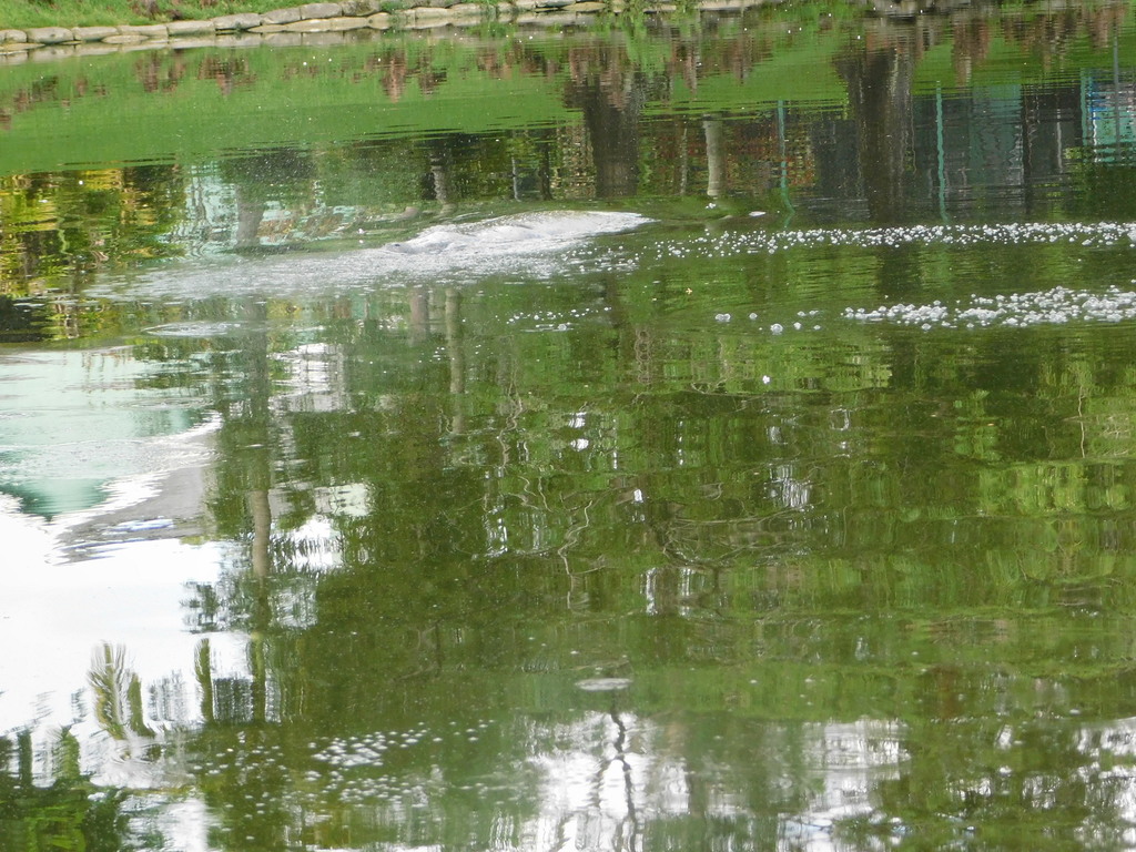
    A manatee may remain almost completely hidden beneath the surface, leaving only bubbles and a series of smooth rings—its “footprint”—to mark where it has passed. | Image credit: buggybuddy, iNaturalistA manatee may remain almost completely hidden beneath the surface, leaving only bubbles and a series of smooth rings—its “footprint”—to mark where it has passed. | Image credit: buggybuddy, iNaturalist
    A manatee may remain almost completely hidden beneath the surface, leaving only bubbles and a series of smooth rings—its “footprint”—to mark where it has passed. | Image credit: buggybuddy, iNaturalist

    A manatee can make a brief burst of speed to escape danger, but that does not mean it can always avoid a boat. In shallow water, there may be nowhere for it to dive. Even when the animal hears or feels a vessel approaching, it still needs enough time and space to move out of the path.

    A propeller can cut deeply into the back or tail. The force of a hull or lower-unit strike can break ribs and cause internal injuries even when the outside of the animal shows little damage (Ackerman et al., 1995; Reep & Bonde, 2021).

    Some manatees survive repeated strikes. The pale lines and deep cuts across their backs become permanent scars. Researchers can sometimes use those patterns to recognize the same animal when it is photographed somewhere else (Ackerman et al., 1995; Reep & Bonde, 2021).

    A scar can help us follow a migration.

    It is still a wound the animal should never have received.

    Propeller scars remain visible across the backs of many manatees. These permanent patterns can help researchers recognize individuals—but each one records a collision the animal survived. | Image credit: USGS
    Propeller scars remain visible across the backs of many manatees. These permanent patterns can help researchers recognize individuals—but each one records a collision the animal survived. | Image credit: USGS

    When Kindness Creates Danger

    A manatee approaching a dock can be hard to resist.

    It may raise its face near a running hose or move toward water draining while someone flushes a boat engine. Offering a drink may feel like helping an animal that has traveled hundreds of miles.

    The problem is not only the water it receives. It is what the manatee learns from the encounter.

    Manatees remember useful places. If a dock provides freshwater or food, the animal may return. It may begin approaching other docks and boats expecting the same reward. Instead of avoiding propellers, fishing lines, and crowded marinas, it learns to remain close to them.

    The behavior that looks friendly may therefore place the animal in greater danger during its next encounter (SC DNR, 2014).

    Never feed a manatee or offer it water. Turn off dock hoses when they are not being used. Do not touch, pursue, surround, or enter the water to approach one (SC DNR, 2014).

    Manatees are protected under the Marine Mammal Protection Act and the Endangered Species Act, but the more immediate reason is simpler: an animal traveling this far needs to remain able to find what it needs without depending on people (Baier, 2023; Marine mammal protection act  of 1972; Perry Roberts & Wieting, 2001).

    The safest manatee is not the one that trusts every boat.

    It is the one that continues to give boats room.

    Sharing the Water

    Because manatees are still unusual here, North Carolina boaters may not think to look for them.

    Summer also brings more boats into our inlets, sounds, and narrow channels. Many are operated by visitors who may be unfamiliar with the waterway, the shifting shoals, or the wildlife moving beneath them.

    Navigation rules are not separate from wildlife protection.

    No-wake and idle-speed zones are not just navigation rules. Slowing down gives boaters more time to see a manatee near the surface—and gives the animal more time to move out of the way. | Image credit: Save the Manatee Club
    No-wake and idle-speed zones are not just navigation rules. Slowing down gives boaters more time to see a manatee near the surface—and gives the animal more time to move out of the way. | Image credit: Save the Manatee Club

    No-wake zones, speed restrictions, channel markers, right-of-way rules, and safe-distance requirements serve much the same purpose as traffic rules on land. They give everyone using a shared space enough time to see a hazard, understand what is happening, and respond.

    That includes swimmers, paddlers, anglers, other boaters, and animals resting or traveling near the surface.

    A person driving too quickly through a narrow waterway is not simply breaking a rule marked on a sign. Speed reduces the time available to notice a kayak, a child in the water, a shallow bar, a floating log, a sea turtle—or the faint circles left by a manatee just below the surface.

    Watching the water means looking beyond the next marker (Calleson & Kipp Frohlich, 2007; Laist & Shaw, 2006).

    Before starting an engine, check around the hull, stern, and dock. A manatee may be resting nearby without making a sound. When underway, polarized sunglasses can reduce glare and make dark shapes easier to see.

    Watch for a rounded nose, part of a broad back, a patch of bubbles, or a trail of circular footprints. If a manatee is present, slow to idle, steer away from its path, and allow it to leave on its own.

    Do not follow it for a photograph or block it against a dock, seawall, or shoreline. If you are in a boat, keep the vessel at least 50 feet away when possible and allow the manatee to choose its own path (Langtimm et al., 2004; USFWS, 2023)..

    A photograph taken from a safe distance can still be useful, particularly if it shows scars on the back or tail (Langtimm et al., 2004) .

    Every North Carolina sighting should be reported to UNCW’s Marine Mammal Stranding Program. Reports help researchers determine whether several observations involve the same animal, identify locations manatees use repeatedly, and record how early they arrive or how late they remain (UNCW, 2026).

    Manatee sightings can be reported to UNCW at 910-515-7354.

    An injured, entangled, distressed, stranded, or dead manatee should be reported immediately to the North Carolina Marine Mammal Stranding Network at 252-241-5119 (UNCW, 2026).

    Do not try to free, move, feed, or treat the animal yourself.

    A sighting report may feel like a small thing after the animal disappears.

    Placed beside reports from other docks, piers, and waterways, it becomes part of the record researchers need to understand what is changing.

    A New Summer Neighbor

    For now, Onslow County is summer habitat at the northern edge of a Florida manatee’s range.

    It cannot provide the dependable winter warmth of Florida’s springs and heated refuges. Autumn still places a limit on how long an animal can safely remain.

    Summer may be becoming a different story.

    Our sounds offer protected water, underwater vegetation, tidal creeks, and connected travel routes. If manatees continue finding those resources here, some may return. A female may eventually travel the route with a calf beside her. A place first reached through exploration may become part of a migration remembered from one year to the next.

    That does not mean Onslow County is suddenly becoming another Florida.

    It means the familiar landscape may be serving an animal many of us never expected to find within it.

    The first sign may be no more than a circle opening across the water. Then another. A dark body rises where we expected a dolphin, takes one breath, and disappears beneath the surface.

    What happens next depends partly on the animal—where it travels, what it finds, and whether it returns.

    It also depends on what it finds from us.

    A mother and calf surface together. If manatees continue finding food, shelter, and safe passage along our coast, places reached by one generation may become part of the next generation’s remembered route. | Image credit: B. Garrett
    A mother and calf surface together. If manatees continue finding food, shelter, and safe passage along our coast, places reached by one generation may become part of the next generation’s remembered route. | Image credit: B. Garrett

    References

    Ackerman, B. B., Wright, S. D., Bonde, R. K., Odell, D. K., & Banowetz, D. J. (1995). Trends and Patterns in Mortality of Manatees in Florida, 1974-1995. National Biological Society, 223-258. https://www.researchgate.net/profile/Robert-Bonde/publication/276987612_Trends_and_patterns_in_mortality_of_manatees_in_Florida_1974-1992_Pages_223-258_in_TJ_O’Shea_BB_Ackerman_and_HF_Percival_editors_1995_Population_Biology_of_the_Florida_Manatee_National_Biological_Serv/links/556db62108aefcb861d9f936/Trends-and-patterns-in-mortality-of-manatees-in-Florida-1974-1992-Pages-223-258-in-TJ-OShea-BB-Ackerman-and-HF-Percival-editors-1995-Population-Biology-of-the-Florida-Manatee-National-Biological-S.pdf

    Baier, L. E. (2023). Appendix C. The Endangered Species Act of 1973, as amended today. The Codex of the Endangered Species Act, 671-718. https://doi.org/10.5771/9781538112083-671

    Bergin, M. (2024, July 12). Drone video shows manatees at Topsail Beach sound. WRAL.com. https://www.wral.com/archive/21522123/

    Bossart, G. D., Meisner, R. A., Rommel, S. A., Ghim, S., & Jenson, A. B. (2003). Pathological features of the Florida manatee cold stress syndrome. Aquatic Mammals, 29(1), 9-17. https://doi.org/10.1578/016754203101024031

    Buchholtz, E. A., Booth, A. C., & Webbink, K. E. (2007). Vertebral anatomy in the Florida manatee, Trichechus manatus latirostris: A developmental and evolutionary analysis. The Anatomical Record, 290(6), 624-637. https://doi.org/10.1002/ar.20534

    Burdick, D. M., & Short, F. T. (1999). The effects of boat docks on eelgrass beds in coastal waters of Massachusetts. Environmental Management, 23(2), 231-240. https://doi.org/10.1007/s002679900182

    Burkholder, J. M., Tomasko, D. A., & Touchette, B. W. (2007). Seagrasses and eutrophication. Journal of Experimental Marine Biology and Ecology, 350(1-2), 46-72. https://doi.org/10.1016/j.jembe.2007.06.024

    Calleson, C., & Kipp Frohlich, R. (2007). REVIEW: Slower boat speeds reduce risks to manatees. Endangered Species Research, 3, 295-304. https://doi.org/10.3354/esr00056

    Cloyed, C., Hieb, E., Whitehead, H., & Carmichael, R. (2025). Distributional analyses of American manatees in the continental United States under current and future conditions using multiple modeling approaches. Marine Ecology Progress Series, 759, 107-122. https://doi.org/10.3354/meps14836

    Cook, P. F., Bauer, G. B., & Reep, R. L. (2025). Manatee cognition and behavior: A neurobiological perspective on an unusual constellation of senses and a unique brain. Frontiers in Behavioral Neuroscience, 19. https://doi.org/10.3389/fnbeh.2025.1576378

    Cummings, E. (2014). Spatial and temporal patterns of habitat use and mortality of the Florida manatee (Trichechus manatus latirostris) in the Mid-Atlantic states of North Carolina and Virginia from 1991 to 2012. Aquatic Mammals, 40(2), 126-138. https://doi.org/10.1578/am.40.2.2014.126

    Deutsch, C. J., Reid, J. P., Bonde, R. K., Easton, D. E., Kochman, H. I., & O’Shea, T. J. (2003). Seasonal Movements, Migratory Behavior, and Site Fidelity of West Indian Manatees along the Atlantic Coast of the United States. Journal of Wildlife Management, 67(1), 1-77. https://www.jstor.org/stable/3830830

    Domning, D. P. (2001). The earliest known fully quadrupedal sirenian. Nature, 413(6856), 625-627. https://doi.org/10.1038/35098072

    Dugan, J. E., Emery, K. A., Alber, M., Alexander, C. R., Byers, J. E., Gehman, A. M., McLenaghan, N., & Sojka, S. E. (2017). Generalizing ecological effects of shoreline armoring across soft sediment environments. Estuaries and Coasts, 41(S1), 180-196. https://doi.org/10.1007/s12237-017-0254-x

    Erftemeijer, P. L., & Robin Lewis III, R. R. (2006). Environmental impacts of dredging on seagrasses: A review. Marine Pollution Bulletin, 52(12), 1553-1572. https://doi.org/10.1016/j.marpolbul.2006.09.006

    Factheu, C., Rycyk, A. M., Kekeunou, S., Keith-Diagne, L. W., Ramos, E. A., Kikuchi, M., & Takoukam Kamla, A. (2023). Acoustic methods improve the detection of the endangered African manatee. Frontiers in Marine Science, 9. https://doi.org/10.3389/fmars.2022.1032464

    FitzGerald, D. M., Fenster, M. S., Argow, B. A., & Buynevich, I. V. (2008). Coastal Impacts Due to Sea-Level Rise. Annual Review of Earth and Planetary Sciences, 36(2008), 601-647. https://www.annualreviews.org/content/journals/10.1146/annurev.earth.35.031306.140139

    Flamm, R. O., Reynolds, J. E., & Harmak, C. (2012). Improving conservation of Florida manatees (Trichechus manatus latirostris): Conceptualization and contributions toward a regional warm-water network management strategy for sustainable winter habitat. Environmental Management, 51(1), 154-166. https://doi.org/10.1007/s00267-012-9985-4

    Gittman, R. K., Peterson, C. H., Currin, C. A., Fodrie, F. J., Piehler, M. F., & Bruno, J. F. (2015). Living shorelines can enhance the nursery role of threatened estuarine habitats. Ecological Applications, 150511113453001. https://doi.org/10.1890/14-0716.1

    Gittman, R. K., Scyphers, S. B., Smith, C. S., Neylan, I. P., & Grabowski, J. H. (2016). Ecological consequences of shoreline hardening: A meta-analysis. BioScience, 66(9), 763-773. https://doi.org/10.1093/biosci/biw091

    Gunter, G. (1941). Occurrence of the manatee in the United States, with records from Texas. Journal of Mammalogy, 22(1), 60. https://doi.org/10.2307/1374684

    Gurney, A. (2024, November 27). First North Carolina live rescue of a manatee. NC Wildlife. https://www.ncwildlife.gov/news/press-releases/2024/11/27/first-north-carolina-live-rescue-manatee

    Harris, W., & Laws, R. A. (1997). Paleogene stratigraphy and sea-level history of the North Carolina coastal plain: Global coastal onlap and tectonics. Sedimentary Geology, 108(1-4), 91-120. https://doi.org/10.1016/s0037-0738(96)00049-8

    Heck, K., Hays, G., & Orth, R. (2003). Critical evaluation of the nursery role hypothesis for seagrass meadows. Marine Ecology Progress Series, 253, 123-136. https://doi.org/10.3354/meps253123

    Hein, C. J., Fallon, A. R., Rosen, P., Hoagland, P., Georgiou, I. Y., FitzGerald, D. M., Morris, M., Baker, S., Marino, G. B., & Fitzsimons, G. (2019). Shoreline dynamics along a developed river mouth barrier island: Multi-decadal cycles of erosion and event-driven mitigation. Frontiers in Earth Science, 7. https://doi.org/10.3389/feart.2019.00103

    Irvine, A. B., & Campbell, H. W. (1978). Aerial census of the west Indian manatee, Trichechus manatus, in the southeastern United States. Journal of Mammalogy, 59(3), 613-617. https://doi.org/10.2307/1380237

    Korpinen, S., & Andersen, J. H. (2016). A global review of cumulative pressure and impact assessments in marine environments. Frontiers in Marine Science, 3. https://doi.org/10.3389/fmars.2016.00153

    Kraus, N. C., & McDougal, W. G. (1996). The Effects of Seawalls on the Beach: Part I, An Updated Literature Review. Journal of Coastal Research, 12(3), 691-701. https://www.academia.edu/31099155/The_Effects_of_Seawalls_on_the_Beach_Part_I_An_Updated_Literature_Review

    Laist, D. W. (2019, April 29). More manatees in NC waters signal recovery. Coastal Review. https://coastalreview.org/2019/04/more-manatees-in-nc-waters-signal-recovery/

    Laist, D. W., & Reynolds, J. E. (2005). Influence of power plants and other warm-water refuges on Florida manatees. Marine Mammal Science, 21(4), 739-764. https://doi.org/10.1111/j.1748-7692.2005.tb01263.x

    Laist, D. W., & Shaw, C. (2006). Preliminary evidence that boat speed restrictions reduce deaths of Florida manatees. Marine Mammal Science, 22(2), 472-479. https://doi.org/10.1111/j.1748-7692.2006.00027.x

    Langtimm, C. A., Beck, C. A., Edwards, H. H., Fick‐Child, K. J., Ackerman, B. B., Barton, S. L., & Hartley, W. C. (2004). Survival estimates for Florida manatees from the photo‐identification of individuals. Marine Mammal Science, 20(3), 438-463. https://doi.org/10.1111/j.1748-7692.2004.tb01171.x

    Marine mammal protection act (1972). (1987). Federal Statutes on Environmental Protection, 66-67. https://doi.org/10.5040/9798216968115.ch-040

    Newell, R. C., Seiderer, L. J., & Hitchcock, D. (1998). The impact of dredging works in coastal waters: a review of the sensitivity to disturbance and subsequent recovery of biological resources on the sea bed. Oceanography and Marine Biology, 36, 127-178. https://www.researchgate.net/publication/298415859_The_impact_of_dredging_works_in_coastal_waters_a_review_of_the_sensitivity_to_disturbance_and_subsequent_recovery_of_biological_resources_on_the_sea_bed

    Nienhuis, J. H., & Lorenzo-Trueba, J. (2019). Simulating barrier island response to sea level rise with the barrier island and inlet environment (BRIE) model v1.0. Geoscientific Model Development, 12(9), 4013-4030. https://doi.org/10.5194/gmd-12-4013-2019

    Orth, R. J., Carruthers, T. J., Dennison, W. C., Duarte, C. M., Fourqurean, J. W., Heck, K. L., Hughes, A. R., Kendrick, G. A., Kenworthy, W. J., Olyarnik, S., Short, F. T., Waycott, M., & Williams, S. L. (2006). A global crisis for seagrass ecosystems. BioScience, 56(12), 987. https://doi.org/10.1641/0006-3568(2006)56[987:agcfse]2.0.co;2

    Perry Roberts, S., & Wieting, D. S. (2001). Marine mammal protection act (MMPA) and Endangered Species Act (ESA) regulations for marine mammal nonfishery interactions. The Journal of the Acoustical Society of America, 110(5_Supplement), 2710-2710. https://doi.org/10.1121/1.4777360

    Peterson, C. H., & Bishop, M. J. (2005). Assessing the environmental impacts of beach nourishment. BioScience, 55(10), 887. https://doi.org/10.1641/0006-3568(2005)055[0887:ateiob]2.0.co;2

    Rathbun, G. B., Bonde, R. K., & Clay, D. (1981). The Status of the West Indian Manatee on the Atlantic Coast North of Florida (Technical Bulletin WL 5). Georgia Department of Natural Resources. https://www.researchgate.net/profile/Robert-Bonde/publication/299397456_The_status_of_the_West_Indian_manatee_on_the_Atlantic_Coast_north_of_Florida/links/56f3f24308ae95e8b6d05e32/The-status-of-the-West-Indian-manatee-on-the-Atlantic-Coast-north-of-Florida.pdf

    Reep, R. L., & Bonde, R. K. (2021). The Florida Manatee: Biology and Conservation (2nd ed.). University Press of Florida. https://books.google.com/books?hl=en&lr=&id=wYLSEAAAQBAJ&oi=fnd&pg=PT11&dq=manatees+north+carolina&ots=5TwY4_i8ry&sig=aIRCpfy2Nf6YHspnimQd1pgUnSg#v=onepage&q&f=false

    Reep, R., Marshall, C., & Stoll, M. (2002). Tactile hairs on the Postcranial body in Florida manatees: A mammalian lateral line? Brain, Behavior and Evolution, 59(3), 141-154. https://doi.org/10.1159/000064161

    Reep, R., Stoll, M., Marshall, C., Homer, B., & Samuelson, D. (2001). Microanatomy of facial vibrissae in the Florida manatee: The basis for specialized sensory function and Oripulation. Brain, Behavior and Evolution, 58(1), 1-14. https://doi.org/10.1159/000047257

    Reidenberg, J. S. (2007). Anatomical adaptations of aquatic mammals. The Anatomical Record, 290(6), 507-513. https://doi.org/10.1002/ar.20541

    Sagerman, J., Hansen, J. P., & Wikström, S. A. (2019). Effects of boat traffic and mooring infrastructure on aquatic vegetation: A systematic review and meta-analysis. Ambio, 49(2), 517-530. https://doi.org/10.1007/s13280-019-01215-9

    SC DNR. (2014, April 24). Feeding, watering manatees is illegal. South Carolina Department of Natural Resources. https://www.dnr.sc.gov/news/yr2014/april24/april24_manatee.html

    Seitz, R. D., Wennhage, H., Bergström, U., Lipcius, R. N., & Ysebaert, T. (2013). Ecological value of coastal habitats for commercially and ecologically important species. ICES Journal of Marine Science, 71(3), 648-665. https://doi.org/10.1093/icesjms/fst152

    Short, F. T., & Burdick, D. M. (1996). Quantifying eelgrass habitat loss in relation to housing development and nitrogen loading in Waquoit Bay, Massachusetts. Estuaries, 19(3), 730. https://doi.org/10.2307/1352532

    Stockbridge, J., Jones, A. R., & Gillanders, B. M. (2020). A meta-analysis of multiple stressors on seagrasses in the context of marine spatial cumulative impacts assessment. Scientific Reports, 10(1). https://doi.org/10.1038/s41598-020-68801-w

    Todd, V. L., Todd, I. B., Gardiner, J. C., Morrin, E. C., MacPherson, N. A., DiMarzio, N. A., &

    Thomsen, F. (2014). A review of impacts of marine dredging activities on marine mammals. ICES Journal of Marine Science, 72(2), 328-340. https://doi.org/10.1093/icesjms/fsu187

    Uhen, M. D. (2007). Evolution of marine mammals: Back to the sea after 300 million years. The Anatomical Record, 290(6), 514-522. https://doi.org/10.1002/ar.20545

    UNCW. (2026). Marine mammal stranding program. University of North Carolina Wilmington | UNCW. https://www.uncw.edu/research/major-programs/marine-mammal-stranding/

    USFWS. (2023). Technical Assistance to Evaluate Effects on Antillean Manatees. U. S. Fish and Wildlife Service – Caribbean Ecological Services Field Office. https://www.fws.gov/sites/default/files/documents/Technical%20Assistance%20to%20Evaluate%20Effects%20on%20Antillean%20manatees_0.pdf

    Velez-Juarbe, J., Domning, D. P., & Pyenson, N. D. (2012). Iterative evolution of sympatric Seacow (Dugongidae, sirenia) assemblages during the past ∼26 million years. PLoS ONE, 7(2), e31294. https://doi.org/10.1371/journal.pone.0031294

    WECT/6. (2025, August 5). Marine mammal expert pushes boating safety after reported increase of more manatees in NC. https://www.wect.com. https://www.wect.com/video/2025/08/05/marine-mammal-expert-pushes-boating-safety-after-reported-increase-more-manatees-nc/

    Wilber, D. H., & Clarke, D. G. (2001). Biological effects of suspended sediments: A review of suspended sediment impacts on fish and shellfish with relation to dredging activities in estuaries. North American Journal of Fisheries Management, 21(4), 855-875. https://doi.org/10.1577/1548-8675(2001)021<0855:beossa>2.0.co;2
  • Where the Coast Keeps Its Wrecks: Shipwrecks Along Onslow County, North Carolina

    Where the Coast Keeps Its Wrecks: Shipwrecks Along Onslow County, North Carolina

    Encountering the Past in the Sand: When the Beach Opens

    There are mornings when the beach feels newly made.

    The tide has pulled back just enough to smooth the sand into a long, pale sheet, the wind from the night before erased except for faint ripples that catch the light at an angle. Ghost crab tracks cross and recross the surface, stitching together small territories that vanish with the next wave. The wrack line sits just above the reach of the water—shells, grasses, fragments of offshore life placed carefully along a boundary that shifts a little each day.

    And then, walking that line, something interrupts the pattern.

    At first it looks like driftwood. Dark. Angular. Out of place, but not unusual. But the closer you get, the more it resists that explanation. The pieces are too regular, too aligned. The sand around it feels different underfoot—firmer, compacted, as though something beneath it has been holding shape long before this tide receded.

    What emerges is not debris, but structure.

    Ribs of timber curve in a way that only makes sense once you recognize them as part of a hull. Iron fastenings stain deep into the grain. The geometry of a vessel that once moved across this water now rests within it.

    The beach has not received this. It has revealed it.

    What remains of the William H. Sumner when shifting sand briefly reveals it along the shoreline. | Photo credit: A. Mitchell
    What remains of the William H. Sumner when shifting sand briefly reveals it along the shoreline. | Photo credit: A. Mitchell

    Along the Onslow County coast, shipwrecks do not arrive as singular events. They exist in cycles of concealment and return. Storms strip sand away. Longshore currents redistribute what was settled. A wreck that has been buried for decades can appear in a single tide cycle, as if placed there overnight, only to be covered again before the week ends.

    The shoreline is not a surface. It is a moving archive (Riggs & Ames, 2003).

    A Coast That Does Not Hold Still

    Standing at the edge of the water, the coastline can appear steady, almost fixed, as though the boundary between land and ocean has settled into a reliable position. The horizon holds its line. Waves repeat their approach in familiar intervals. Even the inlets, from a distance, seem to occupy defined openings in the land.

    But that stability is a surface impression.

    Beneath it, the coastline is in constant adjustment. Sand moves even when the water appears calm, carried alongshore by currents that shift direction with changing wind and wave conditions. Bars form offshore, migrate, and dissolve. Channels deepen and fill. The openings at places like New River Inlet or Topsail are not permanent features so much as temporary alignments of water and sediment, reshaped seasonally and sometimes abruptly after storms.

    For someone approaching from offshore, especially before modern navigation, this would not have presented as a clear pathway but as uncertainty. Depth changes could occur over short distances. A channel that allowed passage one season might be obstructed the next. What looked like open water could rise into a shoal just beneath the surface, invisible until it was encountered.

    Ships moving along this coast were not simply traveling past it. They were moving across a landscape that was itself in motion.

    When a vessel grounded here, it was often not because of a single error, but because the environment it relied on for passage had already changed. The ship met a bottom that no longer matched expectation, and once contact was made, wave energy did the rest—breaking the structure apart and distributing its remains across the same shifting system that had caused the grounding.

    Over time, those remains became part of that movement. Buried, exposed, and buried again as sand continued to migrate, they settled into the coastline not as isolated events but as elements within an ongoing process.

    What appears now as a sudden discovery—a line of timbers revealed after a storm—is not the arrival of something new, but a brief moment when the motion of the coast allows what has long been present to be seen again.

    Vessels Carried Into This Coast

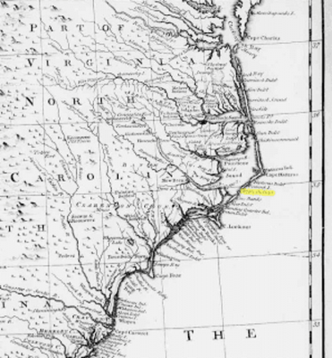
    An early French map depicting the coastal regions of the Carolinas and Georgia before the American Revolution from an antique map, the  "Carte de la Caroline et Georgie" by Jacques-Nicolas Bellin, published around 1773.
    An early French map depicting the coastal regions of the Carolinas and Georgia before the American Revolution from an antique map, the “Carte de la Caroline et Georgie” by Jacques-Nicolas Bellin, published around 1773.

    Walk this shoreline long enough and shipwrecks begin to feel less like isolated events and more like recurring encounters with the same conditions. Different vessels, different centuries, but the same meeting between movement and a coast that does not stay where it was. What changes is not only the vessel, but the way it is lost.

    Two Ways a Ship Becomes Part of the Sea

    Not all shipwrecks begin the same way. Some are lost far offshore, where depth replaces sand as the defining feature. A vessel may be damaged by storm, fire, or attack, take on water, and settle downward through open water until it reaches the seafloor. The descent is vertical, the structure often remaining largely intact as it comes to rest in deeper, more stable conditions. These wrecks lie beyond the horizon, where the bottom changes more slowly and the surrounding water does not rearrange them in the same way (Ward et al., 1999; Hoyt et al., 2021).

    Others meet the coast itself. Along barrier shorelines like Onslow County, ships often do not sink all at once. They run aground. A hull meets sand where water had been expected, forward motion stops, and the energy of waves and tide begins to work against the structure. The vessel lifts, pivots, and settles unevenly as water moves beneath and around it. Over time, it breaks apart. What remains is not a single intact form, but a field of structure distributed across the seabed and shoreline (Riggs & Ames, 2003; Pilkey, 1998).

    Both are shipwrecks, but they belong to different processes. One settles into depth. The other becomes part of a coast that does not hold still.

    Pirate Waters

    Model of the Queen Anne’s Revenge | Photo credit: Qualiesin, licensed under CC BY-SA 4.0.
    Model of the Queen Anne’s Revenge | Photo credit: Qualiesin, licensed under CC BY-SA 4.0.

    Long before modern navigation, these waters were already understood as difficult to pass through cleanly. The channels around what is now Topsail Island were narrow, shifting, and often uncertain from offshore. What appears now as a continuous coastline is, and always has been, a series of openings that do not hold their shape for long.

    Even today, that instability can be seen without leaving shore. After a strong storm or a week of changing wind, the edge of the waterline shifts, bars appear where there had been none, and shallow areas extend farther out than expected. A stretch of water that looked open a few days earlier begins to break differently, waves lifting and folding over something just beneath the surface. The bottom has moved, even if the horizon has not (Riggs & Ames, 2003; Pilkey, 1998).

    For a vessel approaching from offshore, especially without precise depth measurements, that change would not be visible until it was too late. The hull would meet sand where water had been expected. Forward motion would slow abruptly, then stop, while the energy of the sea continued to act on the vessel. Waves begin to lift and drop the structure unevenly, pivoting it sideways, driving it further onto the bar. What had been a path forward becomes a fixed point under pressure (Riggs et al., 1995; Delgado, 1997).

    Stories persist that pirates used this uncertainty to their advantage, positioning themselves within these shifting inlets where passing ships were forced into slower, more confined routes. Whether or not every account is precise, the setting itself made such encounters possible.Further north along this same coastline, in 1718, Blackbeard ran his flagship Queen Anne’s Revenge aground while entering what is now Beaufort Inlet. The ship struck a shallow shoal at the mouth of the inlet, where water depths even today remain modest—on the order of twenty to twenty-five feet at the wreck site. Rather than sinking intact into the deep ocean, it remained within a high-energy, shallow environment where waves and tidal currents gradually broke it apart. Its remains settled into the seabed and have since been buried and re-exposed as sediment continues to move across the inlet (Wilde-Ramsey & Carnes-McNaughton, 2016; Wilde-Ramsing & Carnes-McNaughton, 2018).

    To learn more about Blackbeard’s Queen Anne’s Revenge Shipwreck, watch the Nautilus Productions video.

    Colonial Trade and Storm-Driven Wrecks

    By the mid-eighteenth century, heavily loaded merchant vessels were moving along this coastline as part of transatlantic trade. Their routes followed currents that offered efficiency, but those same currents carried them close to a shoreline that did not remain fixed.

    In 1750, the Spanish ship El Salvador, part of a treasure fleet transporting gold and silver, encountered a hurricane that pushed it northward along the Gulf Stream. The storm did not introduce danger so much as concentrate it. Wind and current worked together, driving the vessel toward a coast already defined by shifting shoals and unstable inlets. Other ships in the same fleet were carried along the same path, driven ashore at different points along the Outer Banks, separated from one another by the same forces that moved them north (Shomette, 2008; Pilkey, 1998).

    When El Salvador met the shoals, there was little margin left for recovery.

    Only a small number of crew survived, carried ashore as the vessel came apart in the surf. The hull did not settle into the water as a whole. Instead, waves lifted and broke it against a bottom that would not hold it in one place. For a short time, portions of the structure remained visible—rigging, fragments of timber, the outline of something that had recently been intact. And then the shoreline resumed its movement. Sand shifted across what remained. Water moved through it. What had been a vessel became something distributed, its structure absorbed into sediment and carried within the same system that had stopped it, continuing to migrate along the coast (Riggs & Ames, 2003; Pilkey, 1998; Shomette, 2008).

    The pattern holds: a vessel enters under force, meets a shifting bottom, and becomes part of it.

    Steam and Certainty: Pulaski (1838)

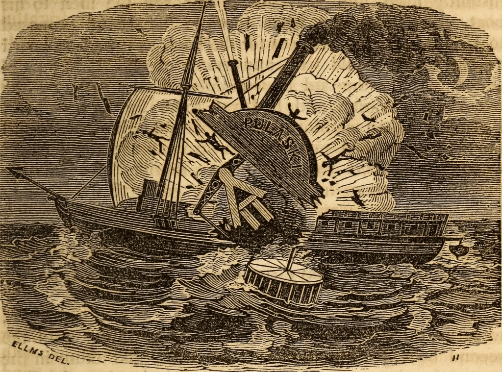
    The Pulaski is depicted during its boiler explosion | Image credit: C. Elms
    The Pulaski is depicted during its boiler explosion | Image credit: C. Elms

    By the early nineteenth century, steam navigation had begun to change expectations. Routes were more regular. Travel felt more predictable. Distance could be measured in time rather than uncertainty.

    The coastline, however, had not changed.

    When the steamship Pulaski exploded offshore of North Carolina in 1838, the rupture was immediate. What followed did not resolve as quickly. Survivors, separated into lifeboats and fragments of wreckage, were no longer traveling across water with direction. They were moving within it (North Carolina Department of Natural and Cultural Resources [DNCR], 2016).

    They drifted for more than a day, in some cases closer to two.

    There was no fixed path in that movement. Coordinates were not precisely recorded, and what direction remained was shaped by current, wind, and wave rather than intention. The horizon held its line, but offered no reference. The sun marked time without marking progress. Salt settled into the skin. Thirst extended the length of the day. Movement continued, but without a way to measure where it led.

    Some survivors eventually reached the barrier islands along this stretch of North Carolina, carried by those same forces rather than guided toward land. Their arrival was not coordinated or immediate, but scattered—individual landings along a shoreline that did not announce itself as destination, only as the end of exposure (DNCR, 2016). Of its 150 passengers and 37 crew, only 59 survived (Falk, 2025).

    The wreck remains offshore, beyond the shifting bars where waves no longer break it apart in the same way. It does not return to the surface in the way some grounded vessels do. It settles instead into deeper water, where structure changes more slowly and remains largely out of view.

    The shoreline holds something else. Not the wreck itself, but the moment when motion without direction became arrival. A place where drifting resolved, not into discovery, but into contact—where water gave way to land, and movement, at last, found its edge.

    Want to learn more about the Pulaski? Listen to a podcast from Shipwrecks and Seadogs about its history.

    War Along the Inlets: New River

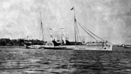
    Blockade runner, Teaser, near Fort Monroe, Virginia, is an example of the blockade runners along our coastline. | Photo credit: MPI/Getty Images
    Blockade runner, Teaser, near Fort Monroe, Virginia, is an example of the blockade runners along our coastline. | Photo credit: MPI/Getty Images

    During the Civil War, this coastline was not only a place of navigation, but of control.

    New River Inlet, leading inland toward what is now Jacksonville, served as a potential access point between coastal waters and interior routes. Union naval forces patrolled the coast as part of a broader blockade, attempting to restrict movement of goods and supplies, while Confederate forces relied on smaller vessels and local knowledge of the waterways to move through the system (Browning, 2002; Stick, 1990).

    For any vessel entering New River, the challenge would have been familiar.

    The inlet itself was shallow and shifting, defined by sandbars that changed position with storms and tides. Navigation required timing, local knowledge, and an ability to read water that did not present itself clearly from offshore (Riggs & Ames, 2003).

    Unlike some of the more widely known Civil War wreck sites along the North Carolina coast, there is no clear record of a major vessel sinking within New River itself. But the absence of a wreck does not mean the absence of difficulty. The conditions that prevent passage do not always leave a visible record. Any ship moving through that inlet would have encountered the same conditions that shape it today.

    Shallow approaches, moving sand, and water that changes faster than it can be mapped. The difference is not in the coastline, only in the ships that attempt to pass through it.

    Farther south along this same stretch of coast lies the Cape Fear Civil War Shipwreck District, a cluster of documented wreck sites near the approaches to the Cape Fear River and the port of Wilmington. These wrecks, concentrated off Brunswick, New Hanover, and parts of Pender County, represent vessels involved in the Confederate blockade-running trade. Ships attempting to slip past Union naval patrols carried cargo that ranged from military supplies and weapons to manufactured goods and cloth desperately needed in the South. Many were narrow, fast steamers built with shallow drafts and reinforced hulls designed to move quickly through inlets and across shoals. Their loss was not incidental, but patterned—occurring in a region where shifting channels, shallow bars, and the pressure of pursuit converged. Archaeological surveys of this coastline describe a dense concentration of wreck sites associated with these movements, forming one of the most significant Civil War maritime landscapes along the Atlantic seaboard (North Carolina Office of State Archaeology, n.d.; Browning, 2002; Hall, 2004).

    Working Maritime Coast: William H. Sumner (1919)

    The William H. Sumner | Photo credit: Cape Fear Museum of History and ScienceWhat remains of the William H. Sumner when shifting sand briefly reveals it along the shoreline. | Photo credit: A. Mitchell
    The William H. Sumner circa 1919 and what remains today. | Photo credits: Cape Fear Museum of History and Science (left); A. Mitchell (right)

    In 1919, the schooner William H. Sumner approached this same coastline carrying cargo northward. The conditions it encountered were not new. The channel it relied on had shifted beyond what the vessel could safely cross.

    The grounding was not violent, but it was final.

    Accounts from the time suggest that by the final days of the voyage, conditions aboard the vessel had already begun to shift. Rations had reportedly run low, and attention moved away from navigation. In the hours after the grounding, the captain was found dead in his cabin from a gunshot wound, and the ship’s mate was later charged with mutiny and murder. Testimony conflicted. Some described tension among the crew, others described familiarity and routine. The trial that followed ended without resolution, leaving the cause of the captain’s death uncertain (North Carolina Shipwrecks, n.d.; Wrightsville Beach Magazine, 2015).

    Once the hull met the sandbar near Topsail Inlet, where multiple vessels have grounded over centuries of shifting channels, wave energy began to work against it, gradually breaking the structure apart (Riggs & Ames, 2003; Pilkey, 1998; Hall, 2004). Salvage efforts removed what could be taken. What remained did not leave with it. It settled into the shoreline system, where it was taken in and buried beneath moving sand (Riggs & Ames, 2003; Pilkey, 1998).

    Over time, and then at intervals shaped by storms, it appeared again.

    Storms and low tides continue to strip away the sand that covers portions of the wreck, exposing curved timbers that seem, for a short time, to return. These exposures are often described as discoveries, but the structure has been present throughout, shifting between visibility and concealment as sediment moves across it (Riggs & Ames, 2003). When these timbers reappear, they are not simply objects to be collected. As registered historic shipwreck remains, they are protected under state law, and removing or disturbing them is prohibited, preserving both the structure and the record it represents (ABC45 News, 2024).

    The wreck does not travel. The coastline moves around it.

    Wrecks Beyond the Shoals

    Farther offshore, beyond the shifting bars and inlets, the nature of shipwrecks begins to change.

    In deeper water, vessels are less likely to run aground and more likely to be lost through damage that begins within the ship itself—fire, structural failure, or, in the case of the North Carolina coast during World War II, torpedo strikes from German U-boats operating just off the continental shelf (Hoyt et al., 2021; Blair, 2000).

    By the time of World War II, this stretch of coastline was already part of what is often called the “Graveyard of the Atlantic,” a name shaped by centuries of shipwrecks driven by storms, shifting shoals, strong currents, and difficult navigation along the North Carolina coast (Stick, 1990; Hoyt et al., 2021). The war did not create this pattern, but added to it, concentrating losses offshore as vessels were targeted in transit. Tankers and cargo ships moving along the eastern seaboard were struck at sea, often at night, their hulls breached below the waterline as they traveled.

    The process is different. Instead of grounding, there is descent.

    A vessel lists, loses buoyancy, and slips beneath the surface, settling onto the seafloor often in a more intact form than those broken apart in shallow surf. Once compromised, these ships took on water rapidly and sank into deeper channels where the seabed lay far below the reach of waves (Wells & McNinch, 1991).

    In some cases, even when a wreck is located, its identity remains uncertain. Historical comparisons of structure, propulsion, and location have led to tentative identifications—such as the possible association of certain offshore remains with Civil War–era blockade runners—but these connections are not always definitive and may remain unresolved despite decades of study (Stallman, 2011).

    Off the coast of Onslow County, these deeper wrecks remain present, though rarely visible from shore.These wrecks are not isolated features, but part of a broader offshore field of structure, scattered across the continental shelf. Some have been mapped and studied, while others remain only partially defined, their forms intact below the reach of waves. What defines them is not their visibility, but their persistence—structures that remain in place long after the events that created them, shaping the surrounding environment in ways that are not immediately seen.

    Storm Without Shore: Normannia (1924)

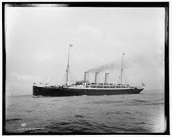
    The Normannia | Photo credit: Library of Congress
    The Normannia | Photo credit: Library of Congress

    Vessels in deeper water faced a different kind of exposure than those nearer to the shoals.

    In 1924, the Normannia foundered during a storm offshore. The forces at work were not those of shifting shoals, but of sustained wind, wave height, and structural stress. Far from the influence of the coastline’s sandbars, the vessel did not run aground. It remained in open water until the structure failed (Gentile, 1992).

    As the hull lost integrity, water entered faster than it could be expelled. Stability gave way. The vessel listed, settled, and slipped beneath the surface (Gentile, 1992).

    There was no bar to hold it, no shoreline to break it apart—only depth to receive it.

    March 1942: A Concentrated Loss Offshore

    In March of 1942, multiple vessels moving along this coastline were struck within a matter of days, part of a concentrated period of U-boat activity along the North Carolina coast.

    Other vessels from this same period reflect the intensity of offshore loss during the war. The tanker Naeco, more than 400 feet in length, was struck by a torpedo from U-124 and broke apart before sinking, its bow and stern sections settling separately on the seafloor miles apart. The tanker Esso Nashville was also torpedoed that year; its bow section sank offshore while the stern remained afloat long enough to be recovered, later refitted and returned to service. When the tanker John D. Gill was struck by U-158, where 23 were lost and 26 survived, burning oil ignited on the water, creating a fire visible from shore, extending the event into the night sky itself (Taylor, 2025).

    John D. Gill | Photo credit: G. GentileNaeco | Photo credit: Marines Museum
    The John D. Gill (left) and the Naeco (left) | Photo credits: G. Gentile (left) and Marines Museum {right}

    These vessels did not meet the coast through sand. They were lost to force applied below the waterline, their structures descending into deeper channels beyond the reach of waves (Hoyt et al., 2021; Blair, 2000; Wells & McNinch, 1991).

    Over time, these wrecks become stable structures in deeper water, less influenced by shifting sand and more by currents, corrosion, and biological growth. They are still part of the same coastal system, but they are shaped by depth rather than motion (Paxton et al., 2023).

    Likely a picture of the Esso Nashville due to stern configuration | Photo credit: G. GentileStarboard and bow anchor | Photo credit: P. Hudy
    Likely a picture of the Esso Nashville, due to its stern configuration (left) and the starboard and bow anchor of the Esso Nashville (right) | Photo credits: G. Gentile (left) and P. Hudy (right)

    War Along the Shore: Observation Without Contact

    While vessels were being lost offshore, the coastline itself became part of the wartime landscape.

    Along Topsail Island, a series of observation towers were constructed as part of Operation Bumblebee, where military personnel tracked missile tests and coastal activity from elevated positions above the shoreline. From these towers, the ocean was not empty space but an active field—ships moving along the horizon, and at times, evidence of conflict unfolding beyond direct reach (Island Life NC, 2025).

    The coastline did not receive these wrecks.

    But it witnessed them.

    Collision in Transit: Cassimir (1942)

    Not all vessels lost during this period were the result of attack.

    The Cassimir, built in 1920, sank in 1942 following a collision with the freighter Lara. The loss occurred offshore, in deeper water, where the structure did not ground but instead descended to the seafloor. Its presence reflects a different kind of vulnerability—navigation intersecting with proximity rather than conflict or storm (Gentile, 1992).

    The outcome, however, remains consistent.

    The vessel did not meet sand.

    It entered depth.

    The Cassimer | Photo credit: G. GentileAnchor of the Cassimer | Photo credit: P. Hudy
    The Cassimer circa 1920 (left) and its anchor at the wreck site (right) | Photo credits: G. Gentile (left) and P. Hudy (right)

    Modern Abandoned Vessels: Those That Become Something Else

    Along the coast today, abandoned vessels follow a similar trajectory, though their timeline is still unfolding. Shrimp boats grounded on shoals or left after mechanical failure may remain in place for years, shifting slightly with storms but never fully leaving.

    Abandoned shrimp vessel in Stump Sound | Photo credit: L. Caldwell
    Abandoned shrimp vessel in Stump Sound | Photo credit: L. Caldwell

    During that time, they begin to change.

    Osprey use the elevated structure for nesting. Barnacles attach to submerged surfaces. Fish gather beneath the hull where shade and form offer protection. In a sandy coastal system, any stable structure creates opportunities for life to organize around it.

    But what develops on these vessels depends strongly on where they come to rest.

    When a boat grounds on a shoal or nearshore bar, the surrounding environment remains in constant motion. Waves pass through the structure with each tide cycle, sand migrates around the hull, and storms periodically bury or expose different portions of the wreck. Habitat in these places is shaped by disturbance. The organisms that establish themselves must tolerate shifting sediment, abrasion, and periodic exposure to air.

    The first arrivals appear quickly. Within weeks, thin microbial films and algae coat the surfaces of exposed wood, steel, or fiberglass. Barnacles and oysters follow, attaching themselves wherever water continues to move across the hull. Mussels cluster along beams and ribs where currents deliver suspended food. Small fish begin to gather in the shadows beneath the structure—pinfish, blennies, and juvenile black sea bass slipping into crevices created by broken ribs or propeller shafts. Sheepshead move in to feed on barnacles and shellfish, while blue crabs and shrimp occupy pockets where sand collects between fragments.

    Over time, the wreck becomes less a single object than a patch of structure embedded in the moving beach system. Sandbars migrate across it. Portions disappear beneath sediment, only to reappear after storms. Habitat here is temporary and episodic, shaped by the same forces that buried the vessel in the first place.

    View interactive Map of Derelict Vessels in North Carolina.

    Farther offshore, the process unfolds differently.

    When a vessel sinks into deeper water beyond the reach of breaking waves, the surrounding seabed is more stable and the structure often settles largely intact. Steel hulls, decks, and internal compartments create vertical relief in a landscape otherwise dominated by sand. Hard surfaces are scarce along this portion of the continental shelf, and life responds quickly when they appear.

    Shipwrecks in North Carolina reflect rich maritime history and are home to a diversity of marine life. | Photo credit: T. Casserley, NOAA.
    Shipwrecks in North Carolina reflect rich maritime history and are home to a diversity of marine life. | Photo credit: T. Casserley, NOAA.

    Within weeks, bacterial films coat the structure. Barnacles, hydroids, and tube worms attach soon after, followed by sponges, anemones, and soft corals that require firm substrate to establish. Over months and years, these organisms layer over one another, transforming the wreck from bare metal or timber into something resembling natural reef.

    Within weeks, bacterial films coat the structure. Barnacles, hydroids, and tube worms attach soon after, followed by sponges, anemones, and soft corals that require firm substrate to establish. Over months and years, these organisms layer over one another, transforming the wreck from bare metal or timber into something resembling natural reef.

    Fish respond just as quickly. Small schooling species—tomtate, baitfish, and spadefish—begin to circle the structure, drawn to shelter and feeding opportunities. As prey accumulates, larger predators follow. Snapper and grouper hold close to the hull, amberjack patrol the upper water column, and barracuda and sharks move through the surrounding water where prey becomes concentrated (Bohnsack & Sutherland, 1985; Paxton et al., 2023).

    In waters off North Carolina, these offshore wrecks are also known for attracting one of the coast’s most recognizable predators. Sand tiger sharks often patrol the edges of wreck sites along the continental shelf, moving slowly through the water column where schools of fish gather around the structure (Castro, 2011; Paxton et al., 2023). Unlike fast-moving pelagic sharks, sand tigers tend to hover deliberately near reefs and wrecks, conserving energy while watching the dense concentrations of prey that form there (Castro, 2011). Divers frequently encounter them circling shipwrecks in loose groups, their presence marking the final stage of a habitat that began as bare metal or timber settling onto an otherwise sandy seafloor (Paxton et al., 2023).

    Over decades, these deeper wrecks can support complex communities that persist long after the vessel itself begins to corrode. The structure weakens slowly, but before it collapses it may host a dense network of organisms comparable to natural hard-bottom reefs.

    A sand tiger shark patrols the SS Tarpon shipwreck. Scientists believe these sharks use shipwrecks as “rest stops” on their long migratory path from New England to Florida and can be beneficial for their conservation. | Photo credit: NOAA
    A sand tiger shark patrols the SS Tarpon shipwreck. Scientists believe these sharks use shipwrecks as “rest stops” on their long migratory path from New England to Florida and can be beneficial for their conservation. | Photo credit: NOAA

    Artificial Reefs and Intentional Sinking

    Recognizing this ecological potential, many coastal states—including North Carolina—have intentionally sunk vessels as part of artificial reef programs. Before sinking, ships are stripped of fuels, wiring, plastics, and other materials that could pollute surrounding waters. What remains is the structural framework: steel decks, beams, and bulkheads that provide vertical complexity.

    Once placed on the seafloor, these vessels follow much the same ecological trajectory as accidental wrecks, often more quickly because the structure is intact and positioned on a stable bottom. Fish communities can begin forming within months, with predators arriving as prey species establish themselves (Bohnsack & Sutherland, 1985; Pickering & Whitmarsh, 1997).

    The resulting reef does more than host new organisms. It changes the surrounding environment. Currents interacting with the hull create eddies that trap plankton and organic material. Sand that once held little structure becomes a landmark on the seafloor where life gathers.

    But the distinction between prepared artificial reefs and abandoned vessels remains important. Ships intentionally sunk for reef programs are cleaned to reduce contamination, while vessels left to deteriorate in place undergo corrosion and material breakdown that can introduce contaminants into surrounding waters as their structure degrades (MacLeod, 2006).

    Even so, the ecological impulse is the same. Wherever the coast receives structure, life organizes around it.

    In some cases, this ecological response has led coastal managers to intentionally place vessels on the seafloor as artificial reefs, recognizing that stable structure can support complex marine communities. Along this coastline, however, similar structures are not treated in the same way. Some wrecks are preserved as part of the historical record, protected because they represent events that cannot be reconstructed once disturbed. Others are managed as hazards, their removal shaped by environmental risk and navigational safety. Still others are placed deliberately, prepared and sunk to provide habitat without the long-term effects of deterioration. What appears similar from the surface carries different meanings depending on how it is understood—as a record, a risk, or a design.

    Along the Topsail Island coast, vessels have been intentionally placed on the seafloor as part of North Carolina’s artificial reef program, where cleaned ships are sunk to create habitat for fish and other marine life while providing new structure in otherwise sandy environments (Report, 2024).

    What the Coast Does With What We Leave Behind

    Shipwrecks are often described as endings, but along the Onslow coast they function more as transitions.

    A vessel moves through stages. It carries people and cargo, meets a coastline that does not hold still, and becomes structure. That structure gathers life, shifts within the movement of sand, and settles into memory. The boundaries between these stages are not fixed. They move with the same currents and tides that shape the shoreline itself.

    Nothing here is entirely lost. It is redistributed.

    Wood, iron, fiberglass, and story all enter the same system, resurfacing when conditions allow. What appears after a storm is not new, but newly visible—a brief alignment of movement and exposure that allows what has long been present to be seen again.

    The beach does not keep everything in sight. But it keeps everything, waiting for the moment the sand moves and the past becomes visible again.

    The surface returns to quiet. The system does not. | Photo credit: A. Mitchell
    The surface returns to quiet. The system does not. | Photo credit: A. Mitchell

    References

    Blair, C. (2000). Hitler’s U-boat war: The hunted, 1942-1945. Modern Library.

    Bohnsack, J. A., & Sutherland, D. L. (1985). Artificial Reef Research: A Review with Recommendations for Future Priorities. Bulletin of Marine Science, 37(1), 11-39(29). https://www.ingentaconnect.com/content/umrsmas/bullmar/1985/00000037/00000001/art00003

    Browning, R. M. (2002). Success is all that was expected: The south Atlantic blockading squadron during the Civil War. Potomac Books.

    Castro, J. I. (2011). The sharks of North America. Oxford University Press.

    Delgado, J. P. (1997). Encyclopaedia of underwater and maritime archaeology. British Museum Press.

    Falk, C. (2025, November 26). The wreck of the S.B. Pulaski (1838). Sedwick Coins Blog. https://sedwickcoins.blog/2025/11/10/the-wreck-of-the-s-b-pulaski-1838/

    Gentile, G. (1992). Shipwrecks of North Carolina from Hatteras inlet south. Gary Gentile Productions.

    Hall, W. (2004). Archaeological Remote Sensing Survey of Topsail and West Onslow Beaches Offshore Borrow Areas (DACW54-03-D-0002-003). U.S. Army Corps of Engineers, Wilmington District. https://www.saw.usace.army.mil/Portals/59/docs/coastal_storm_damage_reduction/TBGRR/Appx_U_Cultural%20Resources%20Report.pdf

    Hoyt, J. C., Bright, J. C., Hoffman, W., Carrier, B., Marx, D., Richards, N., Sassorossi, W., Davis, 

    K., Wagner, J., & McCord, J. (2021). Battle of the Atlantic: A Catalog of Shipwrecks off North Carolina’s Coast from the Second World War (BOEM IA M10PG00048). BOEM’s Office of Renewable Energy Programs and NOAA’s Office of National Marine Sanctuaries. https://www.govinfo.gov/app/details/GOVPUB-Ib4c8d5485d6e8270384848d0e6d5efbc

    Island Life NC. (2025, September 3). Operation bumblebee— the story of the topsail towers. https://islandlifenc.com/operation-bumblebee-topsail-towers/

    Macleod, I. D. (2006). Corrosion and conservation management of iron shipwrecks in Chuuk 

    lagoon, Federated States of Micronesia. Conservation and Management of Archaeological Sites, 7(4), 203-223. https://doi.org/10.1179/135050306793137359

    NC DNCR. (2016, June 14). The Pulaski explosion, 1838. North Carolina Department of Natural and Cultural Resources. https://www.dncr.nc.gov/blog/2016/06/14/pulaski-explosion-1838

    NC OSA. (n.d.). Shipwrecks of North Carolina. North Carolina Office of State Archaeology. https://archaeology.ncdcr.gov/programs/uab/education/shipwrecks

    Paxton, A. B., McGonigle, C., Damour, M., Holly, G., Caporaso, A., Campbell, P. B., 

    Meyer-Kaiser, K. S., Hamdan, L. J., Mires, C. H., & Taylor, J. C. (2023). Shipwreck ecology: Understanding the function and processes from microbes to megafauna. BioScience, 74(1), 12-24. https://doi.org/10.1093/biosci/biad084

    Pickering, H., & Whitmarsh, D. (1997). Artificial reefs and fisheries exploitation: A review of the ‘attraction versus production’ debate, the influence of design and its significance for policy. Fisheries Research, 31(1-2), 39-59. https://doi.org/10.1016/s0165-7836(97)00019-2

    Pilkey, O. H. (1998). The North Carolina shore and its barrier islands: Restless ribbons of sand. Duke University Press.

    Report, S. (2024, March 23). Artificial reef program sinks vessel off topsail. Coastal Review. https://coastalreview.org/2020/07/artificial-reef-program-sinks-vessel-off-topsail/

    Riggs, S. R., & Ames, D. V. (2003). Drowning the North Carolina coast: Sea-level rise and estuarine dynamics (0-9747801-0-3). North Carolina Sea Grant. https://repository.library.noaa.gov/view/noaa/38437

    Riggs, S. R., Cleary, W. J., & Snyder, S. W. (1995). Influence of inherited geologic framework on barrier shoreface morphology and dynamics. Marine Geology, 126(1-4), 213-234. https://doi.org/10.1016/0025-3227(95)00079-e

    Shomette, D. G. (2008). The price of amity: Of wrecking, piracy, and the tragic loss of the 1750 Spanish treasure fleet. The Northern Mariner / Le marin du nord, 18(3-4), 25-48. https://doi.org/10.25071/2561-5467.354

    Stallman, D. A. (2011). Echoes of topsail: Stories of the island’s past (3rd ed.). Carlisle Printing.

    Stick, D. (1990). The Outer Banks of North Carolina, 1584-1958. The University of North Carolina Press.

    Taylor, A. (2025). John D. Gill. Sunken Ships OBX. https://sunkenshipsobx.com/john-d-gill/

    Ward, I., Larcombe, P., & Veth, P. (1999). A new process-based model for wreck site formation. Journal of Archaeological Science, 26(5), 561-570. https://doi.org/10.1006/jasc.1998.0331

    Wells, J. T., & McNinch, J. E. (1991). Role Of Inlet Dynamics In Scour And Burial Of Marine Artifacts In Energetic Coastal Settings. In Maritime heritage (65th ed., pp. 87-96). WIT Press. https://doi.org/10.2495/MH030081

    Wilde-Ramsey, M. U., & Carnes-McNaughton, L. F. (2016). Blackbeard’s Queen Anne’s Revenge and Its French Connection. In Pieces of Eight: More Archaeology of Piracy (pp. 15-56). University Press of Florida.

    Wilde-Ramsing, M. U., & Carnes-McNaughton, L. F. (2018). Blackbeard’s sunken prize: The 300-Year voyage of Queen Anne’s revenge. UNC Press Books.

  • Foraminifera: The Marsh’s Memory Keepers

    Foraminifera: The Marsh’s Memory Keepers

    What microscopic shells along Topsail and Surf City tell us about ancient seas, living marshes, and the future coastline

    On a winter walk along the marsh edge in Topsail or Surf City, the landscape feels quiet. Cordgrass has faded to straw, tidal creeks run clear, and storm tides have pulled back layers of sediment that were hidden just months ago. Winter slows the marsh, but it also reveals it. Along exposed creek banks and tidal flats, the smallest residents of these ecosystems leave behind subtle traces — grains, spirals, and pin-sized shells that most people would mistake for sand.

    These are the remains of foraminifera, key marsh indicators, and they carry a record far older than the marsh itself (Murray, 2006; Scott et al., 2001).

    What Are Foraminifera?

    Foraminifera, often called forams, are single-celled marine organisms — not animals, but protists — that live in oceans, estuaries, and salt marshes around the world (Murray, 2006). Despite their microscopic size, most foraminifera build protective shells, known as tests, made either from calcium carbonate or from tiny grains of sediment cemented together (Scott et al., 2001; Debenay & Guillou, 2002).

    Different species occupy very specific zones within a marsh. Some live high in the intertidal, others closer to open water. Their distribution reflects precise environmental conditions such as salinity, tidal elevation, oxygen availability, and sediment type (Edwards et al., 2004; Culver & Horton, 2005). Because of this tight ecological coupling, foraminifera respond quickly when conditions change (Debenay & Guillou, 2002).

    Peneropolis proteus is the one of three most dominant species of fossil foraminifera in the Onslow Bay area, occurring in about 15% of samples (Schnitker, 1971).
    Peneropolis proteus is the one of three most dominant species of fossil foraminifera in the Onslow Bay area, occurring in about 15% of samples (Schnitker, 1971).

    Why Winter Reveals the Record

    In summer, marsh surfaces are busy and obscured. Dense vegetation, algae, burrowing organisms, and constant sediment mixing make it difficult to see what lies beneath. In winter, vegetation thins, biological activity slows, and storm tides rework creek edges and tidal flats. Fine sediments are redistributed, exposing layers that formed years, decades, or even centuries earlier (Scott et al., 2001; Gehrels, 1994).

    Winter does not create this record — it simply makes it visible (Murray, 2006).

    Size, Stability, and Ancient Seas

    Some fossil foraminifera grew to the size of coins, while most living forms today are no larger than grains of sand (Murray, 2006). This contrast reflects the environments they evolved within. In ancient shallow seas, conditions were often warm, stable, and chemically consistent for long periods of time. Temperature, salinity, and carbonate availability changed slowly, allowing foraminifera to grow over many years, build thick and complex shells, and, in some cases, form partnerships with symbiotic algae — similar to the relationship between corals and the algae that live within their tissues — which provided an additional energy source through photosynthesis (Hallock, 1981; Murray, 2006). These systems favored persistence and size.

    Over time, coastlines shifted and sea levels changed, giving rise to the highly dynamic estuaries and marshes we see today. In these modern environments, conditions can fluctuate over hours or seasons. Salinity rises and falls, oxygen levels vary, sediments are rearranged, and water chemistry responds quickly to storms and freshwater input (Debenay & Guillou, 2002; Culver & Horton, 2005). Under such variability, smaller foraminifera that grow rapidly and tolerate change are more likely to survive. Because foraminifera respond directly to these environmental conditions, even subtle shifts can reorganize their communities, altering shell size, composition, and diversity in ways that can persist in sediments long after the initial change has occurred (Edwards et al., 2004; Kemp et al., 2013).

    Tiny Shells, Deep Time: How Marshes Remember

    Foraminifera are among the most powerful tools scientists use to reconstruct ancient coastal ecosystems because the conditions they live in are permanently recorded in their shells. Individual species occupy narrow ecological ranges defined by salinity, tidal elevation, oxygen availability, temperature, and sediment type. Because of this specificity, the particular mix of foraminifera preserved in a layer of marsh sediment reflects the environmental conditions present when that layer formed.

    When scientists extract sediment cores from marshes, they are not looking for isolated snapshots in time, but for transitions. As layers accumulate, changes in species composition, shifts between calcium-based shells and sediment-built shells, and variations in diversity reveal how marsh conditions evolved. These biological signals can indicate changes in flooding frequency, sediment stability, freshwater influence, and tidal reach — often aligning with known shifts in sea level or shoreline position.

    What makes foraminifera especially valuable is that they record change continuously. Each generation reflects the conditions it experienced, leaving behind a layered biological archive that links past marshes to present ones — comparable to how sedimentary layers exposed in the Grand Canyon record changing environments over deep time.This continuity allows scientists to distinguish gradual environmental adjustment from more abrupt change and to assess whether modern conditions resemble states marshes have previously endured — or represent departures from historical patterns.

    Quinqueloculina seminula is the one of three most dominant species of fossil foraminifera in the Onslow Bay area, occurring in about 20% of samples (Schnitker, 1971).Quinqueloculina seminula is the one of three most dominant species of fossil foraminifera in the Onslow Bay area, occurring in about 20% of samples (Schnitker, 1971).
    Quinqueloculina seminula (left) and Plancopsilina confusa (right) are the top three most dominant species of fossil foraminifera in the Onslow Bay area, each occurring in about 20% of samples (Schnitker, 1971).

    What Lives in a Handful of Marsh Sand

    If you scoop a small handful of sand or mud from a North Carolina marsh and let it dry, it looks ordinary—grains, bits of plant matter, flecks of shell. Where sediment cores reveal depth at the scale of decades and centuries, living marsh surfaces show that same pattern compressed into just a few centimeters. But research from the Outer Banks suggests that even this unremarkable material holds a surprisingly rich living community.

    Foraminifera under biological microscope with sand
    Foraminifera under biological microscope with sand.

    In a detailed study of marsh sediments along the North Carolina coast, scientists examined not just which foraminifera were present, but which ones were alive at the time of sampling. What they found was not a thin layer of life resting at the surface, but a vertically structured community extending down into the sediment itself (Culver, 2005).

    Some foraminifera lived right at the surface, where tides regularly wash over the marsh. Others occupied sediments a centimeter or more below, in darker, less oxygenated layers. In total, more than twenty species were documented living within marsh sediments, their distributions shaped by subtle differences in tidal flooding, salinity, and marsh elevation (Culver, 2005).

    Not all species were equally widespread. A few, including Jadammina macrescens and Tiphotrocha comprimata, appeared across multiple sites and depths, suggesting a tolerance for changing marsh conditions. Many others were more selective, occurring only in certain zones or at particular depths. This means that even small changes in where you stand—closer to a tidal creek or higher on the marsh platform—can correspond to a different microscopic community beneath your feet (Culver, 2005).

    Upper image: Jadammina macrescens under microscope.| Image credit: Parker, G. G., Phleger, et al. 1953. Cushman Found.Foram.Research Spec.Pub. (n.2): 15, pl.3,f.8.
Lower image: Tiphotrocha comprimata under microscope | Image credit: Hesemann, M., The Foraminifera.eu Database (2026). Accessed at http://www.foraminifera.eu. 
https://doi.org/10.13140/RG.2.2.22727.11680/1.
    Upper image: Jadammina macrescens under microscope.| Image credit: Parker, G. G., Phleger, et al. 1953. Cushman Found.Foram.Research Spec.Pub. (n.2): 15, pl.3,f.8.
    Lower image: Tiphotrocha comprimata under microscope | Image credit: Hesemann, M., The Foraminifera.eu Database (2026). Accessed at http://www.foraminifera.eu
    https://doi.org/10.13140/RG.2.2.22727.11680/1.

    As these organisms die, their shells remain. Layer by layer, those shells become part of the sediment, preserving a record of where tides reached, how often flooding occurred, and how stable the marsh surface was at that moment in time (Scott et al., 2001). What begins as a living community quietly becomes part of the marsh’s long-term record.

    Although the Outer Banks are not identical to the marshes behind Topsail and Surf City, the pattern holds across North Carolina’s coast: foraminifera respond to local conditions at very small scales. Their presence, abundance, and depth within the sediment shift from place to place, reflecting the marsh’s relationship with water, salt, and time (Edwards et al., 2004; Culver & Horton, 2005).

    Cibicidoides bradyi (horizontal scale bar = 200μm, vertical scale bar = 400μm) occur in less than 20 m at about 1% of samples in the Onslow County area (Schnitker, 1971).
    Cibicidoides bradyi (horizontal scale bar = 200μm, vertical scale bar = 400μm) occur in less than 20 m at about 1% of samples in the Onslow County area (Schnitker, 1971).

    For someone walking the marsh in winter, this means that the sand exposed along a creek bank carries more than the imprint of the last storm. It carries traces of countless tides before it—each one leaving behind shells small enough to escape notice, yet durable enough to remember.

    What Changes in Foraminifera Mean for the Ecosystem

    An example of how shifts in reef communities reflect shifts in foraminiferal communities below (Prazeres, Martínez-Colón & Hallock, 2020).
    An example of how shifts in reef communities reflect shifts in foraminiferal communities below (Prazeres, Martínez-Colón & Hallock, 2020).

    Foraminifera do not exist in isolation. They are part of the marsh food web, contributing to the transfer of energy and nutrients from microscopic primary producers to larger organisms (Murray, 2006). Many small invertebrates consume foraminifera directly, while others rely on the microbial communities and organic matter associated with their shells (Debenay & Guillou, 2002). In turn, these invertebrates support fish, crabs, and birds that depend on marsh productivity (Scott et al., 2001).

    When foraminiferal communities shift, the effects can ripple outward. A decline in diversity or a move toward stress-tolerant species often reflects changes in sediment stability, oxygen availability, or salinity — conditions that also influence marsh plants, benthic invertebrates, and juvenile fish habitat (Culver & Horton, 2005; Edwards et al., 2004). In this way, changes in foraminifera can foreshadow broader ecological adjustments, even when the marsh surface still appears healthy (Debenay & Guillou, 2002).

    Because foraminifera respond quickly to environmental change, they often register these shifts before larger organisms do. Their shells capture early signals of altered flooding patterns, reduced sediment input, or changing water chemistry (Gehrels, 1994; Kemp et al., 2013). What follows may be changes in plant community structure, altered nutrient cycling, or shifts in the species that use marshes as nursery grounds. Foraminifera do not cause these changes, but they reveal when the system’s internal balance begins to shift (Scott et al., 2001).

    Reading Change in Living Marshes

    Salt marshes are dynamic systems by nature. They grow, erode, migrate, and rebuild as sediment moves and sea level changes (Kemp et al., 2013). The challenge for scientists is distinguishing normal variability from directional change — shifts that push marshes beyond the conditions they have historically been able to tolerate. Foraminifera are especially useful in making that distinction because they respond quickly and directly to their surroundings (Debenay & Guillou, 2002).

    When marsh conditions move outside typical ranges — whether through altered hydrology, changes in sediment supply, or shifts in salinity — foraminiferal communities reorganize. Species diversity may decline, stress-tolerant forms can become dominant, and assemblages tied to specific tidal elevations may disappear (Culver & Horton, 2005). These changes often occur before larger, more visible signs of stress appear, such as widespread plant die-off or shoreline erosion (Edwards et al., 2004). In this sense, foraminifera act as early responders, recording change while the marsh still appears intact at the surface (Scott et al., 2001).

    Along the marshes behind Topsail and Surf City, this sensitivity gives foraminifera particular importance. They help establish local baselines for what healthy marsh conditions look like, provide context for interpreting present-day shifts, and preserve a record of the conditions that supported marsh stability in the past (Culver & Horton, 2005; Kemp et al., 2013). By linking modern observations to sedimentary records, foraminifera allow scientists to ask not only what is changing, but how quickly change is occurring and whether it remains within the range marshes have previously endured. Understanding marsh resilience in this way is not abstract or theoretical — it is grounded in the specific history and behavior of this coastline.

    Salt marsh in Surf City, NC. | Photo credit: Mitchell (2026)
    Salt marsh in Surf City, NC. | Photo credit: Mitchell (2026)

    Closing

    Standing at the marsh edge in winter, it is easy to miss the smallest details. Yet beneath the quiet surface, microscopic shells record centuries of change — how water moved, how shorelines shifted, and how marshes adapted (Murray, 2006). Foraminifera remind us that long before satellites or tide gauges, coastlines were already keeping their own records. All we have to do is learn how to read them.

    References

    Culver, S. J. (2005). Infaunal marsh foraminifera from the Outer Banks, North Carolina, U.S.A. The Journal of Foraminiferal Research, 35(2), 148-170. https://doi.org/10.2113/35.2.148 

    Debenay, J., & Guillou, J. (2002). Ecological transitions indicated by foraminiferal assemblages in paralic environments. Estuaries, 25(6), 1107-1120. https://doi.org/10.1007/bf02692208

    Edwards, R., Wright, A., & Van de Plassche, O. (2004). Surface distributions of salt-marsh foraminifera from Connecticut, USA: Modern analogues for high-resolution sea level studies. Marine Micropaleontology, 51(1-2), 1-21. https://doi.org/10.1016/j.marmicro.2003.08.002

    Gehrels, W. R., & Kemp, A. C. (2021). Salt marsh sediments as recorders of Holocene relative sea-level change. Salt Marshes, 225-256. https://doi.org/10.1017/9781316888933.011

    Hallock, P. (1981). Algal symbiosis: A mathematical analysis. Marine Biology, 62(4), 249-255. https://doi.org/10.1007/bf00397691

    Kemp, A. C., Horton, B. P., Vane, C. H., Berhhardt, C. E., Corbett, D. R., Engelhart, S. E., Anisfeld, S. C., Parnell, A. C., & Cahill, N. (2013). Sea-level change during the last 2500 years in New Jersey, USA. Quaternary Science Reviews, 81(2013), 90-104. https://www.whoi.edu/cms/files/Kemp2013QSR_170144.pdf

    Murray, J. W. (2006). Ecology and applications of benthic foraminifera. Cambridge University Press.

    Schnitker, D. (1971). Distribution of Foraminifera on the North Carolina Continental Shelf. Tulane Studies in Geology and Paleontology, 8(4), 169-215. https://journals.tulane.edu/tsgp/article/view/560

    Scott, D. B., Medioli, F. S., & Schafer, C. T. (2001). Monitoring in coastal environments using foraminifera and Thecamoebian indicators. Cambridge University Press.

  • 5 Marine Myths Under the Mistletoe: Folklore and Real Creatures in North Carolina’s Waters

    5 Marine Myths Under the Mistletoe: Folklore and Real Creatures in North Carolina’s Waters

    Winter Stories Along the Water’s Edge

    Winter settles softly over Onslow County. The marshes turn the color of worn rope, the New River flows like cold steel between its banks, and the wind carries the sharp scent of salt and pine. December is the quiet season — the estuary’s heartbeat slows, nights stretch longer than tides, and the imagination grows louder than the surf.

    This is also when stories rise like mist from the water. Coastal families have passed down tales of mysterious shapes in winter surf, glowing wakes following skiffs, and ghostly sounds echoing across moonlit water. These legends don’t appear in ship logs or lighthouse reports — they survive instead in memories, dockside conversations, and the long tradition of storytelling that has shaped coastal community identity for generations (Cecelski, 2001; Carmichael, 2018).

    Yet behind every winter myth lies a real creature — moving, feeding, navigating the season’s challenges. The line between wonder and wildlife is thin along North Carolina’s coast. These are the marine myths under the mistletoe — stories rooted in an enchanted and scientifically alive winter sea.

    Mermaids of the Winter Shoals

    The shimmering ghosts of the inlet

    The Legend

    Stories collected from coastal residents sometimes describe pale forms just beyond the surf — long shapes rising from green water, a head here, an arm-like movement there, then gone. In fog or dusk, when horizon and water dissolve into the same dull light, figures appear closer to humans than animals.

    The Science — Manatees and Mirage Tricks

    Although uncommon, West Indian manatees (Trichechus manatus) occasionally visit North Carolina waters during warmer periods or anomalous Gulf Stream intrusions (Deutsche et al., 2003). Through Fata Morgana, a mirage formed when warm water meets cold air, large mammals in the water can look elongated or upright — a trick that has sparked mermaid sightings worldwide (Pinney, 2018).

    Reduced daylight, fatigue at sea, and the human brain’s pattern-seeking instincts complete the illusion.

    A legend, yes — but one that begins with a real, gentle giant in cold coastal waters.

    A pair of manatees resemble mermaids in the water
    A pair of manatees resemble mermaids swimming in the water

    The Kraken of Cape Lookout

    Monsters in the storm-worn deep

    The Legend

    When Atlantic gales hammered the coast, some fishermen believed immense tentacled beasts rose from deeper waters and brushed their vessels — massive, silent shapes that existed more in feeling than sight. Winter storms made the ocean seem alive with things too large to name.

    The Science — Giant Squid and Deep-Sea Drifters

    Off Cape Lookout, the continental shelf plunges sharply into canyon habitats that host large cephalopods. Giant squid (Architeuthis dux), while rarely seen alive, have been recorded washing ashore along the U.S. East Coast and retrieved from research and commercial nets in the broader Northwest Atlantic (Guerra et al., 2011; Roper et al., 2015; Roper & Boss, 1982).

    Winter nor’easters can dislodge deep-sea life, delivering strange shapes to shoals or leaving long white arms tangled in wrack.

    What was once interpreted as a monster was instead a rarely seen animal from the dark beneath winter waves.

    A deceased giant squid (Architeuthis dux) on Golden Mile Beach in Britannia Bay, South Africa | Image credit: Adéle Grosse
    A deceased giant squid (Architeuthis dux) on Golden Mile Beach in Britannia Bay, South Africa | Image credit: Adéle Grosse

    The Ghost Lights of Bogue Banks

    Blue sparks swirling under December stars

    The Legend

    Local night fishermen describe glowing water that erupts into blue light when a net drops or a school passes below — a phenomenon that feels supernatural under a new moon in the stillness.

    The Science — Bioluminescent Dinoflagellates

    The glow comes from dinoflagellates, such as Noctiluca scintillans, which emit bright light when disturbed. Warmer months, calmer seas and reduced sediment can make these flashes stand out like underwater meteors (Haddock, Moline & Case., 2010; Johnson & Allen, 2005).

    A natural process — but dazzling enough to inspire talk of spirits beneath the tide.

    U.S. Navy photo of bioluminesence | Photo credit: Specialist 3rd Class Devin M. Langer
    U.S. Navy photo of bioluminescence | Image Credit: Specialist 3rd Class Devin M. Langer

    The Siren of the Shoals

    Voices carried by cold seas

    The Legend

    Some boaters recall hearing a sound — a long moan or rising wail — seeming unmistakably like a human voice drifting over calm winter water. One sound can feel like a warning. Another, like grief.

    The Science — Migrating Whales and Phantom Songs

    Every winter, North Atlantic right whales (Eubalaena glacialis) migrate through waters off North Carolina, including Onslow Bay (Keller et al., 2012). Their massive bodies, seen at dusk, can resemble the curves of a human torso rising unexpectedly from the deep.

    But the haunting songs that travel tens of kilometers belong to humpback whales (Megaptera novaeangliae) farther offshore (Dunlop, Cato & Noad, 2008; Handel, Todd & Zoidis, 2012). Sound refracts through cold, dense winter water — bending, echoing, transforming — until a distant whale becomes a mysterious voice in the marsh.

    A ghost in the story.
    A whale in the science.
    A song carried home by the sea.

    A breaching humpback whale
    A breaching humpback whale

    The Marsh Giant

    A slow breath in frozen reeds

    The Legend

    In winter stillness, some describe hearing something large moving in marsh grass — heavy, careful steps that push aside reeds, a dark back slipping between creek holes. Too cold for gators, they say — so what else could it be?

    The Science — North Carolina’s Cold-Tolerant Alligators

    The American alligator (Alligator mississippiensis) reaches its northernmost range in coastal North Carolina. Even in winter, they can surface and move during brief warm spells — and they maintain openings in ice by pushing upward with their snouts (Brisban, Standora & Vargo, 1982).

    Slow movement in a hushed marsh can feel enormous.
    The “giant” is real — scaled and silent in the cold.

    Alligator in Onslow County, NC | Photo credit: G. Newman
    Alligator in Onslow County, NC | Photo credit: G. Newman

    Where Myth and Marsh Converge

    Winter strips the coast to its bones. Sound travels farther. Shapes blur quicker. The familiar becomes unfamiliar beneath cold air and low light.

    And so legends rise.

    Behind them:

    • a manatee distorted by mirage
    • a giant squid arm pushed ashore by storms
    • living lanterns beneath December water
    • whale voices refracted through the sea
    • an alligator surfacing to breathe through ice

    Folklore and biology share the same tides — wonder and curiosity driving us to explain what the winter coast reveals only in glimpses.

    Even in the quietest months, the estuary is alive with mystery that create marine myths under the mistletoe.

    Learn more about winter estuary ecology here.

    References

    Brisbin, I. L., Standora, E. A., & Vargo, M. J. (1982). Body temperatures and behavior of American alligators during cold winter weather. American Midland Naturalist, 107(2), 209. https://doi.org/10.2307/2425371

    Carmichael, S. (2018). Mysterious tales of coastal North Carolina. Arcadia Publishing.

    Cecelski, D. S. (2001). The waterman’s song: Slavery and freedom in maritime North Carolina.

    Deutsch, C. J., Reid, J. P., Bonde, R. K., Easton, D. E., Kochman, H. I., & O’Shea, T. J. (2003). Seasonal Movements, Migratory Behavior, and Site Fidelity of West Indian Manatees along the Atlantic Coast of the United States. Journal of Wildlife Management, 67(1), 1-77. https://www.jstor.org/stable/3830830

    Dunlop, R. A., Cato, D. H., & Noad, M. J. (2008). Non‐song acoustic communication in migrating humpback whales (Megaptera novaeangliae). Marine Mammal Science, 24(3), 613-629. https://doi.org/10.1111/j.1748-7692.2008.00208.x

    Guerra, Á., González, Á. F., Pascual, S., & Dawe, E. G. (2011). The giant squid Architeuthis: An emblematic invertebrate that can represent concern for the conservation of marine biodiversity. Biological Conservation, 144(7), 1989-1997. https://doi.org/10.1016/j.biocon.2011.04.021

    Haddock, S. H., Moline, M. A., & Case, J. F. (2010). Bioluminescence in the Sea. Annual Review of Marine Science, 2(2010), 443-493. https://www.annualreviews.org/content/journals/10.1146/annurev-marine-120308-081028

    Handel, S., Todd, S. K., & Zoidis, A. M. (2012). Hierarchical and rhythmic organization in the songs of humpback whales (Megaptera novaeangliae). Bioacoustics, 21(2), 141-156. https://www.tandfonline.com/doi/abs/10.1080/09524622.2012.668324

    Johnson, W. S., & Allen, D. M. (2005). Zooplankton of the Atlantic and Gulf coasts: A guide to their identification and ecology. JHU Press.

    Keller, C., Garrison, L., Baumstark, R., Ward-Geiger, L., & Hines, E. (2012). Application of a habitat model to define calving habitat of the North Atlantic right whale in the southeastern United States. Endangered Species Research, 18(1), 73-87. https://doi.org/10.3354/esr00413

    Pinney, C. (2018). The waterless sea: A curious history of mirages. Reaktion Books.

    Roper, C. F., & Boss, K. J. (1982, April). The Giant Squid. Scientific American, a division of Nature America, Inc, 246(4), 96-105. https://www.jstor.org/stable/24966572

    Roper, C. F., Judkins, H., Voss, N. A., Shea, E., Dawe, E., Ingrao, D., Rothman, P. L., & Roper, I. H. (2015). A compilation of recent records of the giant Squid, Architeuthis dux (Steenstrup, 1857) (Cephalopoda) from the western North Atlantic Ocean, Newfoundland to the Gulf of Mexico. American Malacological Bulletin, 33(1), 78-88. https://doi.org/10.4003/006.033.0116