At the soundside edge of Topsail Island, a hole in the ground is not unusual. Marsh grass gives way to higher soil, fiddler crabs disappear when footsteps approach, and small brown crabs move beneath boards, leaves, and anything else that holds a little shade. A burrow at the edge of a coastal yard may belong to an animal that has lived along this shore far longer than the yard has.
That is why a hole alone would be poor evidence of a blue land crab.
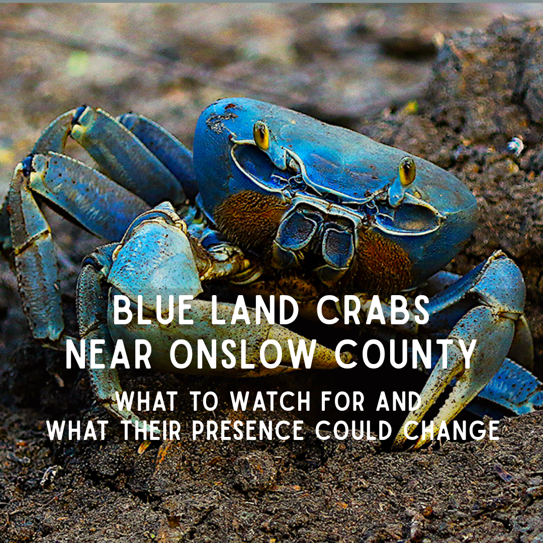
The animal itself would be harder to overlook. A mature blue land crab, Cardisoma guanhumi, can grow to nearly six inches across its shell, with legs that make it appear larger still. An adult male is often blue-gray and carries one powerful claw, but females may be pale gray or white, while younger crabs can be orange, brown, or purple. From a distance, the uneven claws can resemble those of a fiddler crab, except the entire animal has been enlarged to a scale unfamiliar in a Carolina backyard (Hostetler et al., 2025).
Until recently, it was also unfamiliar along this part of the coast. The blue land crab’s historically documented range in the continental United States followed the Gulf of Mexico and southern Florida, with Vero Beach long recognized as its northern Atlantic limit (Scott et al., 2023). Occasional South Carolina records began in 2008, followed by 53 verified sightings there during a concentrated period of public reporting in fall 2022 (Scott et al., 2023). North Carolina confirmed its first blue land crab in summer 2023. By August 2026, 23 sightings had been confirmed statewide and another 34 reports remained unverified. Two of the confirmed records this year came from Emerald Isle (NC DEQ, 2026).
Those numbers do not yet describe a population. They describe a question appearing in yards, along roads, and beside the marsh: whether a warm-water crab is occasionally reaching North Carolina or beginning to live here.
A Crab That Does Not Stay in One World
The blue land crab is neither a displaced Atlantic blue crab nor simply a giant fiddler. The shared color and oversized claw describe what it looks like, not its closest relatives. It belongs to Gecarcinidae, the land-crab family, whose members have moved much of adult life above the tide. Their gills still do the breathing, even in air, and those gills must remain damp. The crab can leave the water; it cannot leave water behind (Marin & Tiunov, 2023).
That need for moisture keeps the crab between two worlds. Adults may live above the reach of ordinary tides—in coastal forests, brushy ground, grasslands, drainage edges, and even yards—but they return to damp shelter when the day becomes hot or when a newly molted shell leaves them vulnerable. Many blue land crabs can live near one another without sharing that refuge; each normally keeps a burrow of its own (Herreid & Gifford, 1963; Moraes-Costa & Schwamborn, 2018).
That higher position separates the blue land crab from many crabs living in the flooded marsh below it, but not completely. Its life still returns to the estuary. After mating, a female carries hundreds of thousands of eggs beneath her abdomen and travels to salt or brackish water to release them (Hostetler et al., 2025). The larvae drift through several planktonic stages before settling and returning to land as small crabs. Warm water is particularly important during this development, while salinity determines which parts of an estuary can carry the larvae successfully (Costlow & Bookhout, 1968a, 1968b).
An adult can therefore live beneath shrubs beside a yard while its offspring begin among fishes and plankton. The species belongs to the coastal upland and the estuary at the same time, and that divided life helps explain how an animal tied to one burrow can appear far beyond the range where its adults were previously known.
How a Southern Crab Reached This Shore
Blue land crabs are not likely to have walked from Florida to the Carolinas. Adults forage close to their burrows and show strong attachment to a small home area. Females make longer reproductive movements toward water, but those are local journeys between upland burrows and larval-release sites rather than migrations along hundreds of miles of coastline (Moraes-Costa & Schwamborn, 2018).
Long-distance movement is more plausible during the larval stage. Once released, larvae spend weeks in coastal water before returning to land, allowing currents to carry them beyond the place where they hatched (Hostetler et al., 2023). A widening pattern of sightings from Florida through Georgia and South Carolina would be consistent with natural range expansion as warming water and milder cold periods make northern development and survival more possible (Costlow & Bookhout, 1968b; NC DEQ, 2026; Scott et al., 2023). Human transport, including movement with vessels or materials, remains another possibility because the present records do not yet reveal how the crabs arrived (NC DEQ, 2026).
Warmer conditions in Florida would not simply make the crabs decide to leave. The more relevant change would occur at the northern boundary, where conditions that once killed larvae or prevented overwintering may no longer do so as reliably (Costlow & Bookhout, 1968b). Warming can open habitat ahead of a species without pushing adults out of the habitat behind it.
It is tempting to imagine worsening conditions in Florida sending blue land crabs north, but that does not fit particularly well with how the adults live. Coastal development, altered groundwater, harvesting, and the loss of mangrove-edge habitat have reduced populations in parts of Puerto Rico and Brazil. When the ground around an adult’s burrow is destroyed, however, the crab may move only a short distance or disappear with the habitat. It does not begin a walk to North Carolina (Govender et al., 2008; Moraes-Costa & Schwamborn, 2018).
Development may matter after the much smaller, drifting stage has already reached a new shore. A canal edge, drainage ditch, watered lawn, or patch of coastal vegetation can offer the damp ground a young crab needs as it leaves the estuary. Human-altered places may therefore help connect suitable patches without being the reason the crab traveled north in the first place (Riascos et al., 2024).
So is the blue land crab native to North Carolina, or is it invasive? Neither label fits neatly yet. The species is native to warmer parts of the western Atlantic and Gulf of Mexico, including Florida, but North Carolina lies beyond its historically recognized Atlantic range in the United States. If larvae are reaching the Carolinas on coastal currents and surviving because conditions have become more favorable, then the crab’s natural range may be expanding. If crabs arrived with boats or transported materials, that would be an introduction. The sightings cannot yet tell us which occurred (Scott et al., 2023; NC DEQ, 2026).
Either way, arrival alone does not make a species invasive. The blue land crab would have to establish a reproducing population, continue spreading, and cause ecological or economic harm. North Carolina has confirmed crabs, but it does not yet have evidence of an established, harmful population (NC DEQ, 2026).
Emerald Isle Is Not Far Away
There were two confirmed blue land crab sightings in Emerald Isle this year, out of 23 confirmed cases across North Carolina (NC DEQ, 2026). This is what makes the Emerald Isle records matter here. The confirmed crabs were not found along some distant part of the North Carolina coast. They were found on Bogue Banks, northeast of Onslow County and only several dozen coastal miles from North Topsail Beach.
Between Emerald Isle and Topsail are connected sounds, tidal creeks, inlets, marshes, developed islands, and the Intracoastal Waterway. A crab confirmed on Bogue Banks does not prove that one is already living around North Topsail, Surf City, or the soundside of Topsail Island. It does place the animal within a coastal landscape that continues toward all three.
That does not mean currents are carrying crabs neatly from Emerald Isle toward Topsail, and the statewide sightings should not be read as a marching line. Some animals may represent separate arrivals; others may have gone unnoticed for years. The map brings the question closer. Only repeated observations can show where the crab has actually found a place—and which members of the existing crab community are already there.
The Crabs Already Here
Onslow County’s marsh edge is not waiting empty for a land crab to arrive. Several native crabs divide the same transition from tidal creek to high ground, although each uses a somewhat different part of it.
Comparison of the blue land crab to other crabs seen in our Onslow County area. | Image credit: SC Department of Natural Resources
At low tide, the easiest to notice are often fiddlers. Atlantic marsh fiddler crabs,Minuca pugnax, favor muddier marsh sediment, while Atlantic sand fiddlers,Leptuca pugilator, are more common across sandy flats and the higher portions of the marsh. Red-jointed fiddler crabs,Minuca minax, appear where the water is fresher. Marsh and sand fiddlers have long been documented in North Carolina salt marshes, gathering into the familiar patches that vanish into small holes when a person approaches (O’Connor, 1993).
They sift algae, microbes, and bits of organic material from the surface, leaving tiny feeding marks across exposed sediment. Even a male carrying an oversized claw has a body only a fraction of the width of an adult blue land crab.
Closer to the cordgrass, purple marsh crabs,Sesarma reticulatum, move along muddy creek banks and feed heavily on the grass, including stems and tissues belowground. At ordinary numbers they are part of the marsh’s long-established community. Where their numbers become unusually high, their feeding can strip away vegetation and leave sediment exposed (Bertness et al., 2014; Wittyngham et al., 2024).
At the upper edge, the small brown crab beneath a board or patch of leaves may be a squareback marsh crab,Armases cinereum. Of the native crabs, it is the most likely to meet a blue land crab where marsh gives way to the yard. It moves above the high-water line, sometimes crossing lawns or climbing garage walls, and eats fallen leaves, living plants, and small invertebrates. Its menu is broad in much the same way as a blue land crab’s, although the squareback itself is far smaller (Buck et al., 2003).
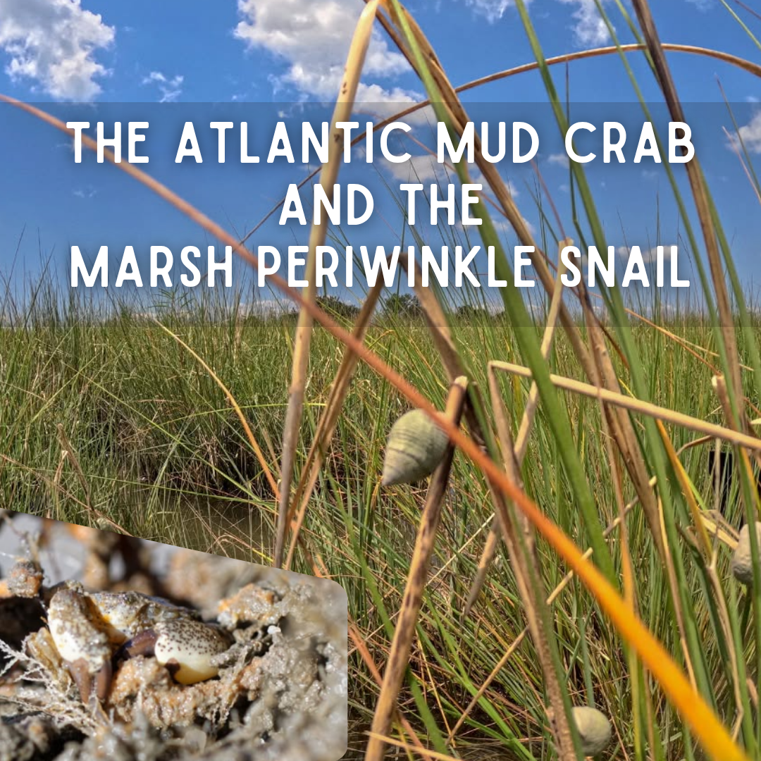
Other familiar crabs belong to neighboring settings. Atlantic mud crabs such as Panopeus herbstii remain among oyster shells, rocks, and submerged structure, where their heavy claws open oysters, clams, barnacles, and snails. Ghost crabs,Ocypode quadrata, occupy the open beach and dune sand on the ocean side. Either may be close in geographic distance to a blue land crab, but neither uses the soundside grass-to-yard boundary in quite the same way.
Each of these crabs already belongs to a particular part of the shore. A blue land crab would not arrive in an empty niche, but it would not duplicate any one of them either. To see where the differences matter, we have to look below the opening.
The Architecture Beneath the Opening
For a burrowing crab, the tunnel is more than a hiding place. It is a shelter from heat and predators, a humid chamber that protects the gills, and a safe place to molt. Its shape reflects the problem the crab needs it to solve, which is why burrows built only a few yards apart can belong to very different lives.
A blue land crab begins on higher ground with a comparatively broad entrance, then turns downward toward moisture. There is no single blueprint hidden below it. Burrows examined with a fiber-optic camera in Puerto Rico included short passages that descended at a shallow angle, longer tunnels that leveled before dropping sharply, and deep curves resembling an inverted S. Forked and corkscrew forms occurred less often. The route varied with the site, but the essential destination was usually the same: a humid refuge at or near groundwater, occupied by one crab rather than a colony sharing one chamber (Moraes-Costa & Schwamborn, 2018; Sample & Albrecht, 2016).
The blue land crab’s burrow will begin their entrance with a steep angle that levels off until a sharp downward turn to reach the water table. | Image credit: Sample & Albrecht, 2016
An Atlantic sand fiddler builds at another scale and for another rhythm. Its narrow shaft descends through sand exposed between tides, and a deeper breeding burrow may extend farther than the temporary refuge used while feeding. Across a flat, many small entrances can stand close together because each belongs to a small crab defending little more than the ground immediately around it. Although the shafts provide shelter and moist air, they remain much narrower than the passage required by an adult blue land crab (Christy, 1982). A fiddler opening would therefore be a poor ready-made home for a mature Cardisoma.
A 3D cast and schematic show the burrow formation of an Atlantic fiddler crab. | Image Credit: di Virgilio & Riberio, 2013
The purple marsh crab offers a different contrast. Its burrows occupy muddy, rooted creek banks and can become part of a connected network with several openings. When those networks become dense, especially where vegetation has already thinned, excavation and cordgrass feeding can loosen the bank and make sediment easier for moving water to carry away (Bertness et al., 2014; Farron et al., 2020). A blue land crab generally begins above ordinary tidal flooding and maintains a more solitary route toward groundwater. Its burrow should not be assumed to undercut a creek bank in the same way simply because both animals dig.
A ghost crab may also leave one obvious opening and a mound of newly moved sand, but its address is usually the open ocean beach or foredune. Its sloping or curving refuge is built in loose, comparatively dry beach sand, not at the moist soundside boundary between marsh and yard.
Ghost crab burrow structure from a 3D cast on a sandy beach | Image credit: Shinoda et al., 2019
The squareback marsh crab makes an even clearer distinction. It commonly slips beneath leaves, logs, rocks, boards, and other cover at the upper marsh edge instead of constructing the large groundwater-reaching tunnel associated with an adult blue land crab. Mud crabs and Atlantic blue crabs do not make permanent terrestrial burrows at all. One uses submerged crevices; the other may bury itself temporarily in bottom sediment.
The squareback marsh crab may use rocks, leaves or other surface materials to hide beneath instead of a burrow. | Image credit: critterbliss, iNaturalist
Burrow reuse deserves equal care. Smaller blue land crabs have been found in openings much larger than their bodies, which is consistent with their moving into burrows abandoned by larger blue land crabs (Carmona-Suárez & Guerra-Castro, 2012). For a smaller crab, an empty tunnel would mean less digging, less time exposed aboveground, and immediate access to a refuge that already holds moisture. Those are likely advantages rather than benefits tested directly.
The other crabs along a Carolina shore do not appear to offer the same shortcut. Their shelters are too narrow, too low in the marsh, too dry, or not true burrows at all. Nothing currently shows that blue land crabs routinely take over and enlarge the burrows of another crab species.
The digging leaves more than a hole. Soil brought up from below is spread across the surface, while leaves, scraps of food, old molts, and waste may collect inside. In places where blue land crabs are established, the soil within their burrows differs from the ground beside them in its mixture of sand and silt, acidity, organic matter, and nutrients including nitrogen, magnesium, and potassium (Quintero-Torres et al., 2018).
The open tunnel also allows air and water to reach soil that had been sealed underground. Across many kinds of coastal crabs, burrowing tends to loosen sediment and change the chemical work carried out there by microbes. How much changes—and whether the effect helps or harms the plants above—depends upon the crab, the vegetation, and where the burrow sits (Rinehart et al., 2024).
Water salinity is shown in a burrowed marsh (a), a straight burrowed marsh (b), a sloped marsh (c ), and a marsh at the high tide stage and how salinity is distributed in the marsh as influenced by burrows. | Image credit: Yin et al., 2023
That does not mean each hole ventilates an entire marsh. Oxygen entering a tunnel may change only a thin layer of soil along its walls. Around fiddler burrows, that reach has been far smaller than the familiar phrase “aerates the soil” might suggest (Michaels & Zieman, 2013). A single high-ground blue land crab tunnel is not a new tidal creek either. Rain, groundwater, or an unusually high tide may enter it and change the wetness immediately around the opening, but blue land crab burrows have not been shown to redirect tidal flow through a maritime forest.
Roots present the same uncertainty. Digging can break fine roots and loosen the soil holding them, while the extra space and shifted nutrients around a tunnel may create new conditions for roots and soil life. Blue land crabs also clip and eat plants aboveground, so a damaged plant would not tell us whether feeding, digging, or both were responsible.
One occupied hole may change little beyond a small patch of ground. If the same digging were repeated across many burrows, those patches could begin to influence which plants take hold, how firmly their roots bind the edge, and how water moves through the soil. That possibility is one reason burrows are worth mapping. It is not evidence that those changes are already happening at North Carolina sighting sites.
At first, the tunnel keeps one crab alive. Only when that work is repeated across a place does it begin to become part of the landscape.
From the surface, however, most of that architecture remains hidden.
What a Burrow Can—and Cannot—Tell Us
A mature blue land crab may leave an opening three to five inches wide. Freshly excavated soil may collect around the entrance, and plant pieces or tracks may be visible nearby. These clues become more persuasive when the hole sits above normal tidal flooding in shaded, moist ground and a very large crab has been seen retreating into it (Hostetler et al., 2025).
It is still not an identification. A smaller blue land crab may occupy an older, larger burrow, while erosion can widen the entrance to a much smaller tunnel. Marsh soil also collapses, roots leave openings, rodents dig, and water continually reshapes the grass line. Size alone can mislead, particularly in a photograph with nothing nearby for scale.
The setting and the pattern offer better clues. Many small holes spread across exposed mud or sand point toward fiddlers. Several openings cut through a rooted creek bank fit purple marsh crabs. One hole high on the dry ocean beach is more likely a ghost crab’s. Squarebacks are often found beneath something rather than beside a large mound of freshly dug soil. The strongest match for the blue land crab would bring several details together: a broad opening on higher soundside ground, signs of recent digging, and a crab far larger than the native marsh species.
That is why a useful photograph includes more than the hole. The crab, entrance, moved soil, surrounding plants, nearby water, and something familiar for scale allow the scene to be read together. There is no need to dig, probe, or flood the tunnel. Without the animal, a burrow can identify a place worth watching, but not the species living beneath it.
What the New Crab Would Eat
The large claw may make a blue land crab look like a hunter arriving to eat every smaller crab in its path. Most of what it gathers, however, is plant material: fallen leaves, fruit, berries, flowers, tender shoots, grasses, and seeds. It may carry that food home and pull some of it underground. Insects, carrion, feces, and other animal matter add to the diet when available, and blue land crabs sometimes eat one another (Gifford, 1962; Herreid, 1963; Moraes-Costa & Schwamborn, 2018).
That does not place native crabs entirely off the menu. A blue land crab may seize a small animal it can catch, but regular hunting of fiddlers, squarebacks, or purple marsh crabs is unlikely to be its main influence. The more important changes would probably begin with the plants and fallen leaves it removes, the ground it excavates, and the space it keeps around its burrow.
The amount of competition would differ from crab to crab. Fiddlers graze the thin film of algae, microbes, and organic particles coating the marsh surface, so they share relatively little food with a crab gathering fruit and leaves above the high-tide line. Squareback and purple marsh crabs share more of that plant-based menu, although they forage at different scales and in different parts of the marsh. If blue land crabs remain, the strongest overlap may be over shaded ground, damp refuge, and nearby plant food rather than over a particular prey animal.
What Established Populations Tell Us
Sharing food and high ground does not make displacement inevitable. Where blue land crabs have lived for generations, other crabs continue to live beside them by using different levels of the shore. Along the Brazilian coast, for example, the mangrove crab,Ucides cordatus, digs into softer ground between the tides, while Cardisoma lives higher in firmer, sandier soil. Their ranges overlap without their burrows occupying precisely the same ground (Firmo et al., 2012).
North Carolina has a different community, but the same separation by water, soil, and elevation is already familiar here. The squareback comes closest to overlapping with a blue land crab at the upper edge. Even there, one defended Cardisoma burrow might cost a squareback a feeding spot without removing squarebacks from the wider marsh.
The first change people noticed might therefore be simpler than one crab replacing another: a much larger animal at the grass line, fresh soil beside an entrance, fallen fruit or leaves drawn toward it, and tender plants clipped within a short walk of the burrow.
That picture could change if the crabs became numerous. Many defended burrows would divide more of the narrow band of damp high ground, increasing competition for shelter and food. Their digging would repeat the small soil changes described above, while their feeding could influence which seeds and seedlings survive and how quickly fallen leaves disappear. Those broader forest effects are known across several land-crab species rather than from a newly established Cardisoma population, but they show why abundance matters more than the mere arrival of one large crab (Lindquist et al., 2009).
Predators would respond only if the crabs became dependable prey. Large birds and mammals eat blue land crabs within their established range, while eggs and larvae released into the estuary become food for aquatic animals (Firmo et al., 2012; Hostetler et al., 2025). One adult crossing a Carolina yard offers one unusual meal. A recurring population could give raccoons or coastal birds a reason to search the marsh edge and could place many larvae into the estuarine food web.
This is where two kinds of change can look like the same thing. Digging alters the ground directly, making the crab an ecosystem engineer (Rinehart et al., 2024). A trophic cascade would have to continue through feeding relationships: fewer surviving seedlings changing the vegetation, for example, or predators drawn to land crabs changing their pressure on other prey (Lindquist et al., 2009).
Blue land crabs are capable of beginning both pathways. What the North Carolina sightings cannot yet tell us is whether enough crabs are arriving, surviving, and reproducing for the work of individuals to become the work of a population.
When One Sighting Becomes a Place
One dated photograph gives the map a place. Another observation weeks or months later begins to show whether the crab stayed. As those records accumulate, they can reveal when the crabs are active, whether they appear after rain, which kinds of ground they use, and whether they return across seasons. Crabs of different sizes at one site may have survived across more than one year, while juveniles, egg-bearing females, or repeated movements toward the water would offer stronger evidence that the species is completing more of its life cycle here.
The same map can show where the larger ecological questions belong. One wandering adult does not tell us that native crabs are being displaced or that a trophic cascade has begun. Several occupied burrows, plant damage, younger crabs, and repeated sightings at the same place would give biologists a reason to compare its vegetation, soil, native crabs, and predators with nearby places where Cardisoma is absent.
Anyone who sees a possible blue land crab can photograph it from a safe distance and submit the image, date, and location through the Blue Land Crab Sightings reporting. A photograph showing the animal, its approximate scale, and the surrounding habitat is more useful than trying to catch or relocate it.
That distinction matters for anyone standing at the grass line. A three-inch hole is not an identification, clipped leaves are not proof of ecological harm, and a large crab is not automatically an invasive species. Each is a piece of context. Together, photographed and reported without catching or relocating the animal, those pieces can show whether North Carolina is receiving occasional southern visitors or adding a new resident to the narrow landscape between the forest and the sea.
The coast will answer that slowly, one place at a time.
References
Bertness, M. D., Brisson, C. P., Bevil, M. C., & Crotty, S. M. (2014). Herbivory drives the spread of salt marsh die-off. PLoS ONE, 9(3), e92916. https://doi.org/10.1371/journal.pone.0092916
Buck, T. L., Breed, G. A., Pennings, S. C., Chase, M. E., Zimmer, M., & Carefoot, T. H. (2003). Diet choice in an omnivorous salt-marsh crab: Different food types, body size, and habitat complexity. Journal of Experimental Marine Biology and Ecology, 292(1), 103-116. https://doi.org/10.1016/s0022-0981(03)00146-1
Carmona-Suárez, C. A., & Guerra-Castro, E. (2015). Comparison of three quick methods to estimate crab size in the land crabs <i>Cardisoma guanhumi</i> Latreille, 1825 and <i>Ucides cordatus</i> (Crustacea: Brachyura: Gecarcinidae and Ucididae). Revista de Biología Tropical, 60, 139. https://doi.org/10.15517/rbt.v60i0.19854
Costlow, Jr., J. D., & Bookhout, C. G. (1968a). The complete larval development of the land-crab, Cardisoma guanhumi Latreille in the laboratory (Brachyura, Gecarcinidae). Crustaceana, 15(3), 259-270.
Costlow, Jr., J. D., & Bookhout, C. G. (1968b). The effect of environmental factors on development of the land-grab,cardisoma guanhumiLatreille. American Zoologist, 8(3), 399-410. https://doi.org/10.1093/icb/8.3.399
Farron, S., Hughes, Z., FitzGerald, D., & Strom, K. (2020). The impacts of bioturbation by common marsh crabs on sediment erodibility: A laboratory flume investigation. Estuarine, Coastal and Shelf Science, 238, 106710. https://doi.org/10.1016/j.ecss.2020.106710
Firmo, A., Tognella, M. M., Silva, S. R., Barboza, R. R., & Alves, R. (2012). Capture and commercialization of blue land crabs (“guaiamum”) Cardisoma guanhumi (Lattreille, 1825) along the coast of Bahia state, Brazil: An ethnoecological approach. Journal of Ethnobiology and Ethnomedicine, 8(1). https://doi.org/10.1186/1746-4269-8-12
Gifford, C. A. (1962). Some observations on the general biology of the land crab, cardisoma guanhumi (Latreille), in South Florida. The Biological Bulletin, 123(1), 207-223. https://doi.org/10.2307/1539516
Govender, Y., Sabat, A. M., & Cuevas, E. (2008). Effects of land-use/land-cover changes on land crab,Cardisoma guanhumi, abundance in Puerto Rico. Journal of Tropical Ecology, 24(4), 417-423. https://doi.org/10.1017/s0266467408005130
Herreid, C. F. (1963). Observations on the feeding behavior of Cardisoma Guanhumi (Latreille) in southern Florida1). Crustaceana, 5(3), 176-180. https://doi.org/10.1163/156854063×00093
Herreid, C. F., & Gifford, C. A. (1963). The burrow habitat of the land crab, Cardisoma guanhumi (Latreille). Ecology, 44(4), 773-775. https://doi.org/10.2307/1933027
Hostetler, M. E., Mazzottii, F. J., & Taylor, A. K. (2025, October 28). Blue land crab (Cardisoma guanhumi) (WEC 30). Department of Wildlife Ecology and Conservation, UF/IFAS Extension. https://ask.ifas.ufl.edu/publication/UW013
Lindquist, E. S., Krauss, K. W., Green, P. T., O’Dowd, D. J., Sherman, P. M., & Smith, T. J. (2009). Land crabs as key drivers in tropical coastal forest recruitment. Biological Reviews, 84(2), 203-223. https://doi.org/10.1111/j.1469-185x.2008.00070.x
Marin, I. N., & Tiunov, A. V. (2023). Terrestrial crustaceans (Arthropoda, crustacea): Taxonomic diversity, terrestrial adaptations, and ecological functions. ZooKeys, 1169, 95-162. https://doi.org/10.3897/zookeys.1169.97812
Michaels, R. E., & Zieman, J. C. (2013). Fiddler crab (Uca spp.) burrows have little effect on surrounding sediment oxygen concentrations. Journal of Experimental Marine Biology and Ecology, 448, 104-113. https://doi.org/10.1016/j.jembe.2013.06.020
Moraes-Costa, D., & Schwamborn, R. (2018). Site fidelity and population structure of blue land crabs (Cardisoma guanhumi Latreille, 1825) in a restricted-access mangrove area, analyzed using PIT tags. Helgoland Marine Research, 72(1). https://doi.org/10.1186/s10152-017-0504-0
O’Connor, N. (1993). Settlement and recruitment of the fiddler crabs Uca pugnax and U. pugilator in a North Carolina, USA; salt marsh. Marine Ecology Progress Series, 93, 227-234. https://doi.org/10.3354/meps093227
Quintero-Torres, E., Chacón, N., & López-Sánchez, B. (2018). The ecosystem engineering role of the neotropical crab Cardisoma guanhumi on mangrove soil properties. Wetlands Ecology and Management, 26(5), 993-1000. https://doi.org/10.1007/s11273-018-9618-7
Riascos, J. M., Obonaga, L. D., & Ramos, J. (2024). Is the threatened land crab Cardisoma guanhumi conquering human‐dominated systems? Ecology and Evolution, 14(4). https://doi.org/10.1002/ece3.10737
Rinehart, S. A., Dybiec, J. M., Walker, J. B., Simpson, L., & Cherry, J. A. (2024). Effects of burrowing crabs on coastal sediments and their functions: A systematic meta‐analysis. Ecosphere, 15(7). https://doi.org/10.1002/ecs2.4927
Sample, S., & Albrecht, M. (2016). Determination of the burrow shapes of Cardisoma guanhumi on Vieques, Puerto Rico. Journal of Coastal Life Medicine, 4(2), 94-97. https://doi.org/10.12980/jclm.4.2016j5-245
Scott, E., Kendrick, M., Kingsley-Smith, P., James, M., Lemeris, J., Weeks, E., & Sasson, D. (2023). Using public sightings to document the widespread distribution of the non-endemic blue land crab, Cardisoma guanhumi, in South Carolina. Southeastern Naturalist, 22(4). https://doi.org/10.1656/058.022.0403
Wittyngham, S. S., Johnson, D. S., Chen, Y., & Kirwan, M. L. (2024). A grazing crab drives saltmarsh carbon storage and recovery. Ecology, 105(9). https://doi.org/10.1002/ecy.4385
Late August does not look much like fall along the Onslow County coast.
The sand is still hot. Afternoon thunderstorms still build over the mainland. The ocean can remain warm enough that stepping into it hardly feels like relief.
But beneath the surface, fall has already begun.
Fish that spent summer scattered through sounds, creeks, reefs, and nearshore water begin gathering. Shrimp start working their way out of nursery creeks. Mature female blue crabs move toward saltier water. Schools of mullet begin appearing along the beaches. Sharks that spent the warmer months farther north or inside coastal waters begin shifting south or offshore.
Above them, the birds begin changing too.
Some are preparing to leave. Others are arriving from places hundreds or thousands of miles away. Still others simply become more noticeable because suddenly there is food everywhere.
What looks from shore like a few gulls working over the water, a school of baitfish flashing beside a pier, or pelicans repeatedly diving beyond the breakers is part of something much larger.
For a few months each fall, the food web itself begins to move.
When the Water Begins to Change
Animals do not wait for a date on the calendar. Along the coast, fall arrives through changes in water temperature and daylight, but also through salinity, currents, rainfall, food availability, and the timing of reproduction. Different species respond to different combinations of those signals, which means the seasonal movement beginning beneath the surface is not one migration triggered in one way.
For some animals, cooling water begins narrowing where they can comfortably remain. King mackerel (Scomberomorus cavalla) favor warm coastal water and become less common as temperatures fall much below about 68°F, while cobia (Rachycentron canadum) begin leaving northern summer habitats as water cools through roughly the same range. Spotted seatrout (Cynoscion nebulosus) respond differently. Rather than leaving our estuaries altogether, they begin shifting toward creeks, channels, and deeper water where a few additional feet of depth can provide protection from the colder temperatures still to come (North Carolina Division of Marine Fisheries, 2022; Jensen & Graves, 2020; Ellis, Buckel, & Hightower, 2017; Ellis, Buckel, Hightower, & Poland, 2017).
King mackerel (Scomberomorus cavalla), a warm-water coastal fish that becomes less common as fall temperatures drop. | Image credit: Sylvain Le Bris, iNaturalist
Temperature can work together with another signal that changes every year whether the weather feels like fall or not: shortening daylight. Blacktip and sandbar sharks moving along the western Atlantic begin their southward migration as sea-surface temperatures change and the days grow shorter, leaving northern and Mid-Atlantic summer habitats and gradually shifting toward the South Atlantic Bight and Florida for winter and spring (Manz et al., 2025).
For other animals, autumn movement is tied less to escaping cooling water than to reaching the next stage of their life cycle. Southern flounder (Paralichthys lethostigma) spend their first years in estuarine waters, where shallow sounds, rivers, and creeks provide nursery and feeding habitat. Females begin maturing surprisingly early: some are reproductively mature by age one, most by age two, and nearly all by age three. Immature fish can remain within the estuary through winter, but once mature, southern flounder begin joining the fall movement through the inlets and toward offshore spawning grounds (Midway & Scharf, 2012; Craig et al., 2015).
That means fish of different ages can occupy the same estuary through summer and then take different paths as fall develops. A young flounder may remain behind while an older fish that spent the season feeding in the same system begins moving toward the ocean.
So while late-August water may still feel thoroughly summerlike to someone standing waist-deep at Topsail, the animals beneath the surface are already responding to a season that is only beginning to become visible above it.
One of the first clues may simply be a fish jumping beside you.
The Mullet Begin to Run
Striped, or sea, mullet (Mugil cephalus) spend much of the warmer season feeding throughout estuaries, sounds, tidal creeks, and protected coastal waters. By late summer, however, their movements begin to change. In North Carolina, striped mullet travel most actively between August and November as mature fish leave rivers, sounds, and tidal creeks for marine spawning habitat. Their journey carries them through the inlets and offshore into the South Atlantic Bight, with spawning habitat extending from nearshore waters toward the outer continental shelf where shelf water meets the influence of the Gulf Stream (Bacheler et al., 2005). For fish that spent the summer inside an estuary, that is a considerable change in geography, but still a relatively regional migration compared with species that will later continue much farther south along the Atlantic coast.
They begin making that seasonal journey relatively young. About half of North Carolina striped mullet are reproductively mature by age one, although maturity varies among individuals, and older adults may return to estuarine habitats after spawning. Rather than leaving the estuary permanently as they mature, they move between estuarine feeding grounds and marine spawning habitat as part of a seasonal cycle (Bichy, 2004; Bacheler et al., 2005).
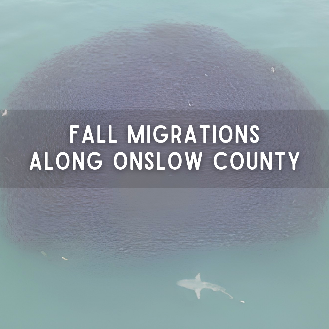
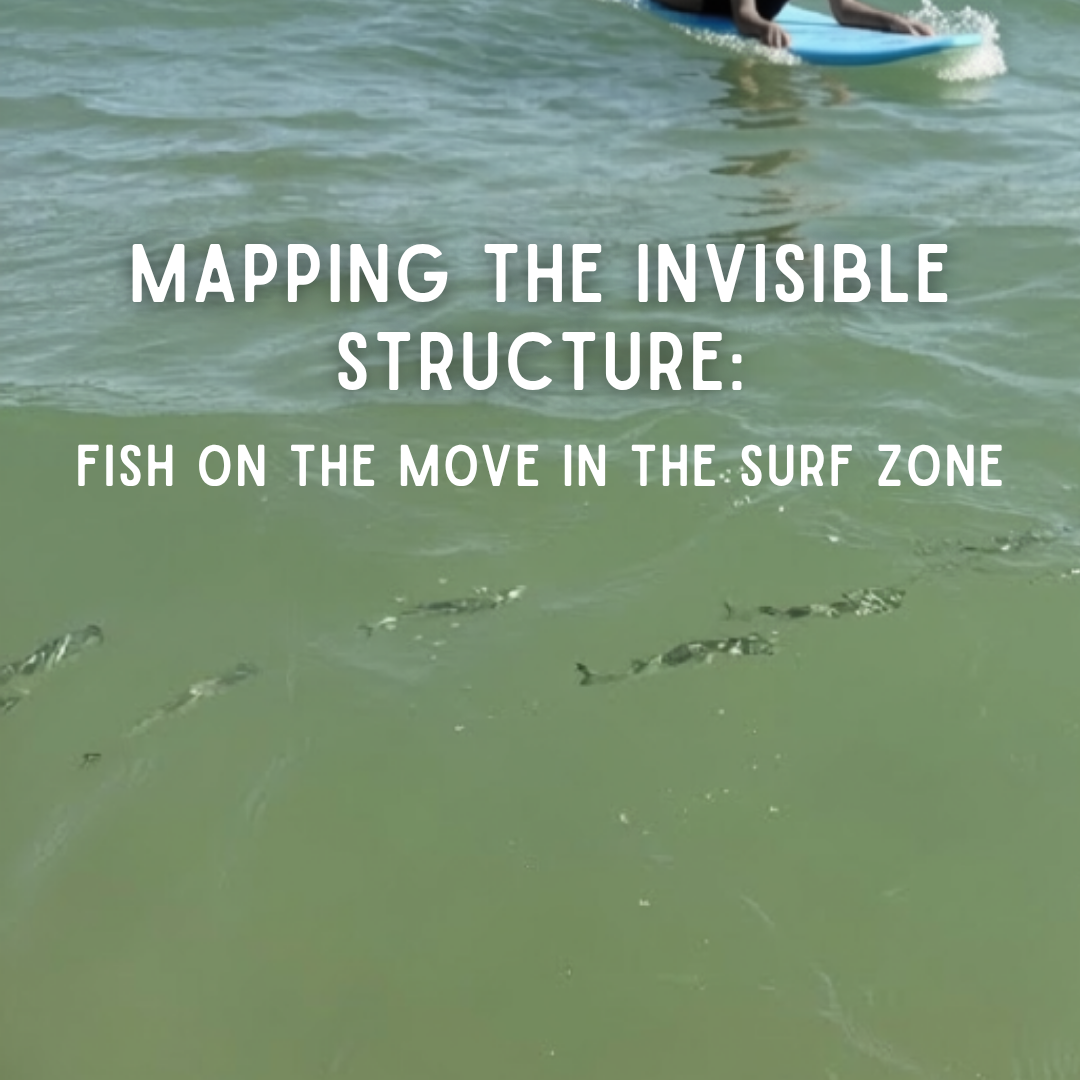
For beachgoers, this can become one of the easiest fall migrations to notice. Fish that spent summer spread through rivers, creeks, and sounds begin collecting into increasingly conspicuous schools as they move toward inlets and coastal water. Once along the ocean beach, dense schools may travel remarkably close to shore, sometimes darkening the shallows or stretching along the surf zone beyond what can be seen from one spot. Mullet are frequent jumpers as well, so a school may first reveal itself as silver fish repeatedly breaking the surface. By the time those schools reach the inlet and beach, they are carrying more than themselves with them. Striped mullet feed low in the food web, consuming algae, detritus, and organic material associated with estuarine sediments. As thousands of them move out of the estuary, that stored production moves with them and becomes available to the larger fishes, sharks, and birds that feed along the coast (Bacheler et al., 2005).
Those predators are already moving through the same corridor. Bluefish (Pomatomus saltatrix) feed heavily on schooling fishes such as mullet, menhaden, and silversides. Spanish mackerel (Scomberomorus maculatus) work schools of anchovies and other small baitfish, while blacktip sharks (Carcharhinus limbatus) and spinner sharks (Carcharhinus brevipinna) take advantage of dense concentrations of coastal prey.
The fall mullet run is therefore more than thousands of fish leaving an estuary. It is estuarine production moving through the inlet and onto the beach, where it begins to intersect with predators following their own seasonal routes.
That intersection is what makes the migration suddenly visible. A school that might otherwise pass unnoticed can tighten near shore as bluefish, mackerel, sharks, and birds begin responding to the same moving concentration of prey.
Spanish Mackerel, Bluefish, and the Surface Chase
Sometimes the easiest way to find a migration is not to look for the animals themselves, but for what happens to the water when they arrive.
Spanish mackerel (Scomberomorus maculatus) spend the warmer months moving north along the Atlantic coast, reaching North Carolina in spring and remaining through summer and early fall while coastal water stays above roughly 68°F. As that warm-water window begins closing, they turn south again toward winter habitat off Florida, feeding heavily along the way on anchovies, silversides, menhaden, mullet, and other small schooling fishes (North Carolina Division of Marine Fisheries, 2026; Sutherland & Fable, 1980).
Spanish mackerel (Scomberomorus maculatus) traveling in a dense school. | Image credit: Shutterstock
Bluefish (Pomatomus saltatrix) are moving through the same changing coast, but their fall pattern varies with age. Smaller bluefish tend to migrate south along the shoreline as water cools, while larger adults make more of an inshore-to-offshore shift. Farther north, fall movement begins as water drops into roughly the mid-50s Fahrenheit, gradually carrying fish into the warmer coastal waters to the south (Lund & Maltezos, 1970). By the time those movements reach the Carolina coast, they are crossing water already crowded with prey. Anchovies, silversides, juvenile menhaden, and other tiny schooling fishes—many of the fishes beachgoers collectively call “glass minnows”—can become compressed near the surface, and even wash onto shore, as mackerel and bluefish strike through the schools from below.
Little tunny (Euthynnus alletteratus), better known locally as false albacore, can join that fall activity around inlets and nearshore waters as well. They too make seasonal movements along the Atlantic coast, shifting north through the warmer part of the year and south again through fall and winter while feeding in fast-moving schools (North Carolina Division of Marine Fisheries, 2026).
Little tunny (Euthynnus alletteratus), also known as false albacore, moving in a feeding school. | Image credit: aurelpap, iNaturalist
From the beach, separating one predator from another may be nearly impossible. What becomes visible instead is the chase. A patch of otherwise smooth ocean suddenly begins to boil as tiny fish scatter across the surface. Gulls and terns converge overhead, pelicans turn toward the commotion, and dark backs or silver flashes cut through the school below.
Sometimes the entire event moves several hundred yards down the beach within minutes.
And the animals doing the chasing are still part of the food web themselves. Spanish mackerel and bluefish may be predators here, but both can become prey for larger sharks and tunas farther up the same moving chain. A small fish feeding on plankton becomes food for a mackerel; that mackerel may later become food for a shark.
Fall has compressed several levels of the food web into the same patch of water, and for a few minutes the whole thing becomes visible from shore.
The Sharks Following Fall
Shark migration can sound dramatic because sharks are dramatic animals.
Ecologically, however, their fall movements make perfect sense. Food is moving, water temperature is changing, nursery seasons are ending, and remaining in shallow water becomes increasingly expensive for animals whose body temperature largely follows the environment around them.
Blacktip sharks (Carcharhinus limbatus) and spinner sharks (Carcharhinus brevipinna) are warm-water coastal sharks frequently associated with schools of mullet, menhaden, and other fishes.
Blacktip (Carcharhinus limbatus) and spinner sharks (Carcharhinus brevipinna) can look very similar; fin markings and body proportions help separate the two. | Image credit: Bowers & Kaijiura, 2023
As coastal waters cool, these highly mobile sharks begin shifting south. For blacktips, that can mean a substantial journey: sharks that spent the warmer months along the Carolinas and farther north move down the Atlantic coast toward Florida, with large winter aggregations forming in the warm coastal waters of southeast Florida. Spinner sharks also shift south as autumn progresses, although exactly how their seasonal routes connect Carolina summer habitat with winter habitat farther south is less clearly understood (Manz et al., 2025). Their movement is not caused by prey alone. Temperature and the gradually shortening length of the day contribute to the timing of autumn migration, while concentrations of prey can influence where sharks pause and feed along the route (Manz et al., 2025). That shortening daylight is the actual span between sunrise and sunset—not the hour shown on our clocks. The gradual loss of daylight from late summer into fall provides a predictable seasonal signal even when water temperatures vary from one year to the next.
The shallow coastal habitats these sharks use during migration are also important much earlier in life. Blacktip pups are born in protected nursery areas away from most adults, and young sharks can remain associated with shallow coastal habitat for several years as they grow. Males generally reach maturity around four to five years old, while females mature closer to six or seven; spinner sharks follow a similarly slow timetable, with females maturing later than males (Carlson et al., 2006; NOAA Fisheries, 2017).
That means the shallow water along the coast is not simply a birthplace young sharks immediately leave behind. It can remain part of their world through several juvenile years before the broader seasonal movements of adulthood become established. Exactly how strongly young sharks remain connected to individual nursery areas is still being studied, but nursery habitat can shape where they spend some of the most vulnerable years of their lives (Heupel et al., 2007; NOAA Fisheries, 2017, 2024).
Around New River Inlet and the beaches of Topsail, those later seasonal movements begin intersecting with the migrations already underway. Schools of mullet, Spanish mackerel, and other coastal fishes can create concentrated feeding opportunities along the same corridor, and both blacktips and spinner sharks may breach during fast pursuits, with spinner sharks sometimes twisting through the air in the leaps that gave the species its name (Bangley, 2014).
A beachgoer watching a fall bait ball may therefore be seeing several stages of the coastal food web converge in the same narrow stretch of water.
Atlantic sharpnose sharks (Rhizoprionodon terraenovae) use shallow coastal waters, sounds, bays, and estuaries throughout the warmer months. Adults are generally only a few feet long and feed on small fishes, shrimp, crabs, squid, and other coastal prey (Bethea et al., 2006; Roskar et al., 2024).
Their fall movement is much smaller in scale than the southward migration of blacktips. During summer, Atlantic sharpnose are abundant in the shallow nearshore waters of Onslow Bay, where both immature and mature sharks occur and pups are likely born. As autumn progresses, they become less common in those shallow areas and shift toward deeper coastal habitat. Adults have even been found using offshore wrecks in North Carolina during winter before returning toward shallower water in spring (Roskar et al., 2024).
So for Atlantic sharpnose, fall may mean moving offshore without leaving the region entirely. Predation does not disappear from the coastal food web; it simply shifts into a different part of it.
Atlantic sharpnose shark (Rhizoprionodon terraenovae), a small coastal shark common in North Carolina’s warmer months. | Image credit: Virginia Institute of Marine Science
Sandbar sharks (Carcharhinus plumbeus) show how different that scale can become. Young sandbars spend the warmer months in shallow nursery habitat farther north along the Mid-Atlantic, then move offshore and south during late September and October. Many repeat that seasonal route for several years as juveniles, wintering from North Carolina toward Florida before returning north in spring. As they grow, the journey expands, with older sandbars ranging from southern New England to Florida and Cuba (Merson & Pratt, 2001; McCandless et al., 2007; Kohler et al., 1998).
Their autumn departure is tied closely to cooling water and shortening day length, while prey encountered along the route determines where they may stop and feed (Manz et al., 2025).
Sandbar sharks (Carcharhinus plumbeus), a large coastal species that shifts south and offshore as fall progresses. | Image credit: Simon Peggs, iNaturalist
Off Onslow County, artificial reefs and natural hard-bottom habitats add patches of structure to that broader migration corridor. AR-342, the Onslow Bay Saltwater Fishing Club Reef, lies in about 49 feet of water and is one such patch where fishes and other prey can concentrate along the shelf (North Carolina Division of Marine Fisheries, 2017).
A reef does not have to be an animal’s destination to matter. Sometimes it is simply a place to feed before the migration continues.
AR-342, the Onslow Bay Saltwater Fishing Club Reef, shown within the nearshore reef network off Onslow County. | Image credit: NC Division of Marine Fisheries
Cobia and the Last Warm-Water Feeding
Cobia (Rachycentron canadum) are another warm-season visitor beginning to run out of time. During spring and summer they move north along the Atlantic coast, using coastal and offshore waters from the Carolinas into Chesapeake Bay and farther north. They favor warm water, generally around 68–86°F, and as autumn temperatures begin slipping toward the lower end of that range, they start shifting offshore and south toward warmer winter habitat (Jensen & Graves, 2020).
Cobia (Rachycentron canadum), a warm-water coastal fish that begins shifting offshore and south as autumn temperatures cool. | Image credit: georgeh04, iNaturalist
That places coastal North Carolina somewhere in the middle of the journey. The cobia moving through our waters are not necessarily arriving for winter or leaving from a summer home here.
For many, this stretch of coast is part of the route between the two.
Along the way, structure matters. Buoys, wrecks, reefs, and artificial reefs can gather baitfish and other prey into small pockets of activity in otherwise open water, giving a traveling cobia a place to feed before continuing south (Jensen & Graves, 2020). A reef that holds feeding cobia may also be busy with reef fishes, passing mackerel, schools of bait, and other predators using the same patch of water for their own reasons.
By fall, the coast begins to feel less like a collection of separate habitats and more like a series of connected stopping places along the migration route.
Flounder Leave Through the Bottom
Not every migration announces itself at the surface. Some of the most important fall movement in Onslow County happens quietly along the bottom.
Southern (left) and summer flounder (right) both spend much of their early lives over shallow estuarine and coastal bottoms before mature fish move offshore to spawn. | Image credits: J. Weferling, iNaturalist (left); harrier, iNaturalist (right)
Southern flounder (Paralichthys lethostigma) spend the first years of their lives inside estuaries, lying over mud, sand, oyster habitat, creek bottoms, and other shallow nursery and feeding areas where they prey on fish and crustaceans. In North Carolina, many females begin reaching reproductive maturity around ages one to two and roughly 16 inches in length, although growth and maturity vary considerably among individual fish (Midway & Scharf, 2012). That means a southern flounder can spend years growing within the estuary before ever contributing to the offshore spawning population. Immature fish may remain within estuarine waters through winter, while mature fish begin leaving in fall for offshore spawning habitat. Fish encountered farther offshore tend to be larger and older, while younger fish remain more closely associated with the sounds, rivers, and creeks where they grew (Craig et al., 2015). A fish that spent its first years nearly invisible beneath New River mud can suddenly become part of an offshore migration.
Summer flounder (Paralichthys dentatus) make a similar outward journey, although their early life follows a slightly different timetable. Larvae and juveniles use coastal bays, sounds, and estuaries as nursery habitat for roughly their first 18 to 20 months, and most reach reproductive maturity around age two to three. In the South Atlantic Bight, about half are mature by roughly 11 to 12 inches total length, although females generally mature at a somewhat larger size than males (Packer, 1999).
Like southern flounder, they spend their younger years feeding and growing in protected coastal habitat before mature fish begin moving offshore in fall toward continental-shelf spawning grounds. By then, the fish leaving the estuary are not simply larger versions of the juveniles that remain behind; they are the part of the population capable of producing the next generation. So the two flatfish a beachgoer might easily confuse are doing something remarkably similar at this time of year. Both spend their younger years in shallow coastal and estuarine nursery habitat, and both eventually move offshore to spawn. What differs is the timing—how quickly they mature, how long they remain closely tied to those nursery grounds, and where along the coast each species is most concentrated.
The Fall Runs Gather Nearshore
The familiar fishes around piers change with fall too.
Spot (Leiostomus xanthurus) and Atlantic croaker (Micropogonias undulatus) spend important parts of their early lives inside estuaries, feeding over sandy and muddy bottoms on worms, small crustaceans, organic material, and other small prey (Warlen & Burke, 1990; Ross, 1988)
Atlantic croaker (Micropogonias undulatus) and spot (Leiostomus xanthurus), two familiar estuarine fishes that move toward coastal spawning waters in fall. | Image credit: C. Dzbanski
Spot remain closely tied to estuarine nursery habitat through their first year, gradually moving into deeper and saltier parts of the system as they grow. By fall, the larger fish begin gathering closer to channels, inlets, and the ocean before continuing toward offshore spawning grounds south of Cape Hatteras. There, spawning continues through fall and winter in substantially warmer shelf water, roughly 63–77°F, with the strongest activity around 68°F (Warlen & Chester, 1985; Allen et al., 2024).
Atlantic croaker follow a similar route on a slightly different schedule. Young croaker enter low-salinity estuarine nursery areas after being spawned offshore, then grow rapidly through their first year. As fall develops, many begin moving back toward open coastal water, with the spawning migration beginning as early as September and continuing into winter (White & Chittenden, 1977; Norcross & Austin, 1988).
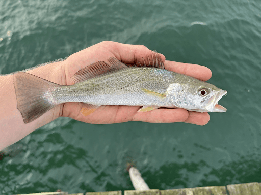
Weakfish (Cynoscion regalis) join that same seasonal pull toward the coast. Through spring and summer they use sounds, estuaries, and nearshore habitat, feeding heavily on shrimp, crustaceans, and smaller fishes. As autumn water cools toward about 75°F, they begin gathering and shifting offshore and south; during warmer years, some linger longer before making that move (Krause et al., 2020).
Weakfish (Cynoscion regalis), a fall migrant along the Atlantic coast and currently listed as Endangered on the IUCN Red List. | Image credit: aiden007, iNaturalist
By this point in fall, fishes that spent summer scattered through different parts of the estuary are beginning to converge along the same channels, inlets, and nearshore corridor. The movement is outward, but not entirely.
While larger spot and croaker are leaving for offshore spawning grounds, their next generation is already beginning the opposite journey. Larvae produced offshore in fall and winter can begin entering North Carolina estuaries by late fall and early winter, with that inward movement continuing through spring (Warlen & Burke, 1990; Allen et al., 2024).
So even as one generation moves out through the inlet, another is beginning to come back in.
The Fish That Stay—but Change Address
Migration does not always mean leaving Onslow County. For some fishes, fall means finding a different part of the same estuary.
Spotted seatrout (Cynoscion nebulosus), or speckled trout, remain in coastal North Carolina through winter, but they do not necessarily stay where they spent August. As the shallow sounds and creek edges cool, trout begin gathering around channels, deeper holes, creek mouths, and other places where a few extra feet of water can provide more stable temperatures.
Spotted seatrout (Cynoscion nebulosus) moving through shallow coastal water before shifting toward deeper winter habitat as temperatures fall. | Image credit: charliew82, iNaturalist
That difference becomes increasingly important as winter approaches. Spotted seatrout begin showing cold stress when water falls below about 45°F, and prolonged periods below roughly 44.6°F can produce substantial winter mortality in North Carolina. Deeper sections of an estuary can remain slightly warmer during a severe cold event, giving fish somewhere to retreat when the shallows become too cold (Ellis, Buckel, & Hightower, 2017; Ellis, Buckel, Hightower, & Poland, 2017).
So the autumn congregation of trout around creek mouths, bridge structure, channels, and deep holes is more than a change in where they happen to be feeding. By fall, they are beginning to settle into the parts of the estuary that may carry them through winter.
Black drum (Pogonias cromis) reorganize themselves through fall as well, although their movement depends partly on age. Young black drum spend their first year within estuaries, feeding over mud, sand, oyster habitat, and other bottoms rich in worms, small crustaceans, and mollusks. As they grow, they begin using saltier water and deeper coastal habitat, while larger fish are often associated with oyster bars, bridge and dock pilings, channels, and other structure where clams, oysters, crabs, and other bottom prey collect (North Carolina Division of Marine Fisheries, 2026).
Black drum (Pogonias cromis) use estuaries when young, then shift toward deeper, saltier water as they grow and fall progresses. | Image credit: zachs, iNaturalist
By late fall, black drum generally shift away from the shallowest summer habitat toward deeper bays, sounds, channels, and offshore water. Unlike spotted seatrout, there is not one well-defined temperature at which that movement begins. Instead, cooling water gradually changes where suitable feeding and winter habitat remain available, with older fish tending to range farther toward high-salinity and offshore waters (North Carolina Division of Marine Fisheries, 2026).
A piling or oyster bar that held one mix of fishes through summer may still be occupied in November, but by a different combination of animals using the same structure for colder-water feeding and refuge.
The habitat has not disappeared. Its seasonal community has changed.
Shrimp Begin Pouring Out of the Creeks
Some of the most important migrants along the Onslow County coast are only a few inches long.
White shrimp (Litopenaeus setiferus), locally called greentails, spend much of their early lives inside estuarine nursery habitat. They grow rapidly in warm water, and once they reach only about 0.8 to 1.2 inches long, they begin leaving the shallowest marsh habitat for deeper creeks, rivers, bays, and sounds. By late summer and fall, larger young shrimp—often around 4.7 inches or more—are moving farther downstream toward channels, inlets, and ultimately the ocean (North Carolina Division of Marine Fisheries, 2023).
White shrimp (Litopenaeus setiferus) grow quickly in estuarine nurseries before moving downstream toward sounds, inlets, and coastal water in late summer and fall. | Image credit: portulaca, iNaturalist
Cooling water helps drive that progression, but rainfall can accelerate it. Heavy freshwater input lowers estuarine salinity and can push shrimp downstream and toward the ocean before they otherwise would have left. That means a wet fall and a dry fall do not necessarily produce the same migration (North Carolina Division of Marine Fisheries, 2023).
The shrimp are responding to an estuary that is changing around them, and almost everything seems interested in eating them. Flounder, speckled trout, red drum, weakfish, sharks, wading birds, and humans all take advantage of shrimp as they move through the coastal food web (North Carolina Division of Marine Fisheries, 2023).
A strong outward movement of white shrimp is therefore not merely a shrimp migration. It is a moving food resource.
When those shrimp leave marsh creeks and spread toward the sound and inlet, predators that were previously separated begin encountering the same pulse of prey in increasingly narrow parts of the estuary.
The estuary briefly becomes a funnel.
The Blue Crabs Take Different Roads
Blue crabs (Callinectes sapidus) complicate the idea of a single fall migration even further because males and females do not necessarily go the same direction.
Blue crab (Callinectes sapidus) in shallow estuarine habitat; mature females eventually move toward saltier water and coastal spawning areas. | Image credit: lenora_irene, iNaturalist
Adult males generally remain farther upriver in lower-salinity water, while mature females move toward saltier portions of the estuary and eventually toward inlet and coastal spawning habitat. Females can travel considerable distances during this migration, using salinity gradients, tides, and currents to move toward the high-salinity water needed for spawning (Bell & Eggleston, 2023; Forward et al., 2003).
That split makes sense once their life cycle is considered. Females typically mate in brackish estuarine water, then store sperm until they are ready to produce an egg mass. As spawning approaches, they move toward the lower estuary and inlet, where much saltier water provides the conditions their developing larvae need. Eggs hatch near the mouth of the estuary or just beyond it, and the larvae are carried offshore before later returning toward the coast as postlarvae (Forward et al., 2003; Epifanio, 2019).
The same inlet therefore serves two directions of the blue crab life cycle: mature females move outward toward spawning water, while a later generation is carried back toward estuarine nursery habitat.
For a blue crab, the difference between a brackish river and a salty inlet is not simply scenery. One supports mating and much of adult life, while the other provides the salinity needed to begin the next generation.
A single life cycle requires both.
Rays Begin Leaving the Shallows
Large dark wings moving beneath clear water are among the more obvious signs that rays are using shallow coastal habitat during summer. By fall, where those rays appear—and how they move through the coast—begins to change.
Cownose rays (Rhinoptera bonasus) are highly mobile schooling rays that use North Carolina sounds, estuaries, and nearshore waters during the warmer months. Through summer they may be scattered across that habitat, sometimes appearing alone or in small groups over shallow flats and sounds. As fall develops, rays that have been using North Carolina estuaries begin moving toward the ocean side, while migrants arriving from farther north join the same southbound corridor along the Carolina coast.
That is when larger schools can become more noticeable along the beaches and nearshore waters. Their movement continues south toward winter habitat off Florida, with cooling water helping shape when they leave northern and estuarine habitats (Goodman et al., 2010; Omori & Fisher, 2017; Bangley et al., 2021).
Cownose rays (Rhinoptera bonasus) traveling in a school, a familiar sight as they gather and move along the coast in fall. | Image credit: Chesapeake Bay Program
For someone watching from Topsail, the rays seen scattered through the sound during summer can become part of something much larger by fall. A few dark wings moving over an estuarine flat may give way to schools traveling along the ocean side as North Carolina becomes part of the passage between northern summer waters and winter habitat farther south.
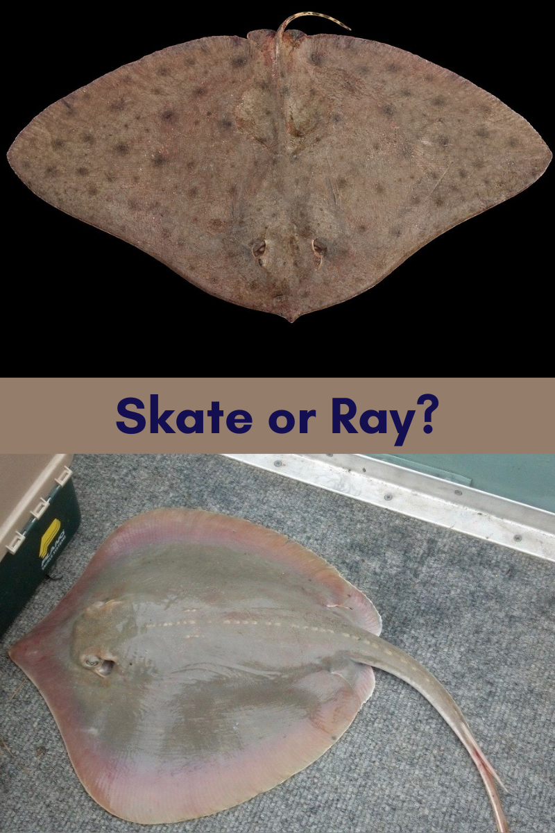
Southern stingrays (Hypanus americanus) make a quieter seasonal shift. Their summer presence along North Carolina is part of a much older warm-season pattern, with southern stingrays historically documented moving north along the Carolina coast as warmer water expands their usable habitat (Coles, 1913).
Unlike cownose rays traveling in schools higher in the water column, southern stingrays remain closely tied to the bottom. Through summer, they can be a familiar sight moving over warm sand and mud flats, along creek mouths, and through shallow estuarine water as they search the bottom for worms, bivalves, shrimp, crabs, and small fishes. Even when they move between habitats, much of that movement remains along or just above the benthic surface rather than through open water (Gilliam & Sullivan, 1993; Tilley et al., 2013).
As the shallow flats cool through fall, they become less common in the places where beachgoers may have seen them repeatedly through July and August. Their seasonal movement is not mapped nearly as clearly in North Carolina as that of cownose rays, so we cannot point to one temperature or one offshore route. What we can say is that southern stingrays are capable of moving between shallow flats and considerably deeper bottom habitat while remaining closely associated with the seafloor (Coles, 1913; Corcoran et al., 2013).
For someone watching the shallows, that change may simply look like absence. The stingray that repeatedly crossed the same warm flat all summer is suddenly harder to find—not because it has joined a large southbound school above the bottom, but because its usable benthic habitat has shifted beyond the shallows where it was easiest to see.
Red Drum Gather at the Edges
Red drum (Sciaenops ocellatus), and our state fish, add another layer to the fall movement. Young fish spend their first years closely tied to estuaries, growing quickly from roughly 12 to 14 inches by their first birthday to more than 27 inches during their second full year. They do not reach reproductive maturity quite as quickly, however. In North Carolina, most become mature around ages three to four, when they are roughly 30 to 36 inches long (Ross et al., 1995).
Red drum (Sciaenops ocellatus) grow in estuaries when young, while larger adults gather around inlets and nearshore waters during late-summer and fall spawning. | Image credit: colesutton, iNaturalist
That difference is something a beachgoer or angler can actually see. The smaller “puppy drum” encountered along marsh edges, creeks, and sounds are still growing within the estuarine part of their life cycle, while the much larger fish appearing around beaches and inlets are increasingly part of the adult population that spends more time in coastal and ocean waters. By late summer and early fall, mature red drum gather around inlets, beaches, and nearshore waters, where spawning and feeding can overlap. In North Carolina, spawning occurs from August into early October near barrier-island inlets and adjacent coastal waters. During that same period, adults move more actively between estuarine and ocean habitats (Ross et al., 1995; Bacheler et al., 2009).
That puts a large red drum outside New River Inlet directly into the same corridor carrying mullet, menhaden, shrimp, spot, croaker, and other prey toward the ocean. It may be there to spawn, to feed, or simply because its own seasonal movement has brought it into the same narrow stretch of coast.
As fall gives way to winter, mature adults increasingly move into ocean waters where temperatures remain more moderate, while younger red drum are much more likely to remain behind in the estuary (Stewart & Scharf, 2008).
The Offshore Visitors Come Close
Fall also brings some animals toward the coast before eventually carrying them away.
King mackerel (Scomberomorus cavalla) are warm-water fish that seldom move into water much below about 68°F. Through summer and the warmer part of fall, they can move surprisingly close to the beaches, inlet mouths, and nearshore reefs of North Carolina, following schools of menhaden, mullet, sardines, and other prey into places where a beachgoer or pier angler may suddenly encounter a fish that spends much of its time farther offshore (North Carolina Division of Marine Fisheries, 2022).
That window does not last. As coastal water continues cooling toward the lower edge of their preferred range, king mackerel begin shifting south and farther toward the warmer waters of the continental shelf. By winter, much of the Atlantic population has moved toward southern Florida, while some fish remain in deeper North Carolina waters near the Gulf Stream (North Carolina Division of Marine Fisheries, 2022).
For a few weeks, that creates an unusual overlap along the Onslow coast. Animals moving out of the estuary meet predators moving closer to shore to feed, while other migrants are already passing south or beginning their move offshore. An inlet or artificial reef that seemed relatively quiet several weeks earlier can suddenly sit at the crossing point of several different seasonal routes.
For a short time, it becomes an intersection.
Then the Menhaden Arrive
By October and November, another migration becomes increasingly visible.
Atlantic menhaden (Brevoortia tyrannus) move south along the Atlantic coast as fall deepens, with older and larger fish returning from summer waters farther north. Spawning can occur along the migration route from late fall into early spring, but one of the major winter gathering areas lies off North Carolina near Cape Hatteras (Lewis et al., 1987; Nicholson, 1978).
For Onslow County, that means some of the dark schools appearing beyond the breakers are part of a much larger coastwide movement passing our beaches on the way toward winter spawning waters.
Menhaden occupy an unusual place in the coastal food web. They filter tiny phytoplankton and zooplankton from the water, then gather that scattered production into dense schools of oily fish large enough for predators to chase (Lewis & Peters, 1994). Bluefish, striped bass, sharks, tunas, dolphins, and seabirds all take advantage of them, making menhaden one of the connections between plankton near the bottom of the food web and some of the largest predators along the coast (Chagaris et al., 2020; Lewis & Peters, 1994).
For a beachgoer, the first sign may simply be a dark patch offshore that does not move like a shadow. Then birds begin gathering above it. The surface breaks as predators push into the school from below, and what looked like an indistinct patch of water suddenly becomes one of the busiest places along the beach.
That is when looking up becomes as important as looking into the water.
Because another migration has arrived.
The Atlantic Flyway Meets the Fall Fish Run
The Atlantic Flyway follows the eastern edge of North America, placing the North Carolina coast directly beneath one of the continent’s major migration routes. For birds traveling hundreds or thousands of miles between breeding and wintering grounds, Onslow County is not simply coastline passing beneath their wings. Its beaches, marshes, tidal flats, sounds, and inlets can provide places to rest and replenish the energy needed for the next part of the journey (Smith et al., 2022).
The Atlantic Flyway follows the eastern edge of North America, carrying migrating birds directly along the North Carolina coast. | Image credit: Audubon
Fall makes that stop especially busy because the migration overhead is unfolding at the same time the water below is changing. Shrimp are moving out of creeks. Mullet and other fishes are funneling toward the inlets. Schools of bait gather along the beaches, and menhaden begin moving down the coast. For birds that feed on fishes and coastal invertebrates, those movements can turn the Onslow shoreline into a series of feeding opportunities along the Atlantic Flyway.
But the transition is not a clean exchange in which the summer birds simply leave and winter birds immediately take their places. It happens gradually, with departures, arrivals, and birds merely passing through overlapping for weeks.
The Birds Moving Through or South
Some of the first changes are easiest to notice in the marsh. Green herons (Butorides virescens) begin moving south from late August through October, while least bitterns (Ixobrychus exilis) also leave much of their northern breeding range for warmer winter habitat. A bird that spent summer hunting from the edge of a tidal creek may simply become harder to find as September advances (Smith et al., 2022).
Along the beaches and nesting islands, the summer community begins loosening in several directions at once. Wilson’s plovers (Anarhynchus wilsonia), least terns (Sternula antillarum), gull-billed terns (Gelochelidon nilotica), black skimmers (Rynchops niger), and sandwich terns (Thalasseus sandvicensis) begin leaving breeding areas or redistributing south along the coast. Royal terns (Thalasseus maximus) may linger longer, while ospreys (Pandion haliaetus) begin following waterways and coastlines toward wintering grounds farther south (North Carolina Wildlife Resources Commission, 2025; Smith et al., 2022).
The shorebirds make the transition even less tidy.
The eastern Willet (Tringa semipalmata semipalmata) breeds in Atlantic salt marshes, including those along the North Carolina coast, before leaving for wintering grounds that can lie as far away as northern South America. But the Willet standing on a Topsail flat in fall is not automatically one of the birds that nested here. Western Willets (Tringa semipalmata inornata), which breed in the interior of western North America, can also occur along the Atlantic coast outside the breeding season. For a few weeks, birds from very different summer landscapes may use the same Carolina shoreline (Oswald et al., 2016; Huysman et al., 2022).
Lesser yellowlegs (Tringa flavipes) and greater yellowlegs (Tringa melanoleuca) add another layer of passing traffic. They arrive from breeding grounds much farther north, with adults beginning their southward movements as early as July and younger birds following later. Along coastal North Carolina, exposed flats, shallow marsh edges, and pools of tidal water become temporary feeding grounds along that journey (Smith et al., 2022).
That makes the falling tide part of the migration too. A mudflat that looked empty beneath the previous high tide can suddenly hold Willets, yellowlegs, plovers, and other shorebirds probing exposed sediment for worms, small crustaceans, mollusks, and other prey. North Carolina barrier-island studies have found fall shorebirds shifting among the swash zone, wet sand, spits, and tidal habitat as water levels change, using different pieces of the shoreline for feeding and resting through the tidal cycle (Tarr, 2008).
For some of those birds, the stop may last days. For others, only hours. The tide falls, a feeding ground appears, and birds moving along the Atlantic coast briefly settle into it before the water—or the migration—carries them onward.
The Winter Coast Begins Arriving
The winter coast does not arrive all at once. Its first birds begin appearing in September, more follow through October, and by November the sounds, marshes, and beaches of Onslow County can hold a noticeably different community than they did at the end of summer.
On the sounds and protected water behind the barrier islands, buffleheads (Bucephala albeola) begin settling into sheltered coves, bays, and estuaries, repeatedly disappearing beneath the surface in search of small crustaceans, mollusks, and other aquatic prey. Red-breasted mergansers (Mergus serrator) arrive as well, often working shallow coastal water and estuaries in small groups as they dive after fish (Gauthier, 1993; Titman, 1999; Smith et al., 2022).
The marsh begins changing at the same time. American black ducks (Anas rubripes) appear more regularly in salt marshes, tidal creeks, ponds, and estuaries, while Green-winged teal (Anas crecca) increase in shallow protected water. Both spent the breeding season much farther north, but by fall the sounds and marshes of the Atlantic coast have become part of their winter landscape (Robinson et al., 2016; Smith et al., 2022).
Along the ocean side, the change is visible at the water’s edge. Dunlin (Calidris alpina), sanderlings (Calidris alba), red knots (Calidris canutus), and black-bellied plovers (Pluvialis squatarola) begin working beaches, shoals, exposed flats, and inlet margins. Some will remain along the southeastern coast through winter, while others are pausing only long enough to feed before continuing south. As the tide falls they spread across wet sand and exposed flats; when the water returns, they are gradually pushed toward higher beaches and roosting areas (Burger et al., 2012; Smith et al., 2022; Tarr, 2008).
Red knots make the scale of that movement especially clear. A bird standing quietly near the wrack line may have arrived from Arctic breeding grounds and may still be headed toward winter habitat in the southeastern United States, the Caribbean, or northern South America. Individual birds do not all travel the same route or distance, but for some, the Carolina coast is only one stop in a journey spanning thousands of miles (Burger et al., 2012; Smith et al., 2022).
That changes what a quiet fall beach can mean. The wet sand, tidal flats, wrack, marshes, and sheltered water are not empty spaces between destinations. For birds arriving from the north, they are places to replace the energy already spent before the next part of the migration begins.
When the Food Web Takes to the Air
Fall adds another layer of hunters above the shoreline.
Peregrine falcons (Falco peregrinus) move south along the Atlantic coast during migration, often following the same barrier islands, mudflats, and shorelines being used by migrating shorebirds. They are not interested in the mullet, shrimp, or menhaden moving below the surface. They are interested in the birds feeding around them. Shorebirds, ducks, gulls, and other coastal birds become prey themselves, adding another level to the food web moving through the coast (Smith et al., 2022).
Farther offshore, the change becomes visible in a different way. Double-crested cormorants (Nannopterum auritum) arrive along the Carolina coast in large numbers and spend much of their time diving after fish. Menhaden are among the schooling fishes they readily take, tying these winter visitors directly into the same fall movement already passing through the inlets and along the beaches (Watts et al., 2023).
Red-throated loons (Gavia stellata) and common loons (Gavia immer) begin appearing along the ocean side as well. Both spend the warmer months much farther north, but by late fall they are back in shallow marine waters, sounds, bays, and estuaries where fish are abundant. A bird that spent summer on a northern lake or tundra pond may now be diving just beyond the breakers along Topsail (Stenhouse et al., 2020; Smith et al., 2022).
Then come the northern gannets (Morus bassanus).
By late fall, they become one of the most spectacular signs that the seasonal food web has shifted. Northern gannets spend much of the nonbreeding season between New York and North Carolina, feeding almost entirely on schooling fishes such as herring, mackerel, and menhaden over the continental shelf (Mowbray, 2020; Smith et al., 2022).
From shore, a feeding aggregation can seem to appear from nowhere. Large white birds circle above a patch of ocean, fold their wings, and plunge headfirst into the water. One follows another until dozens may be dropping into the same moving patch of sea.
The important thing may not be the gannets themselves, but what they are pointing toward. Beneath them is a school of fish. Around that school may be bluefish, sharks, dolphins, or other large predators pushing the same prey toward the surface. The birds above and the predators below are using the same concentration of food from opposite directions.
What began months earlier as plankton, marsh production, and small animals feeding inside estuaries has now moved far enough through the food web to become visible from the beach as birds falling out of the sky.
What Happens if One Migration Does Not Arrive?
It is easy to think about migration as something belonging to individual species—the mullet run, the shrimp migration, the shark migration, the Atlantic Flyway. But the coast does not experience those movements separately. Predators are responding to prey, young fishes are entering estuaries when nursery habitat and food are available, adults are leaving when spawning habitat lies offshore, and blue crabs are moving between different salinity zones because different stages of their lives depend on different parts of the estuary (Warlen & Burke, 1990; Forward et al., 2003).
That means a change in one migration does not necessarily stop with the animal making it.
If fewer mullet leave an estuary, there may be less concentrated prey moving along the beach for bluefish, sharks, pelicans, and terns. The difference is not simply fewer mullet in one place. Some of the energy that spent summer accumulating inside the estuary now reaches the nearshore food web in a different amount, at a different time, or along a different route (Bacheler et al., 2005).
White shrimp show how quickly those relationships can shift. Heavy rainfall lowers estuarine salinity and can push shrimp toward the inlet earlier than they might have moved during a drier fall. Predators farther inside the estuary may encounter fewer shrimp, while those gathered nearer the inlet may suddenly encounter more. The migration still happens, but its timing changes where that pulse of food becomes available (North Carolina Division of Marine Fisheries, 2023).
Temperature can alter the overlap in another way. A coastal shark that remains farther north later into a warm fall may not encounter its prey in quite the same places or at quite the same time if those prey are responding to a different set of seasonal cues. Warmer ocean conditions are already capable of delaying southward shark migrations and extending how long some species remain in northern seasonal habitat (Manz et al., 2025).
None of this means every migration must occur on the same date each year. Coastal systems have always varied with storms, rainfall, temperature, currents, and food availability. What matters is that the movements continue to cross one another often enough for the relationships among them to persist.
A predator still has to encounter its prey. A larva still has to reach suitable nursery habitat, and a migrating bird still has to find enough food to continue south.
The timing does not have to be exact, but the meeting still has to happen.
Watching the Coast Change
By September, the first changes are already beginning. Mullet gather near the inlets, shrimp move out of tidal creeks, rays become less common over shallow flats, and feeding birds begin revealing where bait has collected near the surface.
By October and November, the same places can hold a very different community. Some animals have moved only a few miles into deeper water, while others are passing Onslow County on journeys that continue far beyond the Carolina coast.
The landscape itself looks much the same. New River Inlet still cuts through the barrier island. The marsh grass still bends with the wind. The same beach stretches north and south. What changes is who is moving through it.
For a few months each fall, Onslow County becomes a meeting place between departures, arrivals, and animals simply shifting into the next piece of habitat they need.
The landscape stays where it is. The food web moves through it.
Wilson Bay along the New River in Jacksonville, North Carolina. The landscape stays where it is, even as the food web moves through it. | Image credit: A. Mitchell
References
Allen, D. M., Govoni, J. J., Able, K. W., Buckel, J. A., Hale, E. A., Hilton, E. J., Kellison, G. T., Targett, T. E., Taylor, J. C., & Walsh, H. J. (2024). Long-term dynamics of larval and early juvenile spot (Leiostomus xanthurus) off the U.S. East Coast: Relating ocean origins, estuarine Ingress, and changing environmental conditions. Fishery Bulletin, 122(4), 162-185. https://doi.org/10.7755/fb.122.4.3
Bacheler, N. M., Paramore, L. M., Burdick, S. M., Buckel, J. A., & Hightower, J. E. (2009). Variation in movement patterns of red drum (Sciaenops ocellatus) inferred from conventional tagging and ultrasonic telemetry. Fishery Bulletin, 107(4), 405-419. https://spo.nmfs.noaa.gov/sites/default/files/pdf-content/2009/1074/bacheler.pdf
Bacheler, N. M., Wong, R. A., & Buckel, J. A. (2005). Movements and mortality rates of striped mullet in North Carolina. North American Journal of Fisheries Management, 25(1), 361-373. https://doi.org/10.1577/m04-033.1
Bangley, C. W., Edwards, M. L., Mueller, C., Fisher, R. A., Aguilar, R., Heggie, K., Richie, K., Ahr, B. J., & Ogburn, M. B. (2021). Environmental associations of cownose ray (Rhinoptera bonasus) seasonal presence along the U.S. Atlantic coast. Ecosphere, 12(9). https://doi.org/10.1002/ecs2.3743
Bell, G. W., & Eggleston, D. B. (2023). Timing and route of migration of mature female blue crabs in a large, wind-driven Estuary. Transactions of the American Fisheries Society, 152(2), 253-269. https://doi.org/10.1002/tafs.10391
Bichy, J. B. (2004). A life history assessment on the reproduction and growth of striped mullet, Mugil cephalus, in North Carolina [Unpublished master’s thesis]. North Carolina State University.
Burger, J., Niles, L. J., Porter, R. R., Dey, A. D., Koch, S., & Gordon, C. (2012). Using a shore bird (red knot) fitted with geolocators to evaluate a conceptual risk model focusing on offshore wind. Renewable Energy, 43, 370-377. https://doi.org/10.1016/j.renene.2011.11.006
Carlson, J. K., Sulikowski, J. R., & Baremore, I. E. (2006). Do differences in life history exist for blacktip sharks, Carcharhinus limbatus, from the United States south Atlantic bight and eastern Gulf of Mexico? Environmental Biology of Fishes, 77(3-4), 279-292. https://doi.org/10.1007/s10641-006-9129-x
Chagaris, D., Drew, K., Schueller, A., Cieri, M., Brito, J., & Buchheister, A. (2020). Ecological reference points for Atlantic menhaden established using an ecosystem model of intermediate complexity. Frontiers in Marine Science, 7. https://doi.org/10.3389/fmars.2020.606417
Coles, R. J. (1913). Notes on the embryos of several species of rays, with remarks on the northward summer migration of certain tropical forms observed on the coast of North Carolina. Bulletin of the American Museum of Natural History, 32, 29-35. https://www.biodiversitylibrary.org/page/26891225#page/491/mode/1up
Corcoran, M. J., Wetherbee, B. M., Shivji, M. S., Potenski, M. D., Chapman, D. D., & Harvey, G. M. (2013). Supplemental feeding for ecotourism reverses Diel activity and alters movement patterns and spatial distribution of the southern Stingray, Dasyatis americana. PLoS ONE, 8(3), e59235. https://doi.org/10.1371/journal.pone.0059235
Craig, J. K., Smith, W. E., Scharf, F. S., & Monaghan, J. P. (2015). Estuarine residency and migration of southern flounder inferred from conventional tag returns at multiple spatial scales. Marine and Coastal Fisheries, 7(1), 450-463. https://doi.org/10.1080/19425120.2015.1079578
Ellis, T. A., Buckel, J. A., Hightower, J. E., & Poland, S. J. (2017). Relating cold tolerance to winterkill for spotted seatrout at its northern latitudinal limits. Journal of Experimental Marine Biology and Ecology, 490, 42-51. https://doi.org/10.1016/j.jembe.2017.01.010
Ellis, T., Buckel, J., & Hightower, J. (2017). Winter severity influences spotted seatrout mortality in a southeast US estuarine system. Marine Ecology Progress Series, 564, 145-161. https://doi.org/10.3354/meps11985
Epifanio, C. E. (2019). Early life history of the blue crab Callinectes sapidus: A review. Journal of Shellfish Research, 38(1), 1-22. https://doi.org/10.2983/035.038.0101
Forward, R. B., Tankersley, R. A., & Welch, J. M. (2003). Selective tidal-stream transport of the blue crab Callinectes sapidus: An overview. Bulletin of Marine Science, 72(2), 347-365. https://scholars.duke.edu/publication/771475
Gauthier, G. (1993). Bufflehead (Bucephala albeola). In The Birds of North America (67th ed.). The Academy of Natural Sciences of Philadelphia & The American Ornithologists’ Union.
Goodman, M. A., Conn, P. B., & Fitzpatrick, E. (2010). Seasonal occurrence of Cownose rays (Rhinoptera bonasus) in North Carolina’s estuarine and coastal waters. Estuaries and Coasts, 34(3), 640-651. https://doi.org/10.1007/s12237-010-9355-5
Heupel, M., Carlson, J., & Simpfendorfer, C. (2007). Shark nursery areas: Concepts, definition, characterization and assumptions. Marine Ecology Progress Series, 337, 287-297. https://doi.org/10.3354/meps337287
Huysman, A. E., Cooper, N. W., Smith, J. A., Haig, S. M., Heath, S. A., Johnson, L., Olson, E., Regan, K., Wilson, J. K., & Marra, P. P. (2022). Strong migratory connectivity indicates Willets need subspecies-specific conservation strategies. Ornithological Applications, 124(3). https://doi.org/10.1093/ornithapp/duac015
Jensen, D. R., & Graves, J. E. (2020). Movements, habitat utilization, and post-release survival of cobia (Rachycentron canadum) that summer in Virginia waters assessed using pop-up satellite archival tags. Animal Biotelemetry, 8(1). https://doi.org/10.1186/s40317-020-00212-0
Krause, J. R., Hightower, J. E., Buckel, J. A., Turnure, J. T., Grothues, T. M., Manderson, J. P., Rosendale, J. E., & Pessutti, J. P. (2020). Using acoustic telemetry to estimate weakfish survival rates along the U.S. East Coast. Marine and Coastal Fisheries, 12(5), 241-257. https://doi.org/10.1002/mcf2.10095
Lewis, R. M., Ahrenholz, D. W., & Epperly, S. P. (1987). Fecundity of Atlantic menhaden, Brevoortia tyrannus. Estuaries, 10(4), 347. https://doi.org/10.2307/1351894
Lund, W. A., & Maltezos, G. C. (1970). Movements and migrations of the bluefish, Pomatomus saltatrix, tagged in waters of New York and southern New England. Transactions of the American Fisheries Society, 99(4), 719-725. https://doi.org/10.1577/1548-8659(1970)99<719:mamotb>2.0.co;2
Manz, M. H., Shipley, O. N., Cerrato, R. M., Hueter, R. E., Newton, A. L., Tyminski, J. P., Franks, B. R., Curtis, T. H., Fischer, C., Zacharias, J. P., Scott, C., Dunton, K. J., Kneebone, J., Peterson, B. J., Scannell, B. J., Dodd, J. F., & Frisk, M. G. (2025). Predictions of southern migration timing in coastal sharks under future ocean warming. Conservation Biology, 39(6), e70080. https://doi.org/10.1111/cobi.70080
McCandless, C. T., Pratt, Jr., H. L., Kohler, N. E., Merson, R. R., & Recksiek, C. W. (2007). Distribution, localized abundance, movements, and migrations of juvenile sandbar sharks tagged in Delaware Bay. In Shark nursery grounds of the Gulf of Mexico and the east coast waters of the United States (pp. 45-62). American Fisheries Society Symposium. https://doi.org/10.47886/9781888569810.ch4
Merson, R. R., & Pratt, Jr., H. L. (2001). Distribution, Movements and Growth of Young Sandbar Sharks, Carcharhinus Plumbeus, in the Nursery Grounds of Delaware Bay. Environmental Biology of Fishes, 61, 13-24. https://link.springer.com/article/10.1023/A:1011017109776
Midway, S. R., & Scharf, F. S. (2012). Histological analysis reveals larger size at maturity for southern flounder with implications for biological reference points. Marine and Coastal Fisheries, 4(1), 628-638. https://doi.org/10.1080/19425120.2012.717524
Mowbray, T. B. (2020). Northern Gannet (Morus bassanus). In Birds of the World (1.0th ed.). Cornell Lab of Ornithology. https://doi.org/10.2173/bow.norgan.01
Nicholson, W. R. (1978). Movements and population structure of Atlantic menhaden indicated by tag returns. Estuaries, 1(3), 141. https://doi.org/10.2307/1351455
Norcross, B. L., & Austin, H. M. (1988). Middle Atlantic bight meridional wind component effect on bottom water temperatures and spawning distribution of Atlantic croaker. Continental Shelf Research, 8(1), 69-88. https://doi.org/10.1016/0278-4343(88)90025-8
Omori, K. L., & Fisher, R. A. (2017). Summer and fall movement of cownose ray, Rhinoptera bonasus, along the East Coast of United States observed with pop-up satellite tags. Environmental Biology of Fishes, 100(11), 1435-1449. https://doi.org/10.1007/s10641-017-0654-6
Oswald, J. A., Harvey, M. G., Remsen, R. C., Foxworth, D. U., Cardiff, S. W., Dittmann, D. L., Megna, L. C., Carling, M. D., & Brumfield, R. T. (2016). Willet be one species or two? A genomic view of the evolutionary history of Tringa semipalmata. The Auk, 133(4), 593-614. https://doi.org/10.1642/auk-15-232.1
Packer, D. B. (1999). Essential fish habitat source document. Summer flounder, Paralichthys dentatus, life history and habitat characteristics (NOAA Technical Memorandum NMFS-NE-151). National Marine Fisheries Service. https://repository.library.noaa.gov/view/noaa/3149
Robinson, O. J., McGowan, C. P., & Devers, P. K. (2016). Updating movement estimates for American Black ducks (Anas rubripes). PeerJ, 4, e1787. https://doi.org/10.7717/peerj.1787
Roskar, G., Morley, J. W., & Buckel, J. A. (2024). Seasonality and relative abundance within an elasmobranch assemblage near a major biogeographic divide. PLOS ONE, 19(6), e0300697. https://doi.org/10.1371/journal.pone.0300697
Ross, J. L., Stevens, T. M., & Vaughan, D. S. (1995). Age, growth, mortality, and reproductive biology of red drums in North Carolina waters. Transactions of the American Fisheries Society, 124(1), 37-54. https://doi.org/10.1577/1548-8659(1995)124<0037:agmarb>2.3.co;2
Ross, S. W. (1988). Age, growth, and mortality of Atlantic croaker in North Carolina, with comments on population dynamics. Transactions of the American Fisheries Society, 117(5), 461-473. https://doi.org/10.1577/1548-8659(1988)117<0461:agamoa>2.3.co;2
Smith, M. A., Mahoney, J., Knight, E. J., Taylor, L., Seavy, N. E., Bailey, O. H., Carbone, M., DeLuca, W., Gonzalez, N. S., Jimenez, M. F., W. O’Bryan, G. M., Rao, N., Witko, C. J., Wilsey, C., & Deppe, J. L. (2022). Bird Migration Explorer. National Audubon Society. https://explorer.audubon.org/
Stenhouse, I. J., Berlin, A. M., Gilbert, A. T., Goodale, M. W., Gray, C. E., Montevecchi, W. A., Savoy, L., & Spiegel, C. S. (2020). Assessing the exposure of three diving bird species to offshore wind areas on the U.S. Atlantic outer continental shelf using satellite telemetry. Diversity and Distributions, 26(12), 1703-1714. https://doi.org/10.1111/ddi.13168
Stewart, C. B., & Scharf, F. S. (2008). Estuarine recruitment, growth, and first‐year survival of juvenile red drum in North Carolina. Transactions of the American Fisheries Society, 137(4), 1089-1103. https://doi.org/10.1577/t07-176.1
Sutherland, D. F., & Fable, Jr., W. A. (1980). Results of a king mackerel (Scomberomorus cavalla) and Atlantic Spanish mackerel (Scomberomorus maculatus) migration study, 1975–79 (NOAA Technical Memorandum NMFS-SEFC-12). National Marine Fisheries Service. https://repository.library.noaa.gov/view/noaa/5385
Tilley, A., López-Angarita, J., & Turner, J. (2013). Effects of scale and habitat distribution on the movement of the southern stingray Dasyatis americana on a Caribbean atoll. Marine Ecology Progress Series, 482, 169-179. https://doi.org/10.3354/meps10285
Titman, R. D. (n.d.). Red-breasted Merganser (Mergus serrator). In The Birds of North America (443rd ed.). A. Poole & F. Gill.
Warlen, S. M., & Burke, J. S. (1990). Immigration of larvae of fall/Winter spawning marine fishes into a North Carolina Estuary. Estuaries, 13(4), 453. https://doi.org/10.2307/1351789
Warlen, S. M., & Chester, A. J. (1985). Warlen, S. M., & Chester, A. J. (1985). Age, growth, and distribution of larval spot, Leiostomus xanthurus, off North Carolina. Fishery Bulletin, 83(4), 587–599. Fishery Bulletin, 83(4), 587-599. https://spo.nmfs.noaa.gov/sites/default/files/pdf-content/fish-bull/warlen.pdf
Watts, B. D., Paxton, B. J., Hines, C., & Anderson, S. K. (2023). Estimating potential menhaden consumption by double-crested cormorants along the coast of North Carolina. Frontiers in Marine Science, 10, 1193429. https://doi.org/10.3389/fmars.2023.1193429
White, M. L., & Chittenden, Jr., M. E. (1977). Age determination, reproduction, and population dynamics of the Atlantic croaker, Micropogonias undulatus. Fishery Bulletin, 75(1), 109-123.
Somewhere between watching my daughter catch waves and standing in the surf zone waiting for the next decent one to come through, I noticed the fish.
They were small—anchovy-like from where I stood, although the glare on the water and the constant movement made identification nearly impossible. What caught my attention wasn’t what they were. It was the fish on the move beside us, all traveling in the same narrow line for almost four hours.
They were moving parallel to the beach in a line perhaps four inches wide, almost exactly where the waves were breaking.
A wave would come through hard enough to knock us backward. Water rushed toward shore and then pulled against our legs as it returned. My daughter and I moved with it.
The fish didn’t seem to.
The line continued.
A little farther offshore was another line of larger fish. They were less tightly packed, but moving along the same general stretch of coast. Beyond them, one or two long, slender fish held near my daughter’s board. We couldn’t identify them with certainty, although their shape was consistent with one of our larger needlefishes, possibly a houndfish. They didn’t appear to be simply passing through. They would dart toward the smaller fish, take one, and return.
Farther still, just beyond the breakers, something much larger came partly out of the water while apparently feeding. It happened too quickly to tell whether it was a shark, large fish, or something else.
Then the line of little fishes passing in front of me suddenly broke.
Fish scattered and began leaping from the water, fleeing something I couldn’t see. Almost immediately, there seemed to be another pursuit underway.
That seemed like a good time for us to take a short break on the beach.
We had been in the water for nearly four hours by then, and those little fish had been passing us for much of it.
It was only after watching them for so long that the strange part became obvious.
The water looked like one place. We had been watching fish on the move through the surf zone all afternoon.
The fish were behaving as though it wasn’t.
The Line That Didn’t End
Standing in the surf, it is easy to think of the shallow water as a temporary place.
Waves arrive. Water runs up the beach and retreats. Sand shifts beneath your feet. A few yards offshore, another wave rises over a bar and breaks. Everything seems to be moving too much for anything resembling a pathway to exist.
To a fish, however, that same water contains structure.
Even water only a few inches or a foot deep can hold its own patterns. Small runnels form behind sandbars, wave energy changes as water crosses them, and fishes can move parallel to shore through these shallow strips rather than spreading evenly across the surf. The exact species may change from beach to beach, but the pattern is not unusual: fishes sort themselves through very small differences in shallow-water habitat (Layman, 2000).
Look closely and the tiny fish begin to appear—a narrow line moving through water that, at first glance, looks almost empty. | Image credit: A. Mitchell
Late summer can make those patterns especially noticeable. Along our part of the coast, both the number of fish and the variety of species using the surf climb through the warm months, reaching their highest levels from June through August (North Carolina Sea Grant, 2019).
So the little fish moving past our legs weren’t occupying empty water between the beach and the ocean.
They were inside habitat. And habitat has shape.
Mapping the Invisible Structure
Most of that shape disappears when we look across the water from shore.
We can see the obvious pieces. Waves often reveal where a sandbar rises toward the surface. Darker water may hint at a trough. A break in the waves can sometimes betray a deeper channel. Farther out, the water deepens into another shade.
For a small fish, those changes don’t have to be dramatic to matter.
A few inches of depth can change how quickly the water moves, how much wave energy reaches a spot, what food passes through and which animals can follow. Temperature and wave conditions add another layer. Together, they turn what looks like one open stretch of surf into a collection of much smaller usable spaces (Olds et al., 2018).
The difference between standing here and standing three feet farther out may barely register to us.
To a fish only a few inches long, it can mean different water.
That becomes easier to picture when we pull back and look at the coast beneath us.
Off Onslow County, the continental shelf doesn’t plunge quickly into deep water. It stretches gradually away from shore across a broad, shallow part of Onslow Bay. Near the beach, the bottom is mostly sand, with shell fragments and coarser material mixed through some areas. Closer to shore, that otherwise gentle slope is interrupted again and again by the smaller features we actually feel beneath our feet—bars, dips, troughs and runnels that waves and currents continually reshape (North Carolina Coastal Resources Commission Science Panel, 2026; Tyler & Kowalewski, 2018).
Along the Onslow County coast, the shallow sandy bottom rises and falls in subtle bars, troughs, and runnels that can shape how fish use the surf zone. | Image credit: A. Mitchell
To us, one of those dips may simply feel like the water suddenly came a little higher on our bodies.
For a fish only a few inches tall, it can be a different piece of the landscape.
That doesn’t mean the little school we watched was tracing a particular underwater trough. We couldn’t see the bottom well enough to know that.
But their persistence was revealing something.
Waves repeatedly pushed us out of position while fish continued moving through approximately the same narrow part of the surf. Whatever they were responding to—depth, current, food, protection, or some combination—the fish could perceive differences in that water that we couldn’t.
Their movement made some of the invisible structure visible.
Why the Smallest Fish Remain Close to Shore
There is something counterintuitive about watching tiny fish choose the place where waves are breaking. It doesn’t look protected.
For us, it was the part of the water most likely to knock us over.
But safety underwater doesn’t necessarily look like calm water.
For a small fish, extremely shallow water can make life more difficult for some of the animals trying to catch it. A larger predator may still enter—and plenty do—but depth, turbulence and room to maneuver change as the water shoals toward the beach. Juvenile fishes can shift into different depths as they balance the food available there against the risk of being eaten, so sometimes moving only a little shallower can change the odds (Layman, 2000; Miltner et al., 1995; Munsch et al., 2016).
The breaking surf may look rough and exposed to us, but for small fish, shallow water can change both access to food and the odds of being caught by a larger predator. | Image credit: A. Mitchell
And there is plenty to eat.
During summer, some of the smallest schooling fishes—including bay anchovies, striped anchovies and Atlantic silversides—feed largely on plankton carried through the surf. Summer zooplankton can include copepods, mysids, crab larvae and other tiny animals whose numbers shift with tides and time of day (DeLancey, 1987, 1989). Other fishes take food from the sand itself, including mole crabs, passing energy from animals buried beneath the beach into fishes farther up the food web. Surveys of southeastern surf zones have found dozens of species of fish and swimming invertebrates moving through these waters over the seasons (Anderson et al., 1977).
Even some of the food at the very bottom of that web is being produced right there. The phytoplankton growing in southeastern North Carolina’s surf can make these shallow waters considerably more productive than the coastal ocean just offshore, although not as productive as our estuaries (Cahoon et al., 2017).
There is something else happening in all that breaking white water too.
Warm water cannot hold as much oxygen as cooler water. But every time a wave breaks, it churns air into the water. On a hot August day, the same foam and bubbles tossing us around are also helping oxygen move between the air and the shallows (Deike, 2022).
That doesn’t mean the fish were following an oxygen-rich pathway. We couldn’t know that from what we saw. It is simply another reminder that the breaking surf is not just rougher water. Physically and chemically, things are happening there that are different from the calmer water only a short distance away.
The water washing around our ankles is therefore not simply the edge of somewhere more biologically important. It produces food, carries food, exchanges gases with the air—and fishes use it.
That makes the shallow surf something more complicated than a hiding place. A young fish may be balancing several things at once: finding enough food, spending as little energy as possible to get it, and remaining somewhere its chances of becoming food are lower. Different species solve that problem differently.
Juvenile Florida pompano and gulf kingfish offer a good example. Rather than constantly traveling along the coastline, some can remain surprisingly attached to particular stretches of surf-zone nursery habitat for weeks (Ross & Lancaster, 2002).
So even a fish that appears to be traveling may still be working within a familiar piece of shoreline—feeding through it, shifting with the tide, or repeatedly using the same shallow habitat.
The scale of movement matters as much as the movement itself.
The Edge Is Where Dinner Waits
Where prey gather predictably, predators gain an advantage too.
That made the behavior we saw especially interesting. Houndfish, one possible match for those long fish, are large needlefishes built to take other fish, and the ones near us seemed less interested in charging through the entire school than in picking off individuals. They waited, darted toward the passing fish, took one, then returned to approximately the same area. Meanwhile, the line of small fishes carried on like nothing had occurred.
Farther out, where the water had changed to deep green, something much larger appeared to be doing its own version of the same thing. Whatever the animal was, we saw it break the surface more than once in approximately the same area while fish were there.
A predator doesn’t have to search every yard of open water equally.
Sometimes the predator is little more than a glimpse. A small fin breaking the surface (upper right of image) can be the only visible clue that something larger is working the same patch of water as the baitfish. | Image credit: A. Mitchell
Schooling fishes gather where conditions favor them, and those concentrations can be shaped by depth, temperature, currents and other physical features. When prey collect in one place instead of being scattered widely, feeding opportunities become concentrated there too (Goetsch et al., 2023; Olds et al., 2018).
Surf fishermen have been reading that relationship from above the water for generations. A trough, a cut through a sandbar or a sudden concentration of bait can be a clue not only to where the smaller fish are gathering, but to where something larger may come looking for them (Ward, n.d.).
What looked from our perspective like separate layers of fish may therefore have been something more dynamic.
The smallest fish were using conditions that suited them. Their concentration, in turn, created an opportunity for a predator capable of working alongside that concentration. What gave one animal access to plankton or a little more protection could simultaneously make it easier for another animal to find dinner.
The fish may disappear beneath the surface, but the water can still give it away—a brief wake or disturbance marking movement that is otherwise hidden from view. | Image credit: A. Mitchell
It wasn’t simply a food chain conveniently lined up from smallest fish near shore to largest predator offshore. Each animal was using the same physical landscape differently, and one animal’s useful habitat could become another animal’s hunting ground.
The structure beneath the water wasn’t just organizing where fish could move.
It was helping organize where encounters between them could happen.
When the Line Breaks
The fish themselves add another layer.
Once individuals gather into a school, they begin responding not only to the water and predators around them, but to one another.
“Safety in numbers” captures only part of what that accomplishes. A fish in a school has neighbors watching in many directions, and information about danger can move rapidly through the group. Individuals continually adjust their spacing and direction in response to nearby fish, habitat and perceived threats, so a school can tighten, turn or reorganize without every fish having to detect the predator independently (Munsch et al., 2016).
There are tradeoffs. A large school may be easier to notice than a lone fish, and crowding means sharing food and space. But once a predator attacks, the group can make choosing and isolating a single target much harder. Instead of one fish moving through open water, the predator encounters many similar bodies changing direction almost at once.
And all of that coordination has to happen while the water beneath them is moving too.
A school in the shallow surf isn’t reacting to a predator against a blank background. Depth is changing. Waves are passing through. Currents are pushing alongshore and back toward the sea. The fish have to stay together while continuously adjusting to the landscape around them.
Then an attack can rearrange everything in seconds.
A school may compress, turn sharply, split apart, or scatter as the threat moves through it. Sometimes the quickest route away is upward, and baitfish begin breaking the surface.
Sometimes the chase shows itself before the predator does. A small patch of agitated water can be the only sign that the school beneath the surface has suddenly changed direction. | Image credit: A. Mitchell
From above, that sudden spray of little bodies can look almost disconnected from what caused it. The predator may never become visible at all. What we see is the response moving through the school—the orderly shape breaking apart and reforming as hundreds of tiny decisions happen at once.
The line, in other words, was never simply a line.
It was a coordinated group whose shape could change almost instantly when the balance between traveling, feeding and surviving changed.
Just Beyond the Breakers
The surf zone doesn’t end at a precise biological boundary where the last wave breaks.
The water on either side of that breaker is connected, but the conditions are changing. Depth increases. The bottom falls farther away. Wave energy changes. Animals that can move comfortably through one part of that gradient may use another part differently, and fishes can cross between them as their needs change (Olds et al., 2018).
Beyond the shallow surf, the water deepens and the habitat changes with it—but the boundary is not a hard line. Fish move back and forth across that transition as their needs change. | Image credit: A. Mitchell
That makes the surf less like a row of separate habitats and more like a transition.
On the landward side are the shallow runnels and troughs used by small fishes. Farther out, those waters connect with the open nearshore ocean. Along the beach, the same surf runs toward inlets, and beyond those inlets lie estuaries and nursery habitats. For a fish, these aren’t necessarily separate places encountered one at a time. They can be connected parts of its life.
That connection becomes particularly important for young fishes.
Some species arrive in shallow coastal waters during early life stages. Others move between estuarine nurseries and the ocean as they grow. Still others use the surf primarily to feed or travel. The importance of any one patch of shallow water therefore depends partly on what it connects to (Olds et al., 2018; Ross & Lancaster, 2002).
Predators cross those connections as well. As prey move into deeper water, toward an inlet or along the shoreline, they become available to a different mix of animals. Conversely, a predator following prey does not need to remain on one side of a line humans call “the breakers.”
The larger animal we glimpsed offshore isn’t evidence of a particular cross-shore food chain. We don’t know what it was, what it caught, or why it was feeding there.
What its presence does illustrate is that the ecological landscape continues beyond what we can easily see from knee- or waist-deep water.
The surf is an edge, but it is also a bridge.
Movement Within Movement
Follow that bridge along the North Carolina coast and the scale changes again.
Our long stretches of open beach are repeatedly interrupted by inlets, and behind those inlets lie sounds, tidal creeks, marshes and estuaries. To us, those places often have separate names and boundaries. To a fish moving through them, they are connected pieces of habitat used at different times and for different reasons.
The surf itself can be both a place to feed and a route between those places (Olds et al., 2018). A juvenile using shallow water may later move deeper, follow the coast toward an inlet, or leave a nursery area as it grows. Another fish may do almost the opposite and remain surprisingly local. Juvenile Florida pompano and gulf kingfish tagged along southeastern North Carolina beaches, for example, could remain faithful to relatively small areas of surf for extended periods (Ross & Lancaster, 2002).
A few feet with the tide, weeks along one beach, a journey between estuary and ocean, or a seasonal movement along hundreds of miles of coastline can therefore all belong to the same animal at different times in its life.
What looks like one continuous stretch of water can connect very different habitats—from the shallow surf to inlets, estuaries, and the nearshore ocean. | Image credit: A. Mitchell
Those aren’t separate stories.
They fit inside one another.
That is what makes a shallow stretch of surf important even when it is not a final destination. It may be feeding ground, nursery habitat, temporary refuge, travel corridor—or simply the connective piece that allows a fish to reach the next habitat it needs.
The coastline is not only habitat made of places.
It is habitat made of connections between them.
The Late-Summer Coast
By August, many of those connections are busy.
The surf fills with its greatest abundance and variety of fishes during the warm months from June through August (North Carolina Sea Grant, 2019). The shallowest surf holds its greatest abundance and diversity during this part of the year (Layman, 2000).
For someone walking into warm August water, that means the crowd beneath the surface can be very different from the one occupying the same beach in winter.
By late summer, the shallow surf can look almost unchanged from day to day while the mix of fish moving through it shifts with temperature, tide, food, and life stage. | Image credit: A. Mitchell
Some of the year’s young fishes have had months to grow. Seasonal changes in plankton and animals living on and beneath the sand alter the food available to them, while water temperature, tides, waves and each species’ own life cycle influence which fishes are present and where they spend their time (Anderson et al., 1977; DeLancey, 1987, 1989; Olds et al., 2018; Wickliffe et al., 2019).
Those changes ripple upward. Small fishes link plankton and other tiny prey with larger predatory fishes, and dense gatherings of forage fish can create concentrated feeding opportunities for predators higher in the food web (Goetsch et al., 2023).
But even “late summer” doesn’t describe one fixed community.
The tide can rearrange the shallow habitat over the course of hours. More species enter the very shallow surf at high tide than at low tide, and the community changes again after dark as adult predators move into water they use differently during the day (Layman, 2000).
Temperature, tide, light and life stage change it.
All of those cycles overlap along a coastline where animals are also arriving, leaving, feeding, growing and moving between habitats.
The shoreline may stay in the same place on our map.
Ecologically, it is never quite the same place twice.
Looking at the Water Differently
What began as an odd little line of fish turned out to be a glimpse of several things happening at once.
The shallow surf had physical structure even where we couldn’t clearly see it. That structure could change where food collected, where small fishes found useful habitat, and where predators encountered prey. The schools themselves added another layer, responding not only to the water around them but to one another. Beyond them, the surf connected outward toward deeper water and alongshore toward inlets, estuaries and larger movements taking place along the coast.
None of that requires every fish we saw to have been following a migration route.
In some ways, that makes the afternoon more interesting.
Movement in the ocean doesn’t begin with the thousand-mile journey of a shark or a sea turtle. It can begin with an animal responding to a few inches of depth, a shifting tide, a patch of food or the sudden arrival of a predator. Those small decisions accumulate across schools, habitats, seasons and coastlines until they become some of the larger patterns we recognize.
None of those animals needed the boundaries to be visible to us.
The fish were already responding to depth, water movement, food, risk, season and one another. Their paths crossed a landscape hidden beneath waves and glare.
Maybe that is one of the easiest things to miss when we stand at the edge of the ocean.
We look out and see water.
Sometimes, if we stay there long enough, the animals begin drawing the map.
Once you know what to look for, the water stops looking empty. Larger fish move through the same surf that, from a distance, can seem almost featureless. | Image credit: A. Mitchell
References
Allen, L. G., & Pondella II, D. J. (2006). Surf zone, coastal pelagic zone and harbors. In The Ecology of Marine Fishes: California and Adjacent Waters (pp. 149-166). University of California Press.
Cahoon, L. B., Bugica, K., Wooster, M. K., & Dickens, A. K. (2017). Factors affecting surf zone phytoplankton production in southeastern North Carolina, USA. Estuarine, Coastal and Shelf Science, 196, 269-275. https://doi.org/10.1016/j.ecss.2017.07.012
Deike, L. (2022). Mass transfer at the ocean–atmosphere interface: The role of wave breaking, droplets, and bubbles. Annual Review of Fluid Mechanics, 54(1), 191-224. https://doi.org/10.1146/annurev-fluid-030121-014132
DeLancey, L. B. (1989). Trophic relationship in the surf zone during the summer at Folly Beach, South Carolina. Journal of Coastal Research, 5(3). https://journals.flvc.org/jcr/article/view/78162
Goetsch, C., Gulka, J., Friedland, K., Winship, A., Clerc, J., Gilbert, A., Goyert, H., Stenhouse, I., Williams, K., Willmott, J., Rekdahl, M., Rosenbaum, H., & Adams, E. (2023). Surface and subsurface oceanographic features drive forage fish distributions and aggregations: Implications for prey availability to top predators in the US Northeast shelf ecosystem. Ecology and Evolution, 13(7), e10226. https://doi.org/10.22541/au.167163077.72855489/v1
Koval, G. N., Dugan, J. E., & Hamilton, S. L. (2025). Seasonal variation and response of surf zone fish assemblages to environmental variables in the Northeast Pacific. Continental Shelf Research, 293, 105526. https://doi.org/10.1016/j.csr.2025.105526
Layman, C. (2000). Fish assemblage structure of the shallow ocean surf-zone on the Eastern Shore of Virginia barrier islands. Estuarine, Coastal and Shelf Science, 51(2), 201-213. https://doi.org/10.1006/ecss.2000.0636
Miltner, R. J., Ross, S. W., & Posey, M. H. (1995). Influence of food and predation on the depth distribution of juvenile spot (Leiostomus xanthurus) in tidal nurseries. Canadian Journal of Fisheries and Aquatic Sciences, 52(5), 971-982. https://doi.org/10.1139/f95-096
Munsch, S., Cordell, J., & Toft, J. (2016). Fine-scale habitat use and behavior of a nearshore fish community: Nursery functions, predation avoidance, and spatiotemporal habitat partitioning. Marine Ecology Progress Series, 557, 1-15. https://doi.org/10.3354/meps11862
Olds, A. D., Vargas‐Fonseca, E., Connolly, R. M., Gilby, B. L., Huijbers, C. M., Hyndes, G. A., Layman, C. A., Whitfield, A. K., & Schlacher, T. A. (2017). The ecology of fish in the surf zones of ocean beaches: A global review. Fish and Fisheries, 19(1), 78-89. https://doi.org/10.1111/faf.12237
Parker, R., & Ross, S. W. (1986). Observing reef fishes from submersibles off North Carolina. Northeast Gulf Science, 8(1). https://doi.org/10.18785/negs.0801.03
Ross, S. W., & Lancaster, J. E. (2002). Movements and site fidelity of two juvenile fish species using surf zone nursery habitats along the southeastern North Carolina coast. Environmental Biology of Fishes, 63(2), 161-172. https://doi.org/10.1023/a:1014287917297
Tyler, C. L., & Kowalewski, M. (2018). Regional surveys of macrobenthic shelf invertebrate communities in Onslow Bay, North Carolina, U.S.A. Scientific Data, 5(1). https://doi.org/10.1038/sdata.2018.54
Ulanski, S. (2011). Fishing North Carolina’s Outer Banks: The complete guide to catching more fish from surf, pier, sound, and ocean. University of North Carolina Press.
Wilber, D., Clarke, D., Ray, G., & Burlas, M. (2003). Response of surf zone fish to beach nourishment operations on the northern coast of New Jersey, USA. Marine Ecology Progress Series, 250, 231-246. https://doi.org/10.3354/meps250231
Along the edge of a North Carolina salt marsh, some of the easiest animals to find are also among the easiest to overlook.
Small spiral shells cling to smooth cordgrass, sometimes only inches above the mud and sometimes surprisingly high along the stems. These are marsh periwinkles, Littoraria irrorata, and where they sit changes as the tide moves beneath them. Nearby, oyster shells collect along creek edges and among the vegetation. Beneath one of them may be an Atlantic mud crab, Panopeus herbstii, tucked into a space barely larger than its body.
Neither seems capable of influencing much beyond the few inches it occupies.
Yet the relationship between these two small animals reaches into the grass around them, the sediment beneath them, and eventually the ability of a salt marsh to maintain itself as water levels change.
Both are also indicator species. Their abundance, where they occur, and how they respond to the conditions around them can offer clues about the health of the marsh they share (Fowler & Kingsley-Smith, 2015; Rietl et al., 2018).
For someone walking a boardwalk, paddling a tidal creek, or looking across the marsh on the way to the beach, that makes them particularly interesting. Much of what keeps a salt marsh functioning happens underground, underwater, or so gradually that we never see it happening.
These two animals give us something we can actually watch.
The Snails on the Grass
The marsh periwinkle spends much of its life following the tide up and down the cordgrass.
Marsh periwinkle, Littoraria irrorata. Small enough to fit in the palm of a hand, this marsh snail spends much of its life moving up and down cordgrass with the tide. | Image credit: A. Mitchell
At lower tides, the snails move down the stems and closer to the marsh surface to feed. When the tide comes back in, fish, crabs, and other aquatic predators come with it. The periwinkles respond by climbing higher on the grass, putting distance between themselves and the hunters now swimming below.
So when you see dozens of little snails perched high on the cordgrass beside a flooded marsh, they did not simply choose a nice place to sit.
They have moved upstairs.
As the tide rises, salt marsh periwinkles climb higher on the cordgrass, staying above the water and farther from predators moving through the flooded marsh. | Image credit: andyjones, iNaturalist
That daily trip between the lower grass and the safety of the upper stems is shaped partly by predators. Where those predators are more common, periwinkles change where they spend their time and may even develop differently under that continued pressure (Rietl et al., 2018).
When the water falls again, the little climbers come back down.
As the tide falls, periwinkles move back down through the cordgrass toward the marsh surface, where much of their feeding takes place. | Image credit: JunoMoon, iNaturalist
And this is where their job in the marsh becomes especially interesting.
Periwinkles graze across the surface of smooth cordgrass, Spartina alterniflora. One easy way to picture them is as tiny lawnmowers moving through the marsh. They do not clip every blade equally, though. They often favor older, yellowing, or dead cordgrass, helping work through plant material that is already on its way out (Klinges et al., 2025).
But their feeding is not as simple as taking a bite from a blade of grass.
Those scrapes leave small wounds on the cordgrass where fungi can grow. The snails later return to those areas and feed again, consuming the fungal growth along with plant material. When snail numbers and grazing become unusually high, those repeated wounds can contribute to heavier fungal growth and increasing damage to the cordgrass (Silliman & Newell, 2003).
Like a lawn, the important part is not whether the grass is ever cut.
It is how much.
Enough grazing is part of a functioning marsh. Periwinkles belong here, and their feeding is one of many interactions helping shape the plant community. But put too many little lawnmowers in the same patch and they can begin cutting faster than the grass can recover. Cordgrass becomes shorter and thinner, more plant tissue is wounded, and eventually patches can begin to disappear.
Studies in southeastern salt marshes have shown just how far that change can go when predators are removed and periwinkles become unusually abundant. Heavy grazing can contribute to substantial losses of Spartina rather than simply keeping its growth in check (Altieri et al., 2012).
Fewer snails are not automatically better, either. Grazers are part of the balance of the marsh, just as predators are. What matters is that no single part of the relationship overwhelms the others.
And one of the animals helping keep these little lawnmowers in check is usually not up on the grass at all.
It is waiting below.
Beneath the Shell
Atlantic mud crabs, Panopeus herbstii, are much easier to miss.
Atlantic mud crab, Panopeus herbstii. Small, heavily clawed, and easy to miss among shell and mud, this lower-marsh predator helps keep periwinkle grazers in check. | Image credit: nickifal, iNaturalist
If you have ever looked among oyster shells at the lower edge of a marsh creek, you have looked directly into the kind of neighborhood they prefer. Mud crabs tuck beneath shell and stones, move over muddy bottoms, and use shallow burrows along marsh edges. They live in estuaries where the water is never quite the same from one day to the next—saltier during some periods, fresher after heavy rain, warmer through summer and cooler through winter. Atlantic mud crabs are remarkably good at living within those changing conditions (Fowler & Kingsley-Smith, 2015).
Before any of that, however, a mud crab begins life somewhere very different.
A newly hatched crab does not look like the crab hiding beneath an oyster shell. It begins as a tiny larva drifting in the water, carried through the estuary while it develops. Eventually it must leave that drifting life behind and settle somewhere suitable.
Atlantic mud crab larva, Panopeus herbstii. At this stage, the future bottom-dwelling crab is tiny, transparent, and drifting through the estuary before settling into marsh and oyster-shell habitat. | Image credit: True et al., 2020
Finding that place is not entirely luck.
Young mud crabs can respond to signals in the environment that tell them they have reached the kind of habitat where adult crabs live. Oyster shell, rocks, other organisms, and even the thin films of microorganisms coating submerged surfaces can provide chemical and physical clues that encourage the larva to settle and begin the next stage of life (Andrews et al., 2001; Rodriguez & Epifanio, 2000).
Think about what that means for something small enough to drift with the current.
It does not have a map of the marsh.
Instead, the place itself begins to smell and feel right.
Once settled, the crab eventually becomes one of the predators moving through that habitat. Atlantic mud crabs eat oysters, clams, worms, small crustaceans, snails, and whatever other suitable prey they can capture.
And beneath those oyster shells, researchers have found evidence of one meal again and again.
Periwinkles.
In North Carolina salt marshes, researchers found about 80 percent of the Atlantic mud crab lairs they examined beneath live oyster shells. When they looked at prey remains associated with those lairs, marsh periwinkle shells were among the most common finds (Silliman et al., 2004).
Above the shell, the snail moves along the cordgrass.
Below it, the crab waits.
When Predator Meets Grazer
This is where two small animals begin influencing something much larger.
Periwinkles spend part of each tidal cycle higher on the cordgrass, away from aquatic predators. When the water drops and they move lower to feed, they become more accessible to the mud crabs below.
The crabs do not need to climb the grass and chase them.
They simply need to be there when the snails come back down.
Research has shown that Atlantic mud crabs can keep periwinkle numbers lower, and that mud crab predation increases when more periwinkles are available (Silliman et al., 2004). In practical terms, the predator helps keep all of those little lawnmowers from becoming too numerous.
That matters because the crab is indirectly influencing grass it never eats.
More mud-crab predation can mean fewer periwinkles grazing on the cordgrass. Fewer grazers can mean less pressure on the grass. When predators disappear and periwinkles become too abundant, the opposite can happen.
That chain reaction has a scientific name: a trophic cascade.
A change involving a predator works its way through the animals it eats and eventually affects something farther down the food web. In this case, the path is easy to follow:
mud crab → periwinkle → cordgrass.
Studies elsewhere in southeastern salt marshes have shown how dramatic that cascade can become. Where intensive recreational fishing reduced predator numbers, periwinkles became more abundant, grazing increased, and large areas of marsh vegetation were eventually lost (Altieri et al., 2012).
The Atlantic mud crab never takes a bite from the cordgrass.
Yet by eating an animal that does, it helps influence how much grass remains standing.
And keeping that grass standing turns out to matter far beyond the snail and crab.
An empty periwinkle shell may not stay empty for long. Hermit crabs often move into abandoned shells, turning yesterday’s snail home into today’s shelter. | Image credit: A. Mitchell
What the Grass Holds
A salt marsh has to maintain more than vegetation.
It has to maintain ground.
Smooth cordgrass helps slow the water as each tide moves across the marsh. When the water slows, tiny bits of sand, mud, and other material it was carrying can drop out and settle around the grass. Below the surface, the roots and underground stems help hold that ground together, while old plant material breaks down and becomes part of the marsh soil. Little by little, those layers add up and help the marsh keep its height above the water (Reed, 1995; Elsey-Quirk et al., 2011).
That elevation determines how long and how often the marsh floods.
A difference of only a few inches can change the amount of time vegetation spends underwater, the salinity it experiences, and which plants and animals can occupy a particular part of the marsh.
For a marsh facing rising relative sea level, maintaining elevation becomes increasingly important. If sediment deposition and organic-matter accumulation equal or exceed the rate at which the marsh is becoming submerged, vegetation may persist. If elevation cannot keep pace, flooding increases and vegetation can eventually be lost (Reed, 1995).
A salt marsh has a few ways to keep up as water levels rise. It can build upward as new sediment settles among the grass and as roots and other plant material become part of the soil. It can also slowly shift farther inland onto slightly higher ground—if that ground is still available. How well a marsh can do either depends on the place itself: how much sediment reaches it, how well the vegetation is growing, how strong the tides are, how much erosion is occurring, and how quickly local water levels are rising (Kirwan & Mudd, 2012; Fagherazzi et al., 2020).
The important point is that the biological and physical marsh are not separate systems.
The grass affects sediment.
The sediment affects elevation.
Elevation affects flooding.
Flooding affects the plants and animals.
And among the animals affecting that grass are a snail climbing its stems and a crab waiting below.
When the Water Rises Faster
Sea-level rise can feel abstract when we describe it as a number measured in millimeters or as a line on a map showing where water might be decades from now.
A salt marsh makes it easier to understand.
Marsh plants already live with water coming and going every day. They are built for it. But being covered during part of a normal tide is very different from spending more and more time underwater as the average water level rises.
The marsh has two important ways to respond.
It can build upward as sediment and plant material accumulate. Just up the New River at Camp Lejeune, that struggle to maintain marsh elevation can be seen on the ground.
And, where higher undeveloped ground remains beside it, the marsh can gradually move inland.
That second option matters enormously along a developed coastline.
If rising water makes the lowest edge of a marsh increasingly difficult for cordgrass to occupy, suitable marsh vegetation can begin establishing slightly farther inland. Over time, the position of the marsh shifts.
Unless something is already there.
A road does not move uphill for the marsh.
Neither does a house, parking lot, bulkhead, or other hardened shoreline.
When development occupies the higher ground immediately behind a marsh, rising water can begin pressing from one side while development prevents the marsh from moving on the other. Its room to adjust becomes smaller.
What can eventually disappear is not simply an undeveloped patch of grass that might otherwise have held another building.
NOAA’s Sea Level Rise Viewerlets you watch that landward movement—and where it can become constrained—as water levels change.
The marsh was already working.
Salt marshes provide nursery habitat for fishes and crustaceans, trap sediment, store carbon, help stabilize shorelines, and reduce some of the energy moving through shallow coastal water. Their ability to keep doing those things depends upon the marsh itself remaining high enough, vegetated enough, and connected enough to continue functioning (Fagherazzi et al., 2020).
That is one reason decisions about where and how we build along the coast matter beyond the property line.
A marsh does not have to contain a building to have a purpose.
And Then a Storm Arrives
Sea-level rise changes a marsh gradually.
A storm can rearrange parts of it in a day.
Anyone who lives along the North Carolina coast has seen what heavy rainfall alone can do to local water. Creeks swell. Freshwater pours into sounds and estuaries. Salinity drops. A tropical storm or hurricane can add storm surge, waves, erosion, and enough moving water to carry shell, sediment, wrack, and pieces of the marsh itself from one place to another.
Mud can be stripped away from one creek bank and deposited somewhere else.
Oyster shells that were buried may suddenly be exposed.
Shell that once provided hiding places may be covered.
Cordgrass can be flattened, torn loose, buried beneath wrack, or left standing in a slightly different landscape once the water recedes.
Estuary sediments can preserve that history. In North Carolina’s Albemarle estuarine system, sediments record both the slow changes occurring over decades and the sudden rearrangements associated with storms and other major events (Corbett et al., 2007).
For the Atlantic mud crab and periwinkle, those changes can rearrange the places where their relationship happens.
The periwinkle needs the cordgrass.
The mud crab relies on suitable water conditions, prey, and places such as oyster shell and shallow burrows for cover.
Change the grass, move the shell, freshen the water, or reshape the creek edge and the animals must respond to the new version of the marsh that remains.
That does not mean a healthy marsh should never change.
Quite the opposite.
Tides, storms, erosion, sediment deposition, rainfall, and shifting salinity have always been part of coastal marshes.
What matters is whether enough of the living and physical system remains intact for the marsh to adjust afterward.
Two Species That Tell a Larger Story
This is what makes the Atlantic mud crab and marsh periwinkle especially useful animals to know.
They are not simply inhabitants of the marsh. Both have been used as indicators of conditions within the ecosystems they occupy because their abundance, distribution, and responses are connected to environmental conditions and ecological relationships around them (Fowler & Kingsley-Smith, 2015; Rietl et al., 2018).
The periwinkle gives us one view.
It lives directly on the vegetation, responds to tidal flooding and predation, and can exert increasing pressure on cordgrass when predator–prey relationships change.
The Atlantic mud crab gives us another.
Its abundance is associated with habitat structure, prey availability, Spartina characteristics, oyster habitat, temperature, and salinity, while its predation helps influence the abundance of grazers such as the periwinkle (Silliman et al., 2004; Fowler & Kingsley-Smith, 2015).
Together, they give us something particularly interesting.
They allow us to see part of a trophic relationship that reaches from predator to grazer to plant and, through the plant, into processes affecting the physical marsh.
That does not mean finding ten snails instead of five provides a diagnosis of marsh health, or that turning over one oyster shell and finding no crab means something is wrong. Scientific monitoring requires repeated observations, measurements, and knowledge of local conditions.
But it does mean that these animals are worth noticing.
They can make processes that otherwise seem abstract visible.
Periwinkles scattered through the marsh vegetation offer a visible clue to the living community around them. Their numbers and where they occur can help reveal changes in the balance between grazing, predation, and cordgrass health. | Image credit: BioInteractive
Looking at the Marsh Differently
The next time you are beside the salt marsh along Surf City, look at the grass before you look across it.
Find the little spiral shells.
Notice whether the tide is in or out and where the periwinkles are sitting along the stems. Look lower, toward the mud and oyster shell around the creek edge, at the little spaces where a mud crab might disappear.
Then look at the marsh around them.
Is the cordgrass thick and continuous? Are there areas where the edge is eroding? Has a storm moved wrack or exposed new shell? Where does the water reach at high tide, and where does the ground begin rising toward houses, roads, or other development?
Those observations do not turn a beach walk into a scientific survey.
They do something simpler.
They let us recognize that the marsh is alive with relationships, and that some of the smallest animals in it can help us understand why the larger landscape looks the way it does.
Somewhere in that system, a periwinkle climbs higher as the tide comes in.
Below it, an Atlantic mud crab remains hidden among the shell.
Most people walking toward the beach will pass both without ever knowing they are there.
But once you know what connects them, they become two small signs of something much larger happening beneath your feet.
Across the soundside marshes of Surf City, water, vegetation, wildlife, and the developed shoreline exist side by side—each connected to what happens in the marsh between them. | Image credit: A. Mitchell
References
Altieri, A. H., Bertness, M. D., Coverdale, T. C., Herrmann, N. C., & Angelini, C. (2012). A trophic cascade triggers collapse of a salt-marsh ecosystem with intensive recreational fishing. Ecology, 93(6), 1402–1410.https://doi.org/10.1890/11-1314.1
Andrews, W. R., Targett, N. M., & Epifanio, C. E. (2001). Isolation and characterization of the metamorphic inducer of the common mud crab, Panopeus herbstii. Journal of Experimental Marine Biology and Ecology, 261(1), 121–134.https://doi.org/10.1016/S0022-0981(01)00268-4
Corbett, D. R., Vance, D., Letrick, E., Mallinson, D., & Culver, S. J. (2007). Decadal-scale sediment dynamics and environmental change in the Albemarle estuarine system, North Carolina. Estuarine, Coastal and Shelf Science, 71(3–4), 717–729.https://doi.org/10.1016/j.ecss.2006.09.024
Elsey-Quirk, T., Seliskar, D. M., Sommerfield, C. K., & Gallagher, J. L. (2011). Salt marsh carbon pool distribution in a Mid-Atlantic lagoon, USA: Sea level rise implications. Wetlands, 31(1), 87–99.https://doi.org/10.1007/s13157-010-0139-2
Fagherazzi, S., Mariotti, G., Leonardi, N., Canestrelli, A., Nardin, W., & Kearney, W. S. (2020). Salt marsh dynamics in a period of accelerated sea level rise. Journal of Geophysical Research: Earth Surface, 125(8).https://doi.org/10.1029/2019JF005200
Fowler, A., & Kingsley-Smith, P. (2015). Atlantic mud crab, Panopeus herbstii (H. Milne Edwards 1834). Supplemental Volume: Species of Special Conservation Concern, South Carolina State Wildlife Action Plan.
Kirwan, M. L., & Mudd, S. M. (2012). Response of salt-marsh carbon accumulation to climate change. Nature, 489(7417), 550–553.https://doi.org/10.1038/nature11440
Klinges, D. H., Martin, C. W., & Roberts, B. J. (2025). Ecological associations of the coastal marsh periwinkle snail Littoraria irrorata: Field and laboratory evidence of vegetation habitat preferences. PeerJ, 13, e19071.https://doi.org/10.7717/peerj.19071
Reed, D. J. (1995). The response of coastal marshes to sea-level rise: Survival or submergence? Earth Surface Processes and Landforms, 20(1), 39–48.https://doi.org/10.1002/esp.3290200105
Rietl, A. J., Sorrentino, M. G., & Roberts, B. J. (2018). Spatial distribution and morphological responses to predation in the salt marsh periwinkle. Ecosphere, 9(6), e02316.https://doi.org/10.1002/ecs2.2316
Rodriguez, R., & Epifanio, C. E. (2000). Multiple cues for induction of metamorphosis in larvae of the common mud crab, Panopeus herbstii. Marine Ecology Progress Series, 195, 221–229.https://doi.org/10.3354/meps195221
Silliman, B. R., Layman, C. A., Geyer, K., & Zieman, J. C. (2004). Predation by the black-clawed mud crab, Panopeus herbstii, in Mid-Atlantic salt marshes: Further evidence for top-down control of marsh grass production. Estuaries, 27(2), 188–196.https://doi.org/10.1007/BF02803375
At low tide, an oyster reef can look like the remains of something rather than the beginning of it.
Gray shells rise unevenly from the mud. Some are tightly closed, their animals hidden inside. Others have been opened by predators, weakened by sponges, broken by waves, or left behind by oysters that died years before. Barnacles spread across their ridges. Mud crabs retreat into the narrow spaces between them. Small fish hold near the edges until the falling water carries them toward deeper channels.
Nothing about the reef appears to be moving.
Yet movement is what brought every oyster there.
The eastern oyster, Crassostrea virginica, begins life drifting through the water, small enough to travel wherever tides, winds, and currents carry it. For its first few weeks, it has no permanent place in the sound and no guarantee that it will ever find one.
Then, if it survives long enough, it must stop.
Once an oyster attaches, it will remain in that exact place through changing tides, heavy rain, summer heat, predators, disease, sediment, harvest, and whatever else the sound sends across its gills.
It cannot search for better water.
It cannot climb away from the mud.
It cannot leave when the season changes.
Its life depends upon finding the right place once—and upon what earlier oysters left there before it arrived.
Before the Oyster Has a Shell We Recognize
During the warmer months, adult oysters release eggs and sperm directly into the surrounding water. Fertilization takes place outside the shell, producing microscopic embryos that soon become part of the plankton.
They do not yet resemble the oysters exposed along a low-tide reef.
They are small, mobile, and carried almost entirely by the water around them.
Eastern oyster life cycle, from spawning and free-swimming larvae to settlement,, spat, and adulthood. | Image credit: NOAA Fisheries
Over the next two to three weeks, the larvae pass through several stages while tides move them through the estuary. A larva may be carried from a reef into a creek, pushed toward a marsh edge by wind, or swept farther downriver as freshwater moves through the system. Some remain close to the place where they were spawned. Others may settle in another part of the sound entirely (Hillman & Galtsoff, 1965; Kennedy, 1996).
Most never reach that point.
They are eaten by other plankton-feeding animals. They arrive in water they cannot tolerate. They sink onto soft mud where no hard surface remains exposed. They may reach the bottom only to be buried before they can attach.
An adult female may release millions of eggs during a spawning season (Kennedy, 1996).
That number does not describe how easily oysters survive.
It reveals how many beginnings the estuary loses.
Near the end of its drifting life, the larva develops a temporary foot and begins testing the surfaces below it. It is searching for something firm enough to hold it above the mud.
Stone, concrete, marl or limestone may work. But old oyster shell offers something more familiar: a hard surface already shaped by the reef and positioned where another oyster once managed to survive (Theuerkauf et al., 2015).
When the larva finds that surface, it cements itself permanently in place. Its drifting life ends, and it becomes a juvenile oyster called spat.
This arrival of a new generation is called recruitment (Kennedy, 1996).
But spawning alone does not create recruitment. Larvae must survive the water, find a surface, attach, and remain alive after settlement.
The difference between a river filled with oyster larvae and a river rebuilding an oyster reef lies in what those larvae find when they are finally ready to stop.
The Place Where It Stops
Once attached, the young oyster becomes part of a world that moves around an animal that cannot.
Water enters between its two valves and passes across the gills. Microscopic cilia guide suspended particles toward the mouth, where the oyster sorts what has arrived. Some particles become food. Others are bound in mucus and rejected.
Eastern oysters feed largely on phytoplankton—microscopic algae suspended within the water—although they may also consume bacteria, protozoans, organic material, and other particles small enough to use (Hillman & Galtsoff, 1965; Kennedy et al., 1996).
This is the process we describe when we say an oyster filters water.
The oyster is not cleaning the sound as a separate service.
It is trying to eat.
The oyster therefore lives within a constant exchange between opportunity and risk. The same tide that carries food may bring saltier water, predators, larvae, sediment, or disease. Rainfall may lower salinity enough to offer relief from some marine organisms while forcing the oyster to remain closed. Warmer water may support rapid growth while increasing the demands placed upon the animal.
Oyster reefs create habitat and influence water quality, but the oysters within them remain exposed to changing salinity, temperature, oxygen, sediment, disease, and predators. | Image credit: Estuary Chesapeake
None of those conditions remains fixed.
New River does not carry the same water after several dry weeks that it carries after days of heavy rain. Stump Sound does not behave the same near an inlet as it does within a quieter creek. Wind may hold water against one shoreline, while the tide pulls it away from another.
A few feet of elevation within the reef can matter as well.
An oyster growing near the upper surface receives more moving water and remains farther above accumulating sediment. Another only inches lower may be repeatedly coated with mud.
To us, both oysters appear to occupy the same reef. To the oysters, they may inhabit very different places (Kinsella, 2019; Kennedy et al., 1996).
Growing Where It Landed
A newly settled oyster begins with a thin shell and almost no control over what happens next.
Mud crabs can crush it. Small predators can peel it from the surface. Barnacles, mussels, tunicates, algae, and neighboring oysters compete for the same exposed space. A layer of sediment thin enough to overlook from above may bury an oyster that has only recently become visible (Theuerkauf et al., 2015).
If it survives, its shell begins to thicken.
The oyster does not grow into the smooth, symmetrical form we might expect from something sold on ice. Wild oysters take the shape their surroundings allow. They grow around one another, into narrow openings, across old shell, and toward whatever space remains exposed to the water (Theuerkauf et al., 2015).
Those ridges and uneven curves are not mistakes. They are the record of a life lived without moving.
As neighboring oysters grow together, their shells begin to lock into a larger structure. Spaces open among them. Mud crabs disappear into the crevices. Blennies, gobies, worms, shrimp, barnacles, and anemones occupy surfaces the oysters created simply by surviving in the same place (Theuerkauf et al., 2015).
The reef is not built according to a plan. It emerges from generation after generation solving the same problem together: stay above the mud, remain exposed to moving water, and leave another hard surface behind.
In North Carolina, an oyster may reach the legal market size of three inches in approximately two to three years, although the actual rate varies greatly among locations and between wild and cultivated oysters (North Carolina Division of Marine Fisheries, 2022).
A farmed oyster may be raised above the bottom, protected within bags or cages, cleaned of fouling organisms, and tumbled to create a deeper, more uniform shell. A wild oyster receives no such adjustment. It grows wherever its larval journey ended. That difference helps shape the shell, but the water still shapes both (Kinsella, 2019).
Neither escapes the sound.
When an Oyster Becomes Part of a Place
An oyster growing in New River is the same species as one growing elsewhere along the Atlantic Coast.
But place leaves a mark.
The water moving through the river, the sediment beneath the reef, the distance from the inlet, and the crowded shells around it all influence how an oyster grows. Over time, those conditions can produce oysters recognized not only by species, but by where they came from.
By the beginning of the twentieth century, people were speaking of the New River oyster as something distinctive.
At a fisheries convention held in New Bern in 1911, speakers described New River oysters as unusually large and desirable. The largest were called “whoppers,” and one account placed them among the finest oysters produced along the Atlantic Coast (North Carolina Geological and Economic Survey, 1911).
Tonging for oysters circa 1900, in presumably, Pamlico Sound. | Image credit: C. Graves
The description carried some salesmanship. The convention was intended partly to persuade state leaders that North Carolina’s fisheries needed attention and reform. Still, the language reveals something important.
People believed New River produced an oyster worth naming.
The largest were being packed and shipped to markets in Washington, Baltimore, Philadelphia, and New York. Meanwhile, oysters sold closer to the river were sometimes mixed with smaller harvests brought from Myrtle Grove and Stump sounds (North Carolina Geological and Economic Survey, 1911).
The oysters that had come to represent New River were leaving it, and their size made that loss more important than it first appeared.
Oyster dredging on Pamlico Sound ca. 1900. | Image credit: C. Graves
Eastern oysters do not always remain permanently male or female. Many begin reproductive life as males and later function as females, although individuals may change more than once. Size, age, energy reserves, and surrounding conditions all influence that development (Kennedy, 1996).
Larger females can produce far more eggs than smaller oysters. Older oysters have also survived enough seasons to reproduce repeatedly, add height to the reef, and build shells larger than those they inherited (Kennedy, 1996).
Every whopper removed from New River was therefore more than a large meal.
It was a potential parent, part of the reef’s living height, and one more shell that might eventually have given another oyster somewhere to stop (Kinsella, 2019).
The Reefs People Returned To
The New River oyster had acquired a modern name, but the relationship between people and these reefs was already ancient.
Archaeological sites along the coast preserve part of that relationship. Some contain shell middens—places where oyster and clam shells accumulated alongside fish bones, tools, ceramics, charcoal, hearth remains, and other traces of daily life. A midden may appear at first to be little more than a pile of discarded shell (Claassen-MacClelland, 1979).
Oyster shells accumulated in middens record repeated harvest, meals, and generations of people returning to the same estuarine resources. | Image credit: Library of Congress
It is also evidence of repeated return.
People harvested oysters from particular waters, carried them away from the reef, prepared them near homes or gathering places, and left the shells behind. Layer upon layer, those remains show that shellfish were not an occasional food gathered at the edge of an otherwise land-based life. They were part of how people lived beside the estuary.
The shells may also preserve clues about the waters in which the oysters grew. Their size, shape, growth, chemistry, and attached organisms can reflect earlier environmental conditions (Mouchi et al., 2025).
But a midden is not a direct picture of an ancient reef. People selected the oysters they wanted, harvested some places more often than others, and transported shell away from the water. Erosion, development, soil chemistry, and the uneven reach of archaeological surveys further shaped what remained available to find (Claassen-MacClelland, 1979).
The record cannot tell us exactly how many oysters lived in New River at any one time. It tells us that oysters were abundant enough, reliable enough, and important enough for people to return to them across generations.
By the late nineteenth century, those familiar oyster grounds were also becoming mapped resources.
During the 1880s, Lieutenant Francis Winslow’s surveys began translating North Carolina’s naturally productive oyster bottom into measured boundaries, distinguishing public oyster rocks from areas that might be opened to private cultivation (North Carolina Geological Survey, 1887).
Winslow’s “Map of Pamplico Sound and Tributaries” | Image credit: Outer Banks History Center
Winslow’s most extensive work focused on the large sounds of northeastern North Carolina, but the surveys reflected a broader change along the coast. Reefs known through experience and repeated use were being placed within lines that could determine where oysters were harvested, cultivated, leased, or protected.
Decades later, federal surveyors mapped oyster reefs in New River for another reason.
In 1933, the U.S. Coast and Geodetic Survey charted the river and its tributaries from the inlet toward Jacksonville. Its surveyors recorded channels, shoreline features, depths, and anything a vessel might encounter.
Some oyster reefs rose high enough to matter.
A 1933 chart of New River showing oyster rocks — reefs exposed or awash at low tide — recorded as part of the navigable landscape. | Image credit: Nautical Charts Online
Features shown with the symbol commonly used for rocks awash were identified in the survey records as oyster rocks exposed or washed over at normal low water (U.S. Coast and Geodetic Survey, 1933).
These were not isolated shells scattered across the bottom. They were reefs substantial enough to interrupt navigation and become part of the charted river.
The charts cannot tell us how many living oysters occupied each reef, whether the reefs were still growing, or how much had already been lost to harvest and shell removal. They show what remained visible enough to measure.
At low tide, generations of oysters became geography.
Intertidal oyster rocks exposed at low tide, where generations of living and dead shell build the reef upward from the soft bottom. | Image credit: CoastalReview.org
What Was Taken With the Oyster
The living oysters were not the only useful part of the reef.
Their shells could be burned into lime, spread onto agricultural land, crushed into roads, or used in construction. Once carried away from the sound, however, those shells could no longer become part of another oyster generation (Carter et al., 2006).
The reef was harvested twice.
First came the oyster.
Then came the place where its descendants might have settled.
This was the deeper loss behind the warnings raised at the 1911 fisheries convention. Participants were not only concerned that large New River oysters were disappearing from local markets. They also discussed the importance of leaving or returning shell to the water.
One proposal called for shell to be replaced according to the number of oysters removed (North Carolina Geological and Economic Survey, 1911).
The larva explains why.
A high reef keeps much of its shell exposed above the soft bottom. Water moves through the spaces between oysters. Young spat settle onto hard surfaces rather than disappearing into mud. Crabs and fish occupy openings that persist even after the animals that formed them die (North Carolina Division of Marine Fisheries, 2022; Theuerkauf et al., 2015).
Fewer oysters leave less shell. Less shell gives fewer larvae somewhere to stop (North Carolina Division of Marine Fisheries, 2022; Theuerkauf et al., 2015).
The reef does not simply lose its occupants. It loses the architecture required to replace them.
Returning What the Larva Needed
By 1911, fisheries representatives were warning that New River’s celebrated oysters were disappearing and that the shell removed with them needed to be returned to the water. Four years later, North Carolina began formally planting cultch onto oyster grounds (Daniel, 2015; North Carolina Geological and Economic Survey, 1911).
The reasoning was simple. Oyster larvae could still drift through the estuary, but without exposed hard surface, many had nowhere to settle.
At first, the material returned was largely oyster shell. It had already supported one oyster above the bottom, and its rough surface could support another. Shell recycling continues that same exchange by returning to the water what might otherwise leave the estuary as waste.
But replacing shell does not automatically rebuild a reef.
Loose shell may sink into soft sediment, scatter during storms, or become coated with mud before larvae arrive. Even after settlement, young oysters remain vulnerable to predators, boring sponges, poor water quality, burial, and the changing bottom beneath them (Daniel, 2015; Theuerkauf et al., 2015).
As those limits became clearer—and as clean shell became less available—restoration expanded to include marl, limestone, concrete, and manufactured structures. These materials do not replace oyster shell in every way, but their weight and shape may help them remain exposed where loose shell would sink or shift (Daniel, 2015; Theuerkauf et al., 2015).
Protected reefs and sanctuaries address a different loss. They give oysters time to grow, reproduce, die, and leave their shells where they settled. Over multiple generations, living oysters and empty shell can accumulate into the height and complexity that a newly planted surface does not yet possess (North Carolina Division of Marine Fisheries, 2022).
Aquaculture creates another kind of oyster landscape. Farms may raise oysters above the bottom in bags or cages, reducing some risks from burial and bottom-dwelling predators while producing a marketable crop. The oysters remain connected to the surrounding sound, but the structure is managed around growth and harvest rather than the long accumulation of shell within a natural reef (Kinsella, 2019).
The oysters grown there may be diploid, triploid, or selectively bred for traits such as faster growth, improved shell shape, summer body condition, or resistance to particular diseases. Those choices influence more than the oysters eventually harvested.
Triploid eastern oysters typically invest less energy in reproduction that diploids, often maintaining fuller body condition during warmer months while contributing fewer larvae to surrounding waters. | Image credit: Nell, 2002
Triploids devote far less energy to reproduction and usually contribute fewer larvae to surrounding waters. That can reduce the movement of farm-selected genetics into wild populations, but it also means that a farm containing many living oysters may contribute relatively little to the next generation settling beyond its cages. Selective breeding creates a different tradeoff. By choosing which oysters become broodstock, hatcheries repeatedly reproduce some traits while others present in the broader population are not carried forward in that line (Matt et al., 2025). If those cultured oysters are fertile, their larvae may mix with nearby wild populations and influence the genetic makeup of later generations (Varney et al., 2018).
A trait useful on a farm is not necessarily useful under every condition outside it. An oyster selected for rapid growth, shell shape, or survival against one disease may not be equally suited to burial, predators, storms, low salinity, or another disease on unmanaged bottom. Selection can strengthen a desired trait without preserving every form of variation that helps a wild population respond to an uncertain estuary (Matt et al., 2025).
A restored reef, a sanctuary, and an oyster farm may all place or protect oysters within the same estuary. They are not identical structures, and they do not ask oysters to serve the same purpose.
Cultch returns a place to settle. Heavier material helps that place remain exposed. Sanctuaries provide time for oysters and shell to accumulate. Recycling keeps old shell within the cycle. Aquaculture raises oysters above some hazards while supporting a working fishery.
Each approach returns something.
None returns everything an old reef contained.
Oysters growing near Soundside Park in Surf City, where reef structure, tidal exposure, sediment, and changing water conditions all shape what survives. | Image credit: A. Mitchell
A Coast That Does Not Hold Still
New River and Stump Sound have never been stationary places.
The same barrier-island processes that shape them today—shifting inlets, storms, tides, freshwater flow, erosion, and moving sediment—also surrounded the reefs that once produced New River’s “whopper” oysters. Channels changed, shell was buried and exposed, and salinity rose and fell long before oyster restoration began.
Yet those earlier reefs persisted.
Their stability did not come from an unchanging coast. It came from abundance. Large numbers of oysters spawned into the water, while generations of living and dead shell held parts of the reef above the mud. Losses in one season could be followed by settlement in another. A storm might damage one portion of a reef while exposing shell elsewhere. Enough adults, larvae, and hard surface remained for the structure to continue rebuilding itself.
That capacity changes as reefs become smaller, lower, or more widely separated.
A reduced reef produces fewer larvae and offers less exposed shell when those larvae are ready to settle. A newly planted reef may provide hard surface, but it does not immediately contain the height, age structure, reproductive adults, or accumulated generations of shell found in an older reef. It must develop those qualities while the estuary continues to move around it (North Carolina Division of Marine Fisheries, 2022; Theuerkauf et al., 2015).
Restoration does not begin after that movement has ended.
It happens inside it.
A successful settlement may be followed by storm-driven burial. Repeated rainfall may lower salinity, while drought can allow disease and saltwater predators to move farther upriver. Dredging or a shifting channel may alter the current carrying food and larvae across the reef. A sanctuary can prevent harvest, and heavier material may resist sinking, but neither can supply suitable water or guarantee that enough oysters will survive and reproduce (Ben-Horin et al., 2024; Ford & Tripp, 1996; Kinsella, 2019).
Oyster reef condition is measured by more than abundance alone. Reef height, extent, structural complexity, and the amount of shell retained all help determine how well a reef can persist and rebuild. | Image credit: NOAA Fisheries
This is why restoration does not move in a straight line from damaged to rebuilt. Its outcome depends not only on whether shell or another material was placed in the water, but on what develops there afterward: how many larvae arrive, which oysters reproduce, how much shell remains exposed, and whether the reef can begin replacing its own losses (North Carolina Division of Marine Fisheries, 2022; Theuerkauf et al., 2015).
At low tide, an old reef and a newly restored one may both appear to be fixed patches of shell.
The difference lies in what each can carry forward when the coast moves again.
Oyster farms can remove suspended algae and nutrients as oysters feed, but their benefits still depend on the water moving through the estuary around them. | Image credit: NOAA Fisheries
What the Shell Cannot Tell Us
An oyster growing along the edge of a creek does not look different when the water around it closes to harvest.
Its shell may remain tightly shut at low tide. It may continue feeding when the water returns, adding new growth along its edge and sharing the reef with oysters that appear equally healthy. Nothing visible in the animal tells us whether the surrounding water is approved for harvest, temporarily closed after heavy rain, part of a private lease, or prohibited from direct harvest altogether.
Those distinctions exist on maps rather than shells.
A healthy-looking oyster does not reveal whether the water around it is open to harvest or whether harmful bacteria or contaminants may be present. | Image credit: Chesapeake Bay Program
Shellfish-growing classifications reflect what may enter the water from the land around it: runoff, wastewater systems, marinas, shoreline development, rainfall, currents, and freshwater moving through the estuary. Some areas remain generally open. Others may be harvested only while certain conditions are met, and some remain closed because the risk of contamination is too great (Coulliette & Noble, 2008).
The oyster experiences the water itself, not the line drawn around it.
It may continue to grow in water from which people cannot safely gather it. Contaminants and naturally occurring bacteria do not always change its appearance, smell, or taste. A reef can therefore look alive and productive while the oysters growing there are not legally—or safely—available for someone walking past at low tide.
The old advice to eat oysters only during months containing the letter “R” cannot reveal those conditions either.
The saying reaches back to a time when cool weather made harvested oysters easier to store and transport before reliable refrigeration (Purvis, 2025). It also follows the seasonal life of wild diploid oysters, which use much of their stored energy for reproduction during warmer months and may become thinner or more watery after spawning. Triploid farmed oysters reproduce far less and may retain fuller bodies through summer (Bodenstein et al., 2023).
But the spelling of the month does not tell us where an oyster grew or what happened after it left the water.
Warm conditions increase concerns from naturally occurring Vibrio bacteria (Froelich & Noble, 2016), while heavy rainfall, wastewater failures, harmful algal blooms, and other contamination can affect shellfish waters in any season (Coulliette & Noble, 2008; Rolton et al., 2022). A legally harvested oyster from monitored water may be sold during a month without an “R.” An oyster gathered from closed water in January may still be unsafe (Coulliette & Noble, 2008; Purvis, 2025).
Vibrio vulnificus can occur naturally in coastal waters and may be present in oysters without changing how they look, smell, or taste. Image credit: Northwest Fisheries Science Center
What matters is less visible: where the oyster was harvested, whether that water was open at the time, the tag identifying the shellfish lot, and how quickly the oysters were cooled and handled (U.S. Food and Drug Administration, 2023).
A drifting larva cannot see any of those boundaries or classifications. It encounters water, sediment, predators, and whatever hard surface remains exposed when it is ready to settle.
Only later do people draw lines around the place where it stopped.
What the Reef Keeps
Eventually, the oyster dies.
Its soft body may be eaten or disappear after a predator opens the shell. The shell remains longer. Barnacles spread across it. A mud crab settles beneath one edge, while a small fish slips into the space between it and the next shell.
Waves may break it. Sediment may bury it. A storm may expose it again years later. It may leave the sound with a harvested oyster, return as recycled cultch, or remain where the animal spent its entire attached life.
If it stays within the reef, death changes the oyster’s role without ending it.
The living animal once fed, reproduced, and added new shell along its growing edge. The empty shell now helps hold the reef above the bottom, preserves shelter for other animals, and offers hard surface to larvae still drifting through the sound.
This is what connects the old New River oyster rocks, the shells carried away, the cultch returned, and the reefs still being restored and protected today. The modern oyster landscape has changed, but the next generation still depends upon the same inheritance.
A larva begins with nowhere to belong.
After weeks carried through water it cannot control, it reaches the reef and touches shell. The surface may belong to an oyster that died the previous summer. Beneath it may lie another shell worn by years of tides, and beneath that, fragments left by generations no one saw alive.
The larva cannot know how the reef began or what people have done to preserve it.
It only knows that the surface holds.
The drifting ends, and another life becomes fixed to the history beneath it.
At low tide, the reef may still look like the remains of something. Look closer, and there is no clean line between an ending and a beginning.
What one generation leaves changes what the next can become.
Living and empty oyster shells layered within an Onslow County marsh, where one generation’s remains may become the foundation for the next. | Image credit: A. Mitchell
References
Ben-Horin, T., Ciesielski, M., Lucas, J., Noble, R. T., & Wilbur, A. (2024). Pathology associated with summer oyster mortality in North Carolina. Aquaculture Reports, 34, 101901. https://doi.org/10.1016/j.aqrep.2023.101901
Bodenstein, S., Casas, S. M., Tiersch, T. R., & La Peyre, J. F. (2023). Energetic budget of diploid and triploid eastern oysters during a summer die-off. Frontiers in Marine Science, 10. https://doi.org/10.3389/fmars.2023.1194296
Claassen-MacClelland, C. P. (1979, November). Prehistoric occupation on the central and southern coast of North Carolina: Two hypotheses [Paper presentation]. Annual Meeting of the Southeastern Archaeological Conference, Atlanta, GA.
Coulliette, A. D., & Noble, R. T. (2008). Impacts of rainfall on the water quality of the Newport river Estuary (Eastern North Carolina, USA). Journal of Water and Health, 6(4), 473-482. https://doi.org/10.2166/wh.2008.136
Daniel, L. B. (2015, March). The N.C. experience: The history of oyster management over the past century [Paper presentation]. North Carolina Oyster Summit, North Carolina Coastal Federation, Raleigh, NC.
Ford, S. E., & Tripp, M. R. (1996). Diseases and defense mechanisms. In V. S. Kennedy, R. I. E. Newell, & A. F. Eble (Eds.), The eastern oyster: Crassostrea virginica (pp. 581-660). Maryland Sea Grant College.
Froelich, B. A., & Noble, R. T. (2016). Vibrio bacteria in raw oysters: Managing risks to human health. Philosophical Transactions of the Royal Society B: Biological Sciences, 371(1689), 20150209. https://doi.org/10.1098/rstb.2015.0209
Hillman, R. E., & Galtsoff, P. S. (1965). The American oyster, Crassostrea virginica Gmelin. Chesapeake Science, 6(3), 199. https://doi.org/10.2307/1350854
Kennedy, V. S. (1996). Biology of larvae and spat. In V. S. Kennedy, R. I. E. Newell, & A. F. Eble (Eds.), The eastern oyster: Crassostrea virginica (pp. 371-421). Maryland Sea Grant College.
Kennedy, V. S., E. Newell, R. I., & Eble, A. F. (1996). The eastern oyster: Crassostrea virginica. Maryland Sea Grant College.
Kinsella, J. D. (2019). Environmental effects on cultured oyster Crassostrea virginica: Implications for filtration capacity and production [Unpublished master’s thesis]. University of North Carolina Wilmington.
Matt, J. L., Small, J. M., Kube, P. D., & Allen, S. K. (2025). Quantitative genetic analysis of late spring mortality in triploid Crassostrea virginica. Genetics Selection Evolution, 57(1). https://doi.org/10.1186/s12711-025-00965-3
Mouchi, V., Andrus, C. F., Checa, A. G., Elliot, M., Griesshaber, E., Hausmann, N., Huyghe, D., Lartaud, F., Peharda, M., & De Winter, N. J. (2025). Oyster shells as archives of present and past environmental variability and life history traits: A multi‐disciplinary review of sclerochronology methods and applications. Limnology and Oceanography Letters, 10(2), 179-199. https://doi.org/10.1002/lol2.10461
North Carolina Geological and Economic Survey. (1911). Report of the fisheries convention held at New Bern, North Carolina, December 13, 1911. Edwards & Broughton Printing Company. https://digital.lib.ecu.edu/16832
North Carolina Geological Survey. (1887). Report on the waters of North Carolina, with reference to their possibilities for oyster culture. State of North Carolina. https://doi.org/10.5962/bhl.title.49874
Rolton, A., Rhodes, L., Hutson, K. S., Biessy, L., Bui, T., MacKenzie, L., Symonds, J. E., & Smith, K. F. (2022). Effects of harmful algal blooms on fish and shellfish species: A case study of New Zealand in a changing environment. Toxins, 14(5), 341. https://doi.org/10.3390/toxins14050341
Smith, S., Ciesielski, M., Clerkin, T., Ben-Horin, T., & Noble, R. T. (2025). Farmed oyster mortality follows consistent vibrio community reorganization. mSystems, 10(10). https://doi.org/10.1128/msystems.01078-25
Theuerkauf, S. J., Burke, R. P., & Lipcius, R. N. (2015). Settlement, growth, and survival of eastern oysters on alternative reef substrates. Journal of Shellfish Research, 34(2), 241-250. https://doi.org/10.2983/035.034.0205
U.S. Coast and Geodetic Survey. (1933). Descriptive report: Topographic survey sheets 4721–4725, New River, North Carolina (HT-113). U.S. Department of Commerce. https://www.ngs.noaa.gov/desc_reports/T04721.pdf
U.S. Food and Drug Administration. (2023). National Shellfish Sanitation Program (NSSP) Guide for the Control of Molluscan Shellfish 2023 Revision. https://www.fda.gov/media/181370/download
Varney, R. L., Watts, J. C., & Wilbur, A. E. (2018). Genetic impacts of a commercial aquaculture lease on adjacent oyster populations. Aquaculture, 491, 310-320. https://doi.org/10.1016/j.aquaculture.2018.03.060
Winslow, F. (1885). Report of the Waters of North Carolina with reference to their Possibilities for Oyster Culture. P. M. Hale.
Most people who see an American eel (Anguilla rostrata) for the first time do not think they are looking at a fish at all.
They appear suddenly in shallow blackwater creeks, beneath dock lights, beside culverts after rain, or slipping through spartina grass at dusk. Long and muscular, they move more like a snake than something belonging to a river. In muddy water they are usually seen only in fragments — a curve disappearing beneath tannin-dark current, or a ripple crossing the surface where something alive passed moments earlier.
Along the coast of Onslow County, American eels have likely moved through these waters longer than the marshes themselves have held their present shape. They pass through tidal creeks, estuaries, freshwater streams, flooded ditches, cypress swamps, and inland rivers, connecting habitats that often seem separate to us but function together as one living system.
And almost no one realizes that every eel seen here began life far out at sea.
Born Beyond the Horizon
The American eel’s life cycle spans thousands of miles, linking the Sargasso Sea, Atlantic coast, estuaries, marshes, rivers, and inland lakes through a single migration that can last decades. | Image credit: U. S. Fish and Wildlife Service
Far offshore, beyond the continental shelf and beyond the visible horizon of North Carolina’s beaches, lies the Sargasso Sea — a warm, rotating gyre of Atlantic water bordered by ocean currents rather than land. This is where American eels spawn, though much of their reproduction still remains one of the great biological mysteries of the Atlantic Ocean (Béguer‐Pon et al., 2015).After hatching, eel larvae drift for months within the Gulf Stream. At this stage they do not yet resemble eels. They are thin, transparent, leaf-shaped organisms called leptocephali, nearly invisible against the open ocean (Wang & Tzeng, 2000).
Leptocephali, the larval stage of the American eel, drift within the Atlantic Ocean currents for months before transforming into glass eels and entering coastal estuaries. | Image credit: hunterefs, iNaturalist
As they approach the coastline, their bodies begin to transform. The broad leaf-like shape narrows into the familiar eel form. Their organs reorganize. Their muscles strengthen. By the time they arrive in estuaries along the Atlantic coast, they have become what scientists call glass eels — small, transparent juveniles that move into tidal rivers and marshes under the cover of darkness (Starks, 2026).
Glass eels, the transparent juvenile stage of the American eel, gather along coastlines before moving inland through estuaries, marshes, and rivers. | Image credit: W. O’Connor
At night in late winter and spring, these glass eels enter coastal waters by the thousands. Most people never notice them. But beneath bridge lights and along quiet marsh edges, tiny transparent bodies gather against the current, moving inland on tides that have repeated for thousands of years.
Some settle into estuaries. Others continue far upriver into freshwater creeks and reservoirs. A single eel may spend decades there before returning once again to the open Atlantic.
As they continue growing, American eels pass through a series of color changes that reflect different stages of their life cycle. Newly arrived glass eels are nearly transparent. Within months they develop pigmentation and become elvers, often showing olive, brown, or yellowish coloration. During the longest phase of their lives they are known as yellow eels, displaying yellow-brown to olive sides with lighter undersides while feeding and growing in estuaries, rivers, and wetlands for years or even decades (ASMFC, 2017; Haro et al., 2000). As they mature and prepare for their return migration to the Sargasso Sea, they transform into silver eels. Their bodies darken along the back, their sides become silvery, and their eyes enlarge — adaptations that help prepare them for life in the open ocean and their final spawning migration (Haro et al., 2000; Tesch & White, 2008).
American eels change dramatically throughout their lives, from transparent leptocephali and glass eels to yellow eels in estuaries and rivers before developing the silver coloration of spawning adults returning to the Sargasso Sea. | Image credit: C. Bowser & R. Papish
The Marsh at Night
American eels are largely nocturnal, which means many people living along the coast rarely realize how common they are.
After sunset, they emerge from submerged roots, oyster reefs, marsh undercuts, rock piles, and mud-bottom channels to feed. In tidal creeks around Onslow County, they move through habitats that shift constantly with salinity, rainfall, temperature, and tide.
Unlike many fish that specialize in one narrow environment, eels are remarkably flexible. They can tolerate freshwater, brackish estuaries, and saltwater marsh systems throughout different stages of life (Able, 2005).
This flexibility makes them important ecological connectors between habitats.
An eel feeding in an estuary may consume shrimp, small fish, crabs, worms, insect larvae, and carrion. Larger eels become predators capable of feeding on nearly anything they can overpower. In turn, they become prey themselves for river otters, wading birds, striped bass, sharks, alligators, ospreys, and larger coastal predators (MacGregor et al., 2009).
What appears at first to be a strange solitary fish is actually woven through multiple levels of the food web.
American eels help transfer energy through the ecosystem, linking marsh invertebrates, small fish, and larger predators with the waters of Onslow County. | Image credit: A. Mitchell
Ancient Currents and Modern Coastlines
And in a much deeper sense, eels also connect modern coastal ecosystems to ancient worlds that existed long before humans reshaped shorelines. Their lineage stretches back tens of millions of years, surviving repeated shifts in sea level, climate, and continental geography. Long before beach renourishment projects, before the Outer Banks existed in their present form, and even before many modern mammals evolved, ancestral eels were already moving between oceans and coastal rivers (Inoue et al., 2010).
That timeline overlaps surprisingly well with the broader environmental history explored in my earlier posts. During the Carboniferous Period over 300 million years ago, vast swamp forests covered portions of what would eventually become eastern North America, laying down the organic material that later formed coal deposits (Sahney et al., 2010). The world looked entirely different then, but the shallow coastal environments that support migratory fish today evolved from ancient marine systems shaped across those immense spans of geologic time.
By 66 million years ago — around the end-Cretaceous extinction that eliminated non-avian dinosaurs — early eel relatives already existed in ancient seas (Near et al., 2012). Modern American eels evolved much later, but their migratory strategy reflects something extraordinarily old: the continual exchange between ocean currents, estuaries, rivers, and wetlands.
Fossil eels resembling modern species appear in the geologic record tens of millions of years ago, reflecting a lineage that has persisted through changing oceans, shifting coastlines, and repeated cycles of environmental change. | Image credit: Fossil Forum
Beach renourishment, by contrast, exists on an almost microscopic timescale geologically. Most projects reshape shorelines over years or decades, temporarily altering sediment movement, inlet dynamics, turbidity, and nearshore habitat. Eels are resilient enough to survive natural coastal change — hurricanes, shifting barrier islands, overwash events, and migrating inlets that have continually transformed the Atlantic coast. But human-driven shoreline modification can compress those disturbances into shorter, more frequent intervals that affect how juvenile eels enter estuaries and move inland.
So while beach renourishment itself is modern, the habitats it alters are part of a coastal system assembled over millions of years — one that species like the American eel have been navigating since long before the present coastline existed.
Their ecological importance is recognized even within local fisheries. In many areas, crab pots are now designed with eel escapement openings that allow smaller American eels to exit traps rather than become unintended bycatch. These modifications help reduce eel mortality while acknowledging the species’ role in maintaining healthy estuarine ecosystems.
The Animal That Connects Rivers
Many coastal species remain tied to a single environment. Oyster reefs remain fixed in estuaries. Marsh periwinkle snails cling to grass stems. Flounder shift between nearshore and estuarine waters but remain marine fish.
American eels move between worlds.
A juvenile eel may travel from offshore Atlantic currents into a coastal marsh creek, then into freshwater rivers hundreds of miles inland before eventually returning to the Sargasso Sea years later to spawn. Very few animals along the Atlantic coast connect ecosystems across such enormous distances.
American eels connect ecosystems across the Atlantic Ocean, beginning life in the Sargasso Sea before dispersing into estuaries, rivers, lakes, and wetlands throughout eastern North America. } Image credit: L. Poirier
Because of this, eels transport energy and nutrients between habitats that otherwise remain loosely connected. Predators feeding on eels receive marine-derived nutrients that originated far offshore. When adult eels migrate back toward the Atlantic, they carry inland energy back toward the ocean system (Jessop et al., 2020).
Even freshwater mussels depend upon them.
Several mussel species release microscopic larvae called glochidia that temporarily attach to fish hosts while developing. Research in Mid-Atlantic rivers has shown that American eels are one of the most successful hosts for some native mussel species, helping sustain mussel populations throughout eastern river systems (Schwalb et al., 2013).
So beneath the surface, the eel is doing more than surviving for itself. It is helping move life through the watershed.
What Happens When Eels Decline
Globally, the American eel is listed as “endangered, but stable” on the IUCN Red List because of long-term population declines across much of its range (IUCN, 2023). In the United States, however, the U. S. Fish and Wildlife Service has concluded the species does not currently require federal protection under the Endangered Species Act. The Atlantic States Marine Fisheries Commission determined that their populations are largely depleted in U. S. waters and have recommended continued monitoring of their populations because their life cycle depends upon the health and connectivity of both freshwater and marine environments (ASMFC, 2026).
For centuries, rivers along the Atlantic coast held far larger eel populations than they do today.
In many parts of the eastern United States, dams and hydroelectric turbines block migration routes and kill adults moving back downstream toward the ocean. Those barriers have severely reduced eel access to inland habitat across major river systems (Haro et al., 2000).
Onslow County is different.
The New River estuary is not fed by large mountain rivers or controlled by dams upstream. It is a relatively closed coastal watershed shaped instead by rainfall, groundwater springs, blackwater creeks, tidal exchange, runoff, and low-gradient streams winding through wetlands and forests. Here, eel movement depends less on navigating massive river barriers and more on the health and connectivity of marshes, culverts, floodplains, tidal creeks, and shallow estuarine habitat.
That makes local environmental changes especially important.
Wetland loss, shoreline hardening, stormwater runoff, dredging, declining water quality, and altered tidal flow can fragment the smaller pathways eels rely upon throughout the watershed. Even undersized culverts or poorly designed drainage structures can interrupt movement between creeks and flooded wetlands during critical migration periods.
Barrier islands also shape the system eels enter.
Along the Onslow coast, shifting inlets, overwash events, and beach renourishment projects continually reshape the boundary between ocean and estuary. In some cases, renourishment can temporarily increase turbidity, bury nearshore habitat, or alter tidal exchange patterns affecting juvenile eel recruitment into estuarine creeks. At the same time, healthy barrier islands and functioning marsh systems help buffer salinity extremes, reduce erosion, and maintain the sheltered estuarine habitat young eels depend upon once they arrive from the Atlantic.
Because eels use so many habitats, their decline spreads outward through the ecosystem in ways people may not immediately notice.
River otters lose an important prey source in some waterways. Mussel reproduction declines where host fish disappear. Predators that once relied seasonally on eels shift toward other prey. The disappearance of a species that connects marshes, rivers, estuaries, and offshore currents weakens the ecological ties between those environments.
And unlike species that reproduce quickly, eels recover slowly.
An eel living beneath a dock in coastal North Carolina may already be older than the child fishing above it. Some females remain inland for decades before ever returning to spawn (Haro et al., 2000). Every interruption between inland waters and the sea disrupts a migration pattern older than modern coastlines themselves.
The Fish Most People Never See
On warm summer nights in coastal North Carolina, much of the estuary moves unseen.
Shrimp rise into the water column. Rays cross shallow mudflats beneath darkness. Juvenile fish gather around dock lights. Crabs emerge from oyster beds to forage with the tide.
And somewhere below that shifting water, an eel moves silently between habitats, carrying the Atlantic inland and returning inland waters back toward the sea.
Most people standing along the shoreline will never know it is there.
But the marsh still holds the traces of its passage. So do the river otters weaving through flooded reeds and the herons stalking the quiet creek edges at dusk.
The tidal creeks of Onslow County continue shaping themselves around an animal whose life still stretches beyond much of human observation — from blackwater rivers to the open Atlantic, and back again.
Hidden beneath dark water and shifting tides, American eels remain one of the Atlantic coast’s most remarkable connections between ocean, estuary, and river. | Image credit: E. Smith, iNaturalist
References
Able, K. W. (2005). A re-examination of fish estuarine dependence: Evidence for connectivity between estuarine and ocean habitats. Estuarine, Coastal and Shelf Science, 64(1), 5-17. https://doi.org/10.1016/j.ecss.2005.02.002
Béguer-Pon, M., Castonguay, M., Shan, S., Benchetrit, J., & Dodson, J. J. (2015). Direct observations of American eels migrating across the continental shelf to the Sargasso Sea. Nature Communications, 6(1). https://doi.org/10.1038/ncomms9705
Haro, A., Richkus, W., Whalen, K., Hoar, A., Busch, W., Lary, S., Brush, T., & Dixon, D. (2000). Population decline of the American eel: Implications for research and management. Fisheries, 25(9), 7-16. https://doi.org/10.1577/1548-8446(2000)025<0007:pdotae>2.0.co;2
Inoue, J. G., Miya, M., Miller, M. J., Sado, T., Hanel, R., Hatooka, K., Aoyama, J., Minegishi, Y., Nishida, M., & Tsukamoto, K. (2010). Deep-ocean origin of the freshwater eels. Biology Letters, 6(3), 363-366. https://doi.org/10.1098/rsbl.2009.0989
Jessop, B. M. (2020). Oceanic environmental effects on American eel recruitment to the east river, Chester, Nova Scotia. Marine and Coastal Fisheries, 12(4), 222-237. https://doi.org/10.1002/mcf2.10121
MacGregor, R., Casselman, J. M., Allen, W. A., Haxton, T., Dettmers, J. M., Mathers, A., LaPan, S., Pratt, T. C., Thompson, P., Stanfield, M., Marcogliese, L., & Dutil, J. D. (2009). Natural Heritage, Anthropogenic Impacts, and Biopolitical Issues Related to the Status and Sustainable Management of American Eel: A Retrospective Analysis and Management Perspective at the Population Level. American Fisheries Society Symposium, 69, 713-740. https://www.thelandbetween.ca/wp-content/uploads/2014/06/Anacat_Final_Final-reprint_-macgregor.pdf
Near, T. J., Eytan, R. I., Dornburg, A., Kuhn, K. L., Moore, J. A., Davis, M. P., Wainwright, P. C., Friedman, M., & Smith, W. L. (2012). Resolution of ray-finned fish phylogeny and timing of diversification. Proceedings of the National Academy of Sciences, 109(34), 13698-13703. https://doi.org/10.1073/pnas.1206625109
Sahney, S., Benton, M. J., & Falcon-Lang, H. J. (2010). Rainforest collapse triggered Carboniferous tetrapod diversification in Euramerica. Geology, 38(12), 1079-1082. https://doi.org/10.1130/g31182.1
Schwalb, A. N., Cottenie, K., Poos, M. S., & Ackerman, J. D. (2011). Dispersal limitation of unionid mussels and implications for their conservation. Freshwater Biology, 56(8), 1509-1518. https://doi.org/10.1111/j.1365-2427.2011.02587.x
Tesch, F. W., & White, R. J. (2008). The eel (5th ed.). John Wiley & Sons.
Wang, C., & Tzeng, W. (2000). The timing of metamorphosis and growth rates of American and European eel leptocephali: A mechanism of larval segregative migration. Fisheries Research, 46(1-3), 191-205. https://doi.org/10.1016/s0165-7836(00)00146-6
If you love watching for fins in Onslow County, remember: not every fin belongs to a shark. Sharks, rays, skates, and sawfishes are all elasmobranchs—cartilaginous fishes with skeletons of flexible cartilage instead of bone. Along our beaches and in the New River estuary, you’ll most often meet rays and skates, the sharks’ closest cousins. Below are the species you’re most likely to spot, when they show up, what they eat, who eats them, their environmental preferences, and their conservation status.
Quick ID: Ray vs. Skate
Rays generally have a whip-like tail; many (not all) have a venomous spine.
Skates lack a stinging spine and often have small dorsal fins near the tail tip.
Both glide over sand flats, sounds, and estuary mouths where they vacuum up clams, crabs, and small fishes.
Credit: Florida Museum
Atlantic Stingray (Hypanus sabinus) — Our year-round neighbor in the estuary
Small, spade-shaped, and sand-colored, the Atlantic stingray frequents shallow, warm, and often brackish waters, including the lower New River and surf zones off Topsail. It’s one of the most euryhaline elasmobranchs (tolerant of a wide salinity range), which is why folks see them from tidal creeks to nearshore surf (Johnson & Snelson, 1996).
When to look: Late spring through fall in very shallow water on warm days (watch for “flying” jumps as they evade predators or parasites).
Give them space: Shuffle your feet in the shallows to avoid accidental tail-spine contact.
Diet (Prey): Worms, amphipods, small crustaceans, and mollusks, dug up from the sandy bottom. Predators: Large sharks (bull, hammerhead), some large fish (groupers, snappers), and wading birds preying on juveniles.
Conservation status:
IUCN: Least Concern.
U.S. Status: Not protected under ESA or CITES; not managed in fisheries. Note: Stable populations, though freshwater groups sometimes show reproductive decline tied to water quality.
Cownose Ray (Rhinoptera bonasus) — The bronze “wings” of summer
Bronze-backed and wing-tipped, cownose rays cruise past Topsail in late spring and summer, sometimes in tight schools. Large multi-year telemetry studies show cownose rays migrate seasonally along the Atlantic coast, using mid-Atlantic estuaries for pupping and mating, then overwintering off central Florida (Ogburn et al., 2018).
Local note: Schools moving along Onslow County beaches are most common mid- to late summer, especially on calm, clear mornings.
Diet (Prey): Hard-shelled bivalves (clams, oysters, scallops) and crabs, crushed with strong dental plates. Predators: Large sharks such as sandbar, bull, and tiger sharks.
Conservation status:
IUCN: Vulnerable.
U.S. Status: Not federally protected; some states (e.g., Maryland) have moratoria on killing contests.
Note: At risk due to low reproductive rates, heavy schooling, and targeted culling in parts of its range.
Butterfly Ray (Genus Gymnura) — Rare, paper-thin glider
Two butterfly rays—smooth butterfly ray and spiny butterfly ray—occur only sporadically here, near the northern edge of their ranges. Long-term sampling in Onslow Bay recorded both species mostly April–November, usually as young individuals (Schwartz, 2011).
Where to look: Quiet sandy flats adjacent to inlets during warm months—rare sightings, treat them as a bonus.
Diet (Prey): Small benthic fishes, shrimp, and crabs. Predators: Large sharks, particularly sandbar and hammerhead.
Conservation status:
IUCN: Endangered (spiny butterfly ray).
U.S. Status: Not listed under ESA or CITES.
Note: Populations declining globally; extremely rare in NC, where records are incidental.
Clearnose Skate (Raja eglanteria) — The subtle, spotted skate
Clearnose skates favor our nearshore sandy bottom habitats and show up all year, with peak catches outside the hottest months. In a recent year-round analysis of the North Carolina nearshore elasmobranch community, clearnose skates were among the most abundant species and were often juveniles, highlighting how our inner shelf provides important habitat (Roskar et al., 2024).
Local tip: Anglers bottom-fishing near the bar or just off the beach encounter skates more often in the cooler seasons.
Diet (Prey): Worms, amphipods, squid, and small fishes suctioned from the sand. Predators: Large sharks (sandbar, sand tiger, smooth dogfish) and occasionally other large rays or skates.
Conservation status:
IUCN: Least Concern.
U.S. Status: Not protected individually, but included in the Northeast Skate Complex Fishery Management Plan, from Maine to Cape Hatteras, NC.
Note: Common, often caught as bycatch; no special protections beyond fishery quotas.
Mermaid’s Purses & Season Guide
Elasmobranch egg cases—often called “mermaid’s purses”—sometimes wash up on our beaches in Onslow County. They are protective capsules laid by skates (relatives of sharks and rays). Each capsule once held a developing embryo. If you find one, it will most likely be an egg casing of a clearnose skate.
Rays and stingrays (Atlantic stingray, cownose ray, butterfly rays) give birth to live pups—so their egg cases will never be found. Skates (like clearnose skate) are oviparous and the main source of egg cases on our shores.
Seasonal Timing in Onslow County
Species
Egg Case Season
What to Expect on Beaches
Clearnose Skate
Spring–Summer (Apr–Jul)
Freshly laid egg cases in spring; more likely to wash ashore in late spring/early summer.
Little Skate(rare in Onslow)
Spring (Apr–May) & Fall (Oct–Dec)
Occasionally reported; smaller cases than clearnose.
Atlantic Stingray, Cownose Ray, Butterfly Rays
None
Live-bearers (no egg cases).
Environmental Preferences: Temperature & Salinity
The presence of rays and skates in Onslow County shifts with water temperature and salinity. These factors determine when species move inshore, offshore, or migrate seasonally.
Species
Temperature Preference
Salinity Tolerance
Seasonal Pattern in Onslow Co.
Atlantic Stingray
15–30 °C (59–86 °F); prefers warm shallows
Freshwater → marine (highly euryhaline)
Common spring–fall in estuary & surf
Cownose Ray
20–30 °C (68–86 °F)
Marine & brackish; avoids freshwater
Peaks summer (Jun–Sep) in schools
Butterfly Rays
20–30 °C (68–86 °F)
Marine & estuarine
Rare, Apr–Nov in warm surf/inlets
Clearnose Skate
10–25 °C (50–77 °F); cooler months
Mostly marine; avoids low salinity
Most common fall–spring nearshore
Smalltooth Sawfish
>20 °C (68 °F); cold-sensitive
Marine & brackish estuaries
Historically summer visitor; now extirpated locally
A seasonal cast: What rotates through Onslow waters and when?
Multiple studies show our coast hosts a seasonally shifting elasmobranch assemblage—from warm-season rays nearshore to cool-season species on the inner shelf—driven largely by temperature. While many surveys historically emphasized sharks, batoids (rays & skates) make up a large fraction of biomass on our continental shelf, and Onslow’s inner shelf and estuary mouths act as corridors and nurseries through the year (Roskar et al., 2024).
What about sawfish?
Smalltooth sawfish (Pristis pectinata)—a ray with a chainsaw-like rostrum—is the most likely sawfish historically near NC, with a U.S. range that once extended to North Carolina. Today, it’s critically endangered and largely restricted to Florida, with only rare Northern reports (Brame et al., 2019).
Diet (Prey): Small schooling fishes (mullets, herrings) and crustaceans, stunned or stirred up with its saw-like snout. Predators: Juveniles preyed on by large sharks; adults have few natural predators.If you ever encounter one, do not handle—it is federally protected.
Conservation & Ecology Summary Table
Species
IUCN Status
U.S. Status
Prey (Diet)
Predators
Atlantic Stingray (H. sabinus)
Least Concern
Not protected
Worms, crustaceans, mollusks
Sharks, large fish, birds (juveniles)
Cownose Ray (R. bonasus)
Vulnerable
Not federally listed
Clams, oysters, scallops, crabs
Sharks (bull, tiger, sandbar)
Clearnose Skate (R. eglanteria)
Least Concern
Managed in Northeast Skate FMP
Worms, amphipods, squid, small fish
Sharks, rays, humans (bycatch)
Spiny Butterfly Ray (G. altavela)
Endangered
No U.S. federal listing
Small fish, shrimp, crabs
Sharks
Smalltooth Sawfish (P. pectinata)
Critically Endangered
ESA Endangered; CITES Appendix I
Small fishes, crustaceans
Sharks (juveniles); few as adults
How our community can help
Observe & report: Photograph rays, skates, or egg cases (from a safe distance) and note date, location, water conditions.
Support clean water projects: Healthy estuary bottoms = healthy benthic prey = healthier ray & skate populations.
References
Brame, A. B., Wiley, T., Carlson, J., Fordham, S., Musick, J., & Grubbs, R. D. (2019). Biology, ecology, and status of the smalltooth sawfish Pristis pectinata in the USA. Endangered Species Research, 39, 9–23. https://doi.org/10.3354/esr00947
Johnson, M. R., & Snelson, F. F., Jr. (1996). Reproductive life history of the Atlantic stingray, Dasyatis sabina (Pisces, Dasyatidae), in the freshwater St. Johns River, Florida. Bulletin of Marine Science, 59(1), 74–88.
Ogburn, M. B., Bangley, C. W., Aguilar, R., Fisher, R. A., Curran, M. C., Webb, S. F., & Hines, A. H. (2018). Migratory connectivity and philopatry of cownose rays Rhinoptera bonasus along the Atlantic coast, USA. Marine Ecology Progress Series, 602, 197–211. https://doi.org/10.3354/meps12686
Roskar, G., Morley, J. W., & Buckel, J. A. (2024). Seasonality and relative abundance within an elasmobranch assemblage near a major biogeographic divide. PLOS ONE, 19(6), e0300697. https://doi.org/10.1371/journal.pone.0300697
Schwartz, F. J. (2011). Butterfly rays (Gymnuridae) of North Carolina. Journal of the North Carolina Academy of Science, 127(4), 275–284.
Sulikowski, J. A., Williams, L. J., Kneebone, J., & Tsang, P. C. W. (2022). Rangewide population structure of the clearnose skate Raja eglanteria. Transactions of the American Fisheries Society, 151(2), 143–155. https://doi.org/10.1002/tafs.10351